The capital city development overall plan by 2045 with a vision toward 2065 will be submitted to the National Assembly’s seventh session, scheduled to open on May 20, for consideration.
The overall plan mentions important programs and projects expected to help change the face of Hanoi in the future, especially in solving traffic jams, pollution, and overloaded hospitals and schools.
4 dependent cities
Under the overall development plan, Hanoi in the future will have four dependent cities in the north, west, south and Son Tay – Ba Vi City, which are expected to act as the new driving force for city development.
Hanoi will reserve resources to build a city in the north, in the area of Dong Anh, Me Linh and Soc Son districts; a city in the west belonging to Hoa Lac High-tech Park in Thach That district and Xuan Mai Town (Chuong My district); and a city in the south (in the districts of Phu Xuyen and Ung Hoa). Also, Hanoi is considering building a tourism city in the area of Son Tay – Ba Vi.
The establishment of an urban area in the south aims to develop a general transport service center of airways and railways (national railways, North-South high-speed railways, urban railways); waterways (Red River) and highways (Phap Van – Cau Gie, 5B Highway-Northwest).
The Noi Bai International Airport will serve as the nucleus for development of industries and services. It will also be a financial service and hi-tech industrial center.
Under the plan, the city in the north covers an area of 633 square kilometers and has a population of 3.25 million by 2045. The urban part of the city covers an area of 385 square kilometers and population of 2.92 million, while the other area is 248 square kilometers and 330,000 people. The city in the north is expected to have 45 wards and 25 communes.
The city in the west will have Hoa Lac Hi-tech Park and Xuan Mai Town at the center. This will be a science and technology research center, education and training center, and center for high technology transfer, hi-tech products, semiconductor products, software and AI.
The city is expected to cover an area of 251 square kilometers and have a population of 1.2 million. Of these, urban land for construction is 135 square kilometers and population of 1.08 million, while the suburbs cover 116 square kilometers and 120,000 people. There will be 16 wards and eight communes.
These cities in Hanoi are listed among the regions with specific development, so they will need special policies, including an urban administration model with a specific institutional regime.
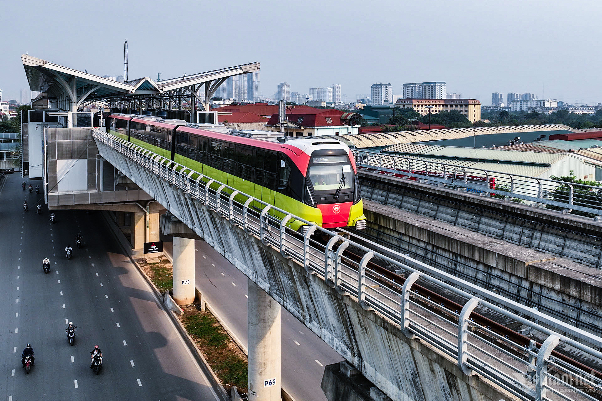
14 urban railway routes
Regarding transport development, Hanoi plans to develop 14 urban railway routes, with priority given to ring railway system, major stations and routes connecting with cities in the north and west.
Hanoi plans to build a railway network in the central urban area, ensuring a reasonable density of train stations which allows people to move to every location in the city, capable of replacing personal means of transport.
In addition, Hanoi's railway network will connect with urban centers in the region and suburban districts, going underground for sections within ring roads 3 and 5.
The capital city will also reserve resources to build elevated monorail which goes along the two sides of the Red River. The route will connect tourism sites, landscapes and the old residential quarter.
It will prepare conditions to join forces with the central government to build a high-speed North-South Expressway which serves as backbone, creating important driving forces for socio-economic development.
Second airport
Hanoi’s second airport is expected to be located in the south and will satisfy requirements for the capital city area and national development.
The exact location for the airport will be planned by consultants and agencies which will submit to agencies for decision. The construction of the second airport is expected to begin in 2040 and be put into operation by 2050.
Hanoi has suggested building the second airport, 1,700 hectares, in the northern part of the Northwest - Highway No 5 route (Tan Dan and Chuyen My communes of Phu Xuyen district), and Dong Tan, Minh Duc, Trung Tu communes of Ung Hoa district.
The location for the airport would help connect the central urban areas and connect with Phu Xuyen, which is an industrial urban area, major transport and goods transshipment point.
Quang Phong