Chinese scholars recently published a "new map of the People's Republic of China", saying that this map was first published in 1951 and was "discovered" during thorough investigation of the national archives.
Gac Ma (Spratly Islands) belongs to Vietnam
They also said that the map more clearly clarifies the exact expansion of China's official claims in the disputed waters in the East Sea. However, is this a real discovery or simply a fabrication that serves China's illegal purpose of monopolizing the waters with this particular geographic and economic position?
The difference between the new map and the maps previously published by China is that the new map shows a solid line describing the "national border and regional administrative boundary", instead of the dash line (as described in China's U-shaped 9-dash line claim that covers nearly all the East Sea).
The investigation and research process has not been officially confirmed by the Chinese Government, but everyone knows that nothing can be conducted and published by academics without permission.
They did not answer the question about how this map was discovered. This raises serious doubts about the authenticity of the map discovery. One just needs to look at the Chinese tricks to dominate the region to understand what is behind the "discovery" of the map.
| They did not answer the question about how this map was discovered. This raises serious doubts about the authenticity of the map discovery. One just needs to look at the Chinese tricks to dominate the region to understand what is behind the "discovery" of the map. |
Former director of India's Joint Intelligence Committee, and former national security adviser, SD Pradhan, cited six factors for everyone to think about the Chinese game.
First, since the last quarter of the 20th century, China has tried to expand its maritime boundaries. Since the 1970s, it has gradually seized entities in the East Sea, first by waging war against Vietnam, then taking advantage of opportunities to acquire maritime entities.
There is a long list of islands, shoals and other entities put under their management through the "salami slice strategy". The entity most recently occupied by China is the Scarborough Shoal over which the Philippines claims sovereignty.
Second, China has resorted to changing geographical entities to declare its claims on the East Sea. It has "created artificial islands" in the East Sea to make claims in the U-shaped region. (The use of the term "territorial claim" aims to be misleading, because none of these entities is called an island if referring to the 1982 United Nation’s Convention on the Law of the Sea - UNCLOS).
Besides, they have also militarized these artificial islands to use as their military bases. China once blatantly viewed other countries' exclusive economic zones (EEZs) as its own. They placed the 981 oil drilling platform in Vietnam's EEZ. Japanese Prime Minister Shinzo Abe was right when he said that China is seeking to turn the East Sea into a "home pond".
Third, besides illegal actions, China is focusing on carrying out propaganda campaigns to make its claims in areas under the sovereignty of other states.
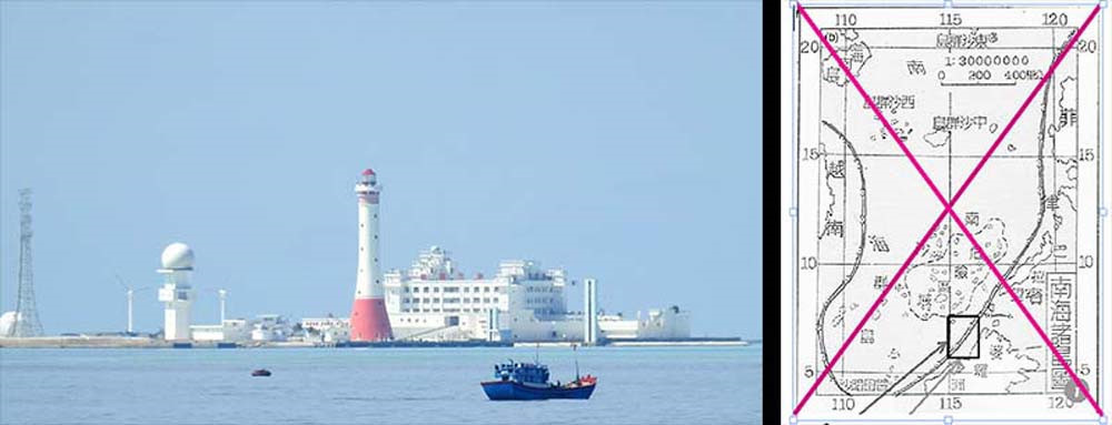
After submitting a map with the “cow tongue line” to the UN in 2009, China in 2012 established a committee to guide, coordinate, monitor, educate and spread awareness of national maps and control the entire national map market by connecting 13 ministries and branches.
In late 2012, China issued biometric passports with a Chinese map with the 9-dash line. The move led to strong reaction from neighboring countries.
On January 1, 2013, China issued a new map, for the first time marking more than 130 islands, reefs and shoals in the East Sea over which Beijing claims its sovereignty within the U-shaped line.
Fourth, there are more authentic maps which depict China's sovereignty as limited to the mainland. The map that German Chancellor Angela Merkel presented to Chinese President Xi Jinping in 2014 during Xi's visit to Germany shows this clearly.
It was a 1735 map created by French cartographer Jean-Baptiste Bourguignon d’Anville and printed by a German publisher. This map shows "all of China", including the land mostly inhabited by Han Chinese, without Tibet, Xinjiang, Mongolia or Manchuria. The islands of Taiwan and Hainan – which became parts of modern China, which were in dispute before - were represented by a boundary with a different color. This map shows that China has expanded its territory since the 18th century.
Fifth, while being polite to the other claimant states, China has shown no sign of compromise.
It rejected the Arbitration Tribunal's Decision in July 2016, which denied China's claims over most of the East Sea. Chinese Foreign Ministry spokesman Hong Lei asserted that it is an illusion to hope that China will accept the decision publicly or diplomatically.
On the occasion of the 90th anniversary of the establishment of the Chinese People's Liberation Army (August 1, 2017), President Xi Jinping stated China will not compromise even a small piece of its territory.
The militarization of artificial islands in the East Sea continues. China has illegally built seven such islands, three of which have a runway of 3,000 meters.
The Center for Strategic and International Studies (CSIS) headquartered in Washington, analyzed the images taken by satellites and found that there are many runways, aircraft parking slots, radar points and surface-to-air missile launchers on three entities - Subi Reef, Mischief Reef and Fiery Cross Reef. All seven artificial islands now have air defense systems.
China has established an undersea surveillance system. The $400 million project has raised concerns that it could be used to detect and discover the activities of foreign ships and provide information to China. Norinco CS/AR-1 55mm system, with the ability to detect, identify and attack enemy combat divers, has been installed at the Fiery Cross Reef and Truong Sa (Spratly) Islands. This is clearly another step to strengthen its presence in the region in order to claim the entire area within the nine-dash line.
Sixth, China is now focusing on the "three warfare" strategy, under which the use of media, social network, and legal warfare play an important role.
The phrase "three warfare" is used by China to create psychological pressure to create threats to deter enemies.
The media war aims to spread information that China is a vulnerable country that needs to create international public opinion that is beneficial to them, and "expose" the weaknesses of the other claimant states as well as to persuade the domestic public about the plausibility of its claims.
In its legal warfare strategy, they publish "legal" arguments based on their own views to justify their claims to resources and territories in the South China Sea and East China Sea. The "three warfare" strategy is based on misinformation.
In summary, the newly published map is completely artificial and created in order to generate new arguments for China's claims in the East Sea. China found that the nine-dash line did not produce the expected results.
In fact, the Chinese administration has changed the number of segments of the line to support its arguments. It was originally an 11-segment line which later was reduced to 9 segments and in recent years has expanded to 10 segments, including Taiwan.
Carlyle Thayer, a security expert, said if China officially adopts the new map, it will claim the waters and resources of the coastal countries that have jurisdiction. This will exacerbate the current situation because the Court of Arbitration has resolved the Philippine case against China.
So far, China has not officially approved the map. But if it does, it will cause tensions in the East Sea to escalate to an extreme level, and may lead to conflict.
China should understand that under international law, a map cannot be used to assert territorial sovereignty unless it is attached to a recognized agreement. China must carefully consider the consequences of its intentional approach when it wants to strengthen its excessive territorial claims and create its hegemony in the East Sea.
This will cause other claimant states and powers concerned about peace in the region to be more assertive in their approach, and any opportunities to reduce tensions will be missed.
China's intention to reject the legitimate rights of other countries in the region to these waters and access to resources under international law could ultimately cost China economically.
Dieu An

East Sea: China needs to change behavior for its own sake
Maintaining peace and security in the East Sea and strictly implementing the 1982 United Nations Convention on the Law of the Sea (UNCLOS) is completely in line with China's interests, and with its important role in the international arena.

China’s unilateral activities in East Sea violate UNCLOS: Japanese expert
China’s recent activities in the East Sea are more unilateral and provocation, seriously violating the UNCLOS, said Professor Daisuke Hosokawa at the Osaka University of Economics.