Aeronautical technologies widely applied in Vietnam
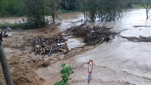 |
| Earth observation technologies are vital to the early warning and management of natural disasters. — VNA/VNS Photo Hong Ninh |
What are the most remarkable uses for earth observation technologies?
Earth observation (EO) is the gathering of information about the physical, chemical, and biological systems of the planet via remote-sensing technologies.
These technologies have been utilised in many ways. They are divided into major fields, such as agriculture, forestry, geology, hydrology, land use, ocean and coastline management, air control and meteorology.
Satellite observations can benefit many areas of society, including environmental and resource management, agriculture and food security, transport, air quality and health, risk management, and security.
For example, sensors, satellites, radar, and other earth observation technologies are used to monitor typhoons, oil spills, deforestation, and more. Data retrieved from satellite images makes it possible to track, learn, and take action when events threaten the environment and human safety.
Accurate weather predictions enabled by earth observation technology have become a critically-important element in our daily lives, impacting government, industry, and personal decision making.
Earth observation provides information and support for agricultural production, fisheries management, freshwater management, and forestry management, as well as monitoring of harmful activities, such as illegal logging, animal poaching, fires, and environmentally-pernicious mining.
Remote sensing helps defence and military to provide different kinds of information for decision-making, including supervising and detecting threats to national security.
In what fields has earth observation been applied in Vietnam?
Remote sensing has been used in Vietnam since 1980, and at first was used in topographic map making and other specific map types like land use or administrative maps.
From 1994 to 2002, remote sensing was applied on a broader scale, providing remote sensing images for research units, institutes, universities, ministries and localities. During this period, Vietnam was able to make maps that showed the movements of riverbeds, ports and coastlines; maps of wetlands or fisheries.
From 2003 to 2012, remote sensing technologies served more fields, including land management, environment management, forestry and hydrometeorology. Besides, the data received at the centre was used by many ministries and sectors, including agriculture and rural development, public security, defence, search and rescue, research institutes and universities.
From 2013 to the present, remote sensing has been used in natural resources and environment observation and climate change adaptation.
Has Vietnam been able to take advantage of these technologies in an effective way?
In order to tackle a certain problem, it’s necessary that we have a standardised database. Such a database can be acquired by earth observation technologies.
We also need to have proper tools to analyse and process the images provided by remote sensing, for instance, a standard image processing software, for all ministries and sectors.
In addition, we also need a national standard procedure for addressing any problems arising from the use of remote sensing technologies. For instance, if an environmental incident happens, the procedures would be to identify the location of the incident; using satellite images; taking samples, and analysing the samples in combination with consideration of hydrology elements.
Scientists and researchers will analyse the data collected from satellites and present their findings to policymakers for follow up action.
Looking at these critical points, we’re still lacking.
Currently, advanced remote sensing technologies had not been applied in many fields. For instance, illegal sand exploitation is a pressing problem in Vietnam. If satellite images are used in sand management, authorities can observe the changes in the volume of sand in rivers. Based on this they can have an accurate evaluation if a company overexploits sand in rivers or not.
But sadly authorities in many provinces in the country now are not using this for management, instead they still use out-of-date measuring methods.
The failure to use remote sensing technologies in environmental management can also lead to failures in addressing environmental incidents.
For instance, the recent fire at the Rang Dong lightbulb warehouse, in which some 6,000 square metres of the facility was destroyed. But what’s more dangerous is the fact that between 15 and 27 kilograms of mercury was released into the air.
In cases like this, both satellite images and modern hydrology technologies are needed to build an action plan. It’s not just about the fire – elements like the rain, the atmospheric pressure, the wind, have to be taken into account. Taking samples is only one step in a whole procedure to identify health threats to nearby residents and impacts on the environment.
Currently, there’s no standard and proper tool for satellite image processing and analysis. Ministries and sectors have their own satellite image processing tool. And as I said, there are no standard procedures for tackling emergencies.
Do we have any difficulties in terms of legal basis or financial resources in the application of earth observation technology in Vietnam?
While space technology and earth observation technology can be of great benefit to the country’s social-economic development and well-being, we do not yet have a co-ordinating agency regarding this matter in Vietnam. Such an agency can gather all requests from ministries and sectors that can be answered with the application of earth observation technologies, then build a long-term strategy for the country.
We do have facilities for the development of earth observation technologies – yet they are insufficient and overlapping.
Human resources in this field are also very rare – most of those who are knowledgeable in earth observation are trained overseas.
How can we take advantage of the achievements in earth observation technologies?
Currently, many international organisations have their own need for satellite images and they have developed their own technologies. We can buy these databases at very reasonable prices, and all ministries and sectors in Vietnam can share them.
However, I think the way we’re spending on satellite images now is not effective. The Government is spending a lot on making our own satellites at a huge cost, but that wouldn’t be cost-effective given the fact that many private businesses also have demand for satellite images themselves.
For instance, in some countries, many individuals or companies use their own drones or flycams to manage huge farms. So, I think there needs to be a mechanism for investment to share the facilities for earth observation technologies. The Government will only need to buy the satellite images from credible sellers, without having to spend too much state budget.
Even if Vietnam wants to make its own satellite, it’s necessary to keep in mind that satellites are now more popular due to their small size, low cost, and light weight. They are being increasingly used for applications such as weather forecast, surveillance, earth observation, navigation, communication, meteorology, and other purposes.
This is the chance for developing countries with limited funding to have access to the most advanced satellite technologies. It makes building the foundation for a country’s space technology strategy much more feasible at a much lower cost. An old generation satellite would cost several hundred million dollars, while a new small satellite would cost only a few million dollars.
VNS