 |
|
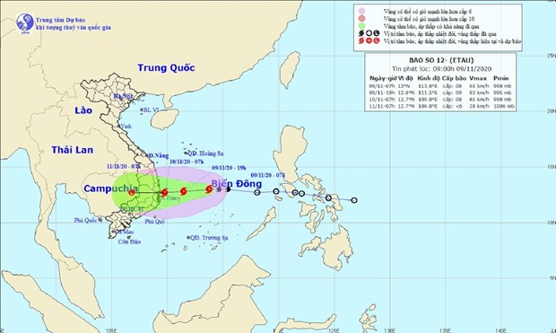
The predicted path of Storm Etau (Photo: National Centre for Hydro-Meteorological Forecasting) |
At 7am on November 9, the storm’s eye was about 450km offshore the coastline between Binh Dinh and Ninh Thuan provinces, packing wind of up to 75 km per hour.
It is moving west at around 20km per hour, and is likely to gain strength.
Etau is forecast to move on land between Phu Yen and Ninh Thuan provinces on early November 11, then weaken into a tropical depression and later a low pressure system.
Strong wind and rains are expected offshore the coastline from Quang Ngai to Ninh Thuan from the night of November 9.
Under the effect of Etau and a cold wave, rainfalls of 200 to 400 mm are forecast for cities and provinces from Quang Tri to northern Khanh Hoa province. Quang Binh province, localities south of Khanh Hoa and the Central Highlands should expect rainfalls of 100-200mm./.VNA