For eight years, researchers painstakingly compared aerial photographs, decoded historical maps and gathered eyewitness testimony to identify three mass burial trenches believed to contain the remains of around 900 soldiers sacrificed during the 1968 Tet Offensive beneath what is now Le Thi Rieng Park in Ho Chi Minh City.
The findings were presented at a workshop on June 8 focused on verifying information related to fallen soldiers and burial sites in the former Do Thanh Cemetery area in Sai Gon's Chi Hoa district - today known as Le Thi Rieng Park in Hoa Hung Ward.
Speaking at the event, Colonel Bui Yen Tinh, Deputy Director of the Operations Department under the General Staff of the Vietnam People's Army, described the research dossier locating the three mass graves as an exceptionally meticulous piece of work.
The project, led by architect Nguyen Xuan Thang, has been underway since 2018.
Four years spent proving three photographs captured the same event

Colonel Bui Yen Tinh speaks at the workshop. Photo: T.L.
According to Colonel Tinh, the research team drew on a wide range of materials, including battlefield photographs, aerial and satellite imagery from the United States and France, urban maps of Sai Gon from 1958 to 1966 at various scales, post-1975 maps of Ho Chi Minh City, military reports and eyewitness accounts.
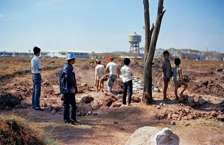
Among the most important discoveries were three field photographs collected from different online sources. Researchers spent four years analysing terrain features, structures, individuals and visual details to prove that the images depicted the same location, the same period and the same event.
"Using technical methods, we were able to demonstrate that the three photographs are indeed connected in terms of location, timing and the event itself," Colonel Tinh said.
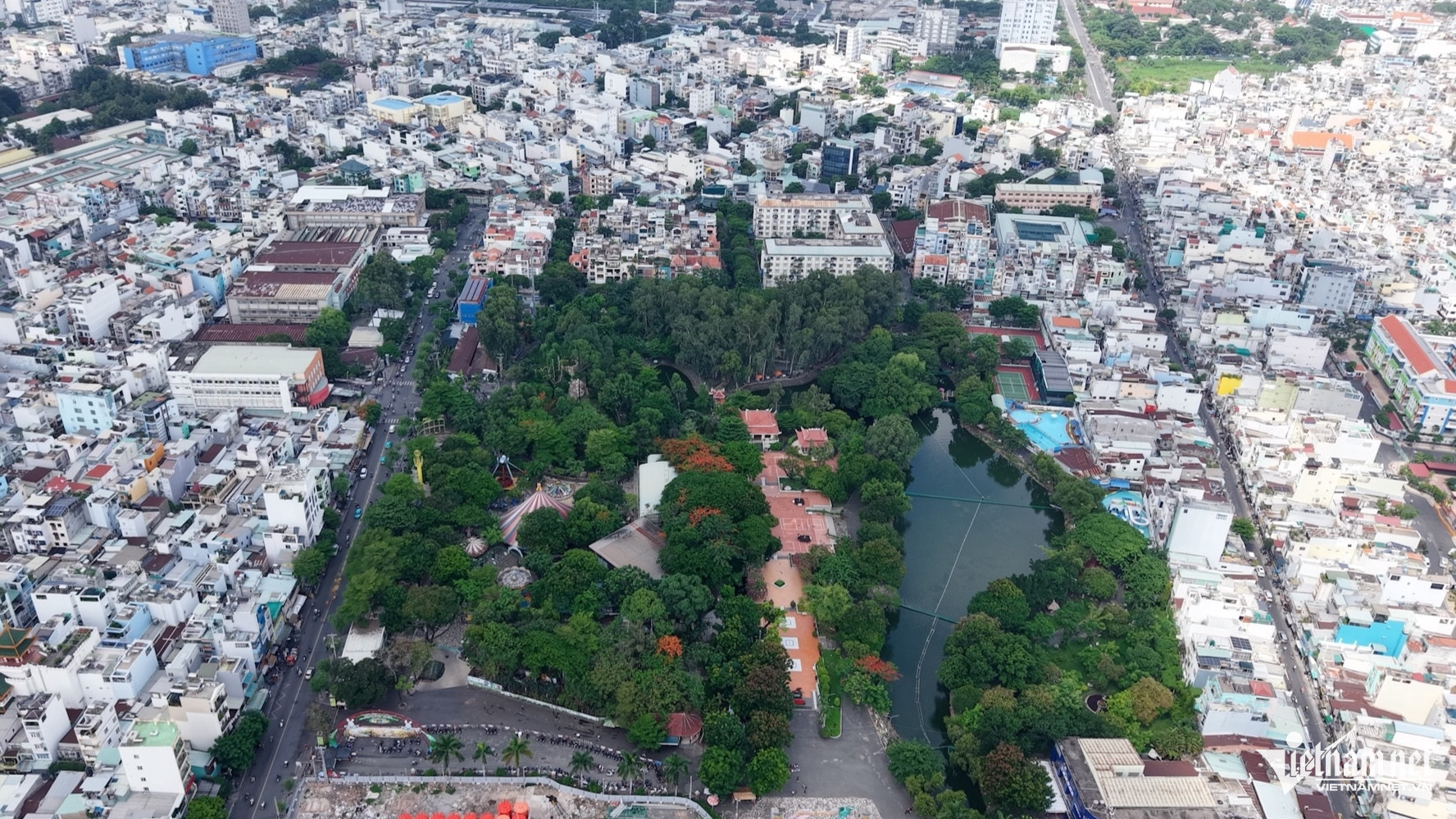
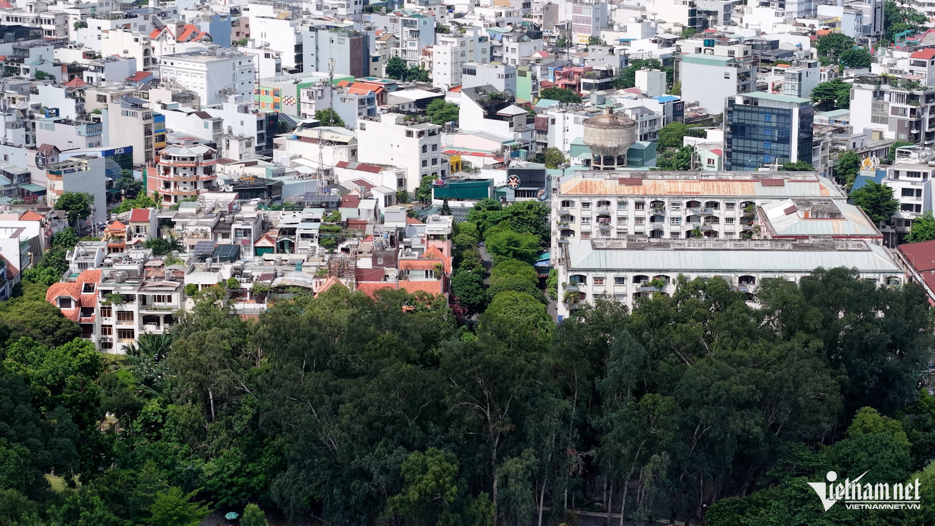
The analysis revealed that four two-storey residential blocks and a water tower visible in the photographs matched aerial images taken in 1972 of the former Bac Hai residential area in what was then District 10.
Based on these matches, researchers concluded that the photographs were taken within the grounds of today's Le Thi Rieng Park, which at the time formed part of the Chi Hoa - Cho Quan Cemetery. The photographer was facing away from Le Van Duyet Street, now known as Cach Mang Thang Tam Street.
Further comparison with reports from the General Staff of the Army of the Republic of Vietnam and Military Assistance Command, Vietnam (MACV) records indicated that the photographs documented events occurring between 8 a.m. and 10 a.m. on February 12, 1968.
Strong evidence for grave trench No. 3
The team also worked to pinpoint the location of each burial trench by matching field photographs with 1972 satellite images. The water tower and residential blocks served as fixed reference points, while researchers searched for signs of disturbed ground resembling trench formations.
The process was repeated using aerial photographs from 1969 to cross-check findings. Suspected locations were then transferred onto a 1968 Sai Gon map at a scale of 1:10,000 before being converted into modern coordinates and overlaid with satellite images from 2002 and 2024.
Researchers also compiled information on the collection of war dead following the Tet Offensive in the Sai Gon - Cho Lon area, the history of the clearance of Chi Hoa - Cho Quan Cemetery, previous search efforts and eyewitness testimony to estimate the number of remains buried at the site.
After years of research and data collection, the team identified three mass burial trenches believed to contain approximately 900 fallen soldiers.
Colonel Tinh concluded that the location of trench No. 3 is supported by strong scientific and practical evidence and can be considered highly reliable. However, additional research and supporting information are still required for trenches No. 1 and No. 2.
At the workshop, Major General Tran Chi Tam, Deputy Political Commissar of Military Region 7 and head of its Steering Committee 515, noted that the burial trenches, ranging from 500 to 1,200 square metres in size, had been identified through systematic research.
He stressed that the number of soldiers buried there could be substantial, while the landscape has changed dramatically over nearly six decades.
He called for the search and recovery process to follow strict scientific procedures and warned against rushing the work.
The Steering Committee proposed that Ho Chi Minh City mobilise experts from institutions such as the University of Science and Ho Chi Minh City University of Technology, along with specialised agencies, to conduct geophysical surveys, ground-penetrating radar studies and stratigraphic analysis before excavation begins.
Excavation expected to begin in early July
Speaking at the workshop, Deputy Prime Minister Pham Thi Thanh Tra instructed the Ho Chi Minh City People's Committee to urgently develop a comprehensive plan in coordination with the Ministry of National Defence, Military Region 7 and relevant universities, organisations and businesses.
She called for excavation to begin first at locations where evidence is strongest, particularly trench No. 3, following the principle of "excavate where evidence is clear while continuing to verify less certain locations."
The Deputy Prime Minister requested that all preparations be completed in time for excavation work to commence no later than early July, ahead of the 79th anniversary of War Invalids and Martyrs Day on July 27.
Phuoc Sang