For years, Hanoi has continuously upgraded and renovated inner-city transport corridors. Yet reality shows that if roads are widened without synchronized traffic organization, the city falls into a familiar cycle: once expansion gets completed, congestion returns.
Ring Road 2, one of Hanoi’s key arterial routes, is a typical example. The section from Vinh Tuy Bridge to Truong Chinh, after the completion of both elevated and ground-level lanes, has largely eased traffic pressure. However, the Nga Tu So – Cau Giay stretch remains frequently overloaded due to heavy traffic volume and complex intersections that hinder vehicle flow, causing recurring congestion.
Facing that pressure, the Hanoi Department of Construction proposed expanding this section to 53.5m and considering the addition of an elevated or underground route, with an expected total investment of more than VND21,300 billion.
Technically, the option of building an elevated viaduct is considered more feasible under current conditions, as it can separate radial traffic flows and reduce conflicts at major intersections such as Nguyen Trai - Tay Son, Lang Ha - Le Van Luong, and Nguyen Chi Thanh - Tran Duy Hung.
But in a metropolis of more than 10 million people, Hanoi cannot focus solely on immediate solutions. The city must calculate development across three spatial layers: ground level, elevated space, and underground. In the long term, underground space should prioritize mass public transport systems rather than continue to be sealed off by high-rise foundations and dense underground infrastructure.
If Ring Road 2 is completed in coordination with Ring Road 1, Ring Road 2.5, and radial axes such as Le Duan – Giai Phong, Hanoi could form a relatively complete ring-and-radial network in the inner city. If so, traffic from gateways could then be distributed more rationally, reducing pressure on chronic bottlenecks like Nga Tu So, Kim Lien, and the Giai Phong – Dai Co Viet area.
Le Van Luong Road lesson
Road expansion, if not accompanied by strict control over construction density and residential planning, can quickly become a magnet for high-rise developments. Newly expanded infrastructure is soon filled by apartment towers, while schools, hospitals, parking facilities, and public spaces do not grow proportionally.
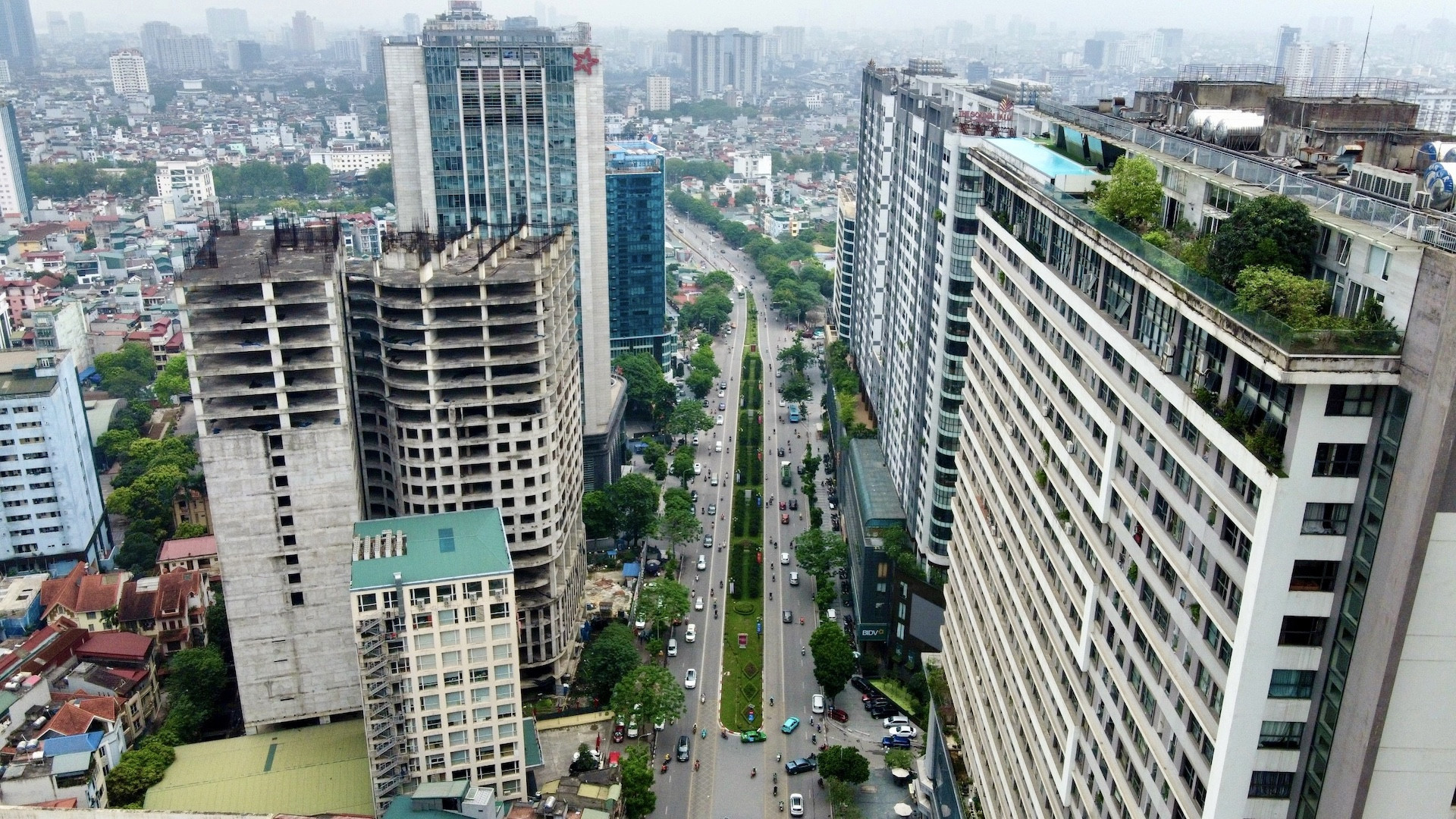
Traffic congestion in Hanoi is no longer confined to the urban core area; it has spilled over to Ring Roads 2 and 3, even extending toward Ring Road 3.5. Areas such as Cau Giay, My Dinh, Linh Dam, and Thanh Xuan frequently face overload as rapid population growth outpaces infrastructure.
Along radial corridors like Tran Duy Hung – Thang Long Boulevard, Nguyen Trai – Tran Phu – National Highway 6, Le Van Luong – To Huu, and Xuan Thuy – Ho Tung Mau – National Highway 32, high-rise buildings on both sides are placing increasing pressure on transport infrastructure. Each new project brings thousands of additional residents and private vehicles, continuously intensifying traffic flow and turning former “relief routes” into new bottlenecks.
The clearest example is Le Van Luong – To Huu section. Once a six-lane road, it has been enveloped by high-rise apartments after 15 years. Population growth and private vehicles have surged. With one lane reserved for BRT, mixed traffic space narrowed further, making congestion an almost daily occurrence.
The construction of the underground section of the Nhon – Hanoi Railway Station metro line also illustrates this challenge: underground space has been constrained by dense building foundations and technical infrastructure. Once urban development becomes tightly packed, any underground intervention will be costly.
Without strict control of construction density along Ring Road 2 and newly expanded roads, Hanoi risks creating multiple “second or third Le Van Luong corridors.”
Restructuring space, not just building more roads
Hanoi needs a comprehensive master plan to reorganize urban space in a synchronized and long-term manner.
For Ring Road 2, the city must clearly define whether its primary role is to channel through traffic or function as a commercial-service axis. If traffic distribution is prioritized, elevated construction should be considered to minimize direct access points, while high-rise developments along the corridor must be tightly controlled.
Any elevated or underground solution must be considered within a 50- to 100-year vision. Infrastructure projects worth tens of trillions of VND cannot be short-term fixes; they must form part of the future urban structure.
Vu Diep