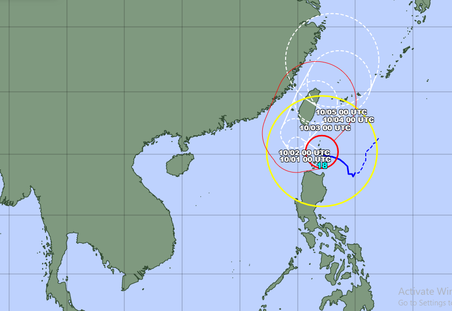
Typhoon Krathon, a strong tropical cyclone, is currently heading towards the southern region of Taiwan. However, its associated low-pressure trough, spanning latitudes 19-22 degrees North, is causing significant weather disturbances in the eastern areas of the northern East Sea.
According to the National Center for Hydro-Meteorological Forecasting, as of 7am on September 30, Typhoon Krathon was located at approximately 20.2 degrees North latitude and 122.1 degrees East longitude. The forecast for the next 24 hours predicts that Typhoon Krathon will move slowly west-northwest towards southern Taiwan.
On the evening and night of September 30, the eastern area of the northern East Sea, particularly east of the 118.5-degree East longitude, will experience increasingly strong winds reaching force 6-7, gusting to force 9. Areas closer to the storm's center will see winds of force 8-10, with near-storm center conditions escalating to force 12-14, gusting to force 17. The sea will be extremely rough, with wave heights ranging from 4 to 6 meters.
Additionally, during the day and night of September 30, this region will also experience heavy rain and thunderstorms, with the potential for tornadoes during these storms.
The weather agency warns that on October 1, the eastern part of the northern East Sea will continue to face strong winds of force 6-7, gusting to force 9, with areas further east experiencing even stronger winds of force 8-10 near the storm center, with wave heights remaining dangerously high.
From the afternoon of October 1, the Gulf of Tonkin will see strengthening northeast winds reaching force 6, gusting to force 7-8, causing rough seas with wave heights of 1.5-2.5 meters.
All vessels operating in these areas are at high risk from tornadoes, strong winds, and high waves.
Ly Dao