Nguyen Duc Hoa, Deputy Head of Climate Forecasting at the National Center for Hydro-Meteorological Forecasting, reported that from now until August 10, the average temperature across the country will be 0.5-1 degrees Celsius higher than usual. The Central and South Central regions, as well as the Central Highlands and the Southern regions, will see temperatures 0.1-0.5 degrees higher than the average for the same period in previous years. The heatwave will continue in the North and Central regions, potentially increasing in intensity in the latter half of the forecast period.
It's notable that the Central region, the Central Highlands, and the Southern region will have rainfall levels at or above the average for this time of year. Other areas in the North will have slightly below-average rainfall.
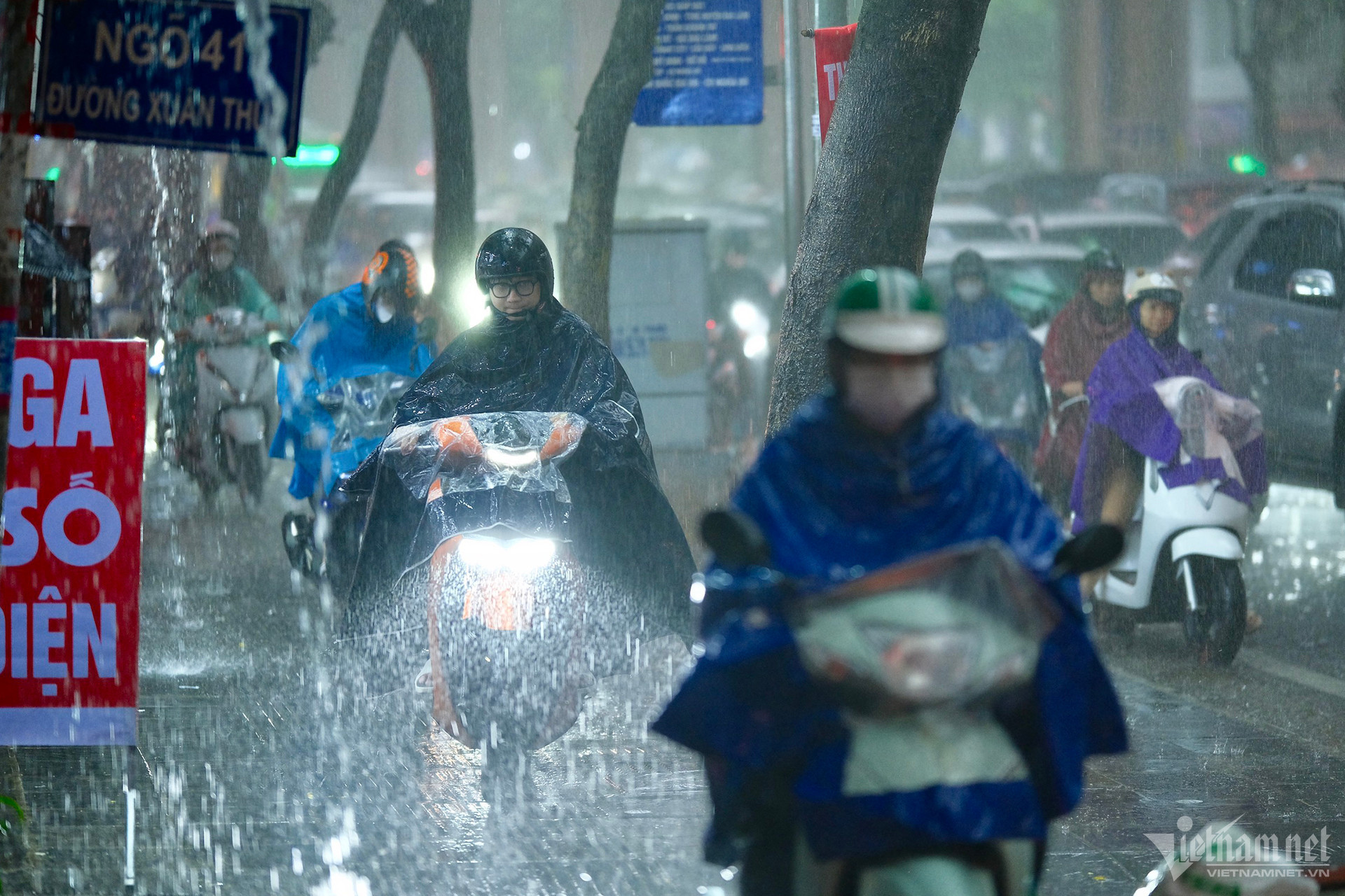
From July 11 to August 10, widespread thunderstorms are expected across the country. Some areas may experience moderate to heavy rain for 2-4 days at a time, along with phenomena like lightning, whirlwinds, hail, and strong winds.
Additionally, from now until early August, the East Sea is likely to see 1-2 storms or tropical depressions, potentially affecting mainland areas.
Hoa warned that dangerous weather phenomena such as storms and tropical depressions caused by the southwest monsoon could bring strong winds and high waves, impacting maritime activities in the East Sea. Severe thunderstorms accompanied by lightning, whirlwinds, hail, and strong winds could significantly affect production and civilian activities. During this period, the North and Central regions will continue to experience heatwaves, raising the risk of fires and explosions.
Experts noted that the current record streak of no storms in Vietnam, which has now reached 635 days (since October 16, 2022), is still ongoing. The last storm to hit Vietnam was storm No. 5 (Son Ca) on October 15, 2022. Since then, eight more storms have been recorded in the East Sea, with seven of them hitting southern China.
On July 11, the Southern Regional Hydro-Meteorological Station predicted that the low-pressure trough extending northwest-southeast across the northern region and the central East Sea would continue moving southward. On July 13-14, a tropical cyclone may form in the central-southern East Sea and possibly intensify and move northwest.
Around July 19-20, another tropical cyclone may form east of the Philippines and move into the northeast East Sea, potentially intensifying. The low-pressure trough extending across Central and Southern Central Vietnam may then shift northward, with the southwest monsoon intensifying.
In the immediate future, the National Center for Hydro-Meteorological Forecasting reported that from July 12-13, the area from Thanh Hoa to Phu Yen will continue to experience intense heat with maximum temperatures of 35-38 degrees Celsius, with some areas exceeding 38 degrees Celsius. Humidity levels will be 50-55%. The northern plains, southern Son La, and Hoa Binh will have temperatures of 35-36 degrees Celsius, with some areas exceeding 36 degrees Celsius and humidity levels of 55-60%.
The northwest and northeast regions will experience scattered thunderstorms, with some areas receiving heavy rainfall. Other northern and central regions will see isolated thunderstorms in the evening and at night.
In the Central Highlands and Southern regions, there will be scattered thunderstorms in the evening and at night, with some areas experiencing heavy rainfall. During the day, there will be isolated showers and thunderstorms.
The forecast for July 13-21 indicates that from the night of July 13-16, northern Vietnam will experience scattered thunderstorms, with some areas receiving heavy to very heavy rainfall.
In the Central and South Central regions, heatwaves will continue, with some areas experiencing intense heat until about July 15. Heavy rain is expected from the night of July 14-16.
During this period, the Central Highlands and Southern regions will experience continuous rain, mainly in the afternoon and evening, with some areas receiving heavy to very heavy rainfall. Thunderstorms could bring lightning, whirlwinds, hail, and strong winds.
On July 11, the Ministry of Agriculture and Rural Development issued a document advising coastal provinces and cities to proactively respond to adverse weather conditions at sea.
According to forecasts, on the nights of July 11-12, the seas from Khanh Hoa to Ca Mau, the southern part of the central East Sea, and the southern East Sea (including the Spratly Islands) will experience strong southwest winds of 6, occasionally 7, with gusts of 8-9.
Around July 12-13, a tropical convergence zone is expected to form in the central East Sea, potentially leading to tropical disturbances and bad weather.
To proactively respond, the Ministry advised coastal provinces and cities to closely monitor warnings and forecasts of strong winds, high waves, thunderstorms, and adverse weather at sea.
They should inform captains, shipowners, and vessels operating at sea to take preventive measures and plan their activities to ensure the safety of people and property. Maintaining communication to handle adverse situations promptly and preparing forces and means for rescue operations is essential.
Bao Anh