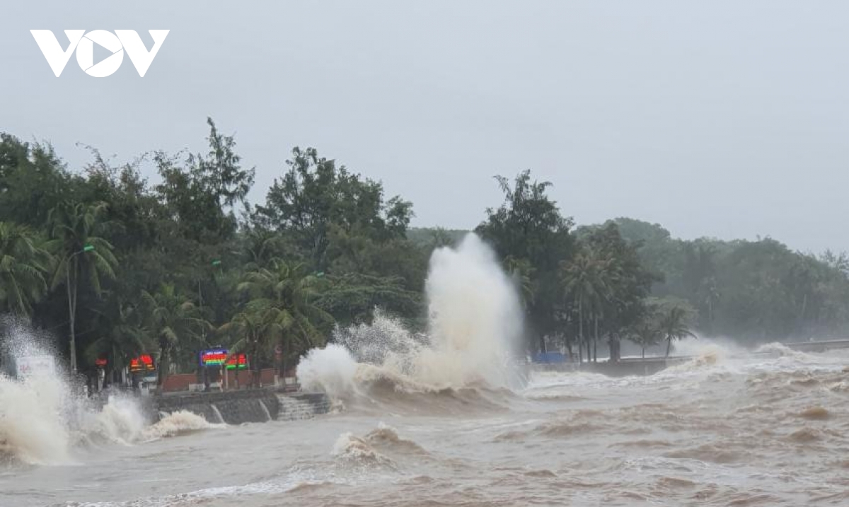
Strong winds and high sea waves in Do Son district cause damage to coastal embankments.
With winds raging at 11:30 a.m. on October 14, competent forces also prohibited rudimentary vehicles from passing through Bai Chay bridge to Hon Gai, while local authorities have also devised plans aimed at ensuring the safety of 20 tourists, including four foreign visitors in Co To island.
This comes after the Quang Ngai province People's Committee issued an urgent telegram to request that relevant agencies and 13 districts and towns throughout the region take drastic measures aimed at minimising the impact of the typhoon.
Most notably, provincial military and police forces have been urged to make thorough preparations in an effort to deal with the possible risk of landslides and severe flooding occurring in affected localities.
A prolonged spell of rain in Hai Phong has affected traffic in the northern port city, whilst Do Son district has seen strong winds and high waves cause damage to coastal embankments.
The Hai Phong Border Guard Command at 10:00 a.m., in co-ordination with coastal localities such as Do Son, Bach Long Vy, Cat Hai, and Kien Thuy, urged over 2,300 fishing vessels anchored at ports, along with over 7,000 local workers, to seek shelter from the impending storm.
As a result, relevant forces in Cat Hai district have evacuated 99 workers from dangerous areas and have successfully relocated them to safe shelters based in Gia Luan commune.
Spells of torrential rain have been reported in localities such as Hai Duong, Cao Bang, Bac Kan, and Lang Son, with the storm’s circulation expected to see heavy rain hit these localities over the coming days.
Another tropical depression forecasted to develop in East Sea
Another tropical depression has been forecasted to appear in the East Sea and then develop into a storm.
According to the National Centre for Hydrometeorology Forecasting, by 4 pm today, Storm Nangka made landfall in coastal areas of provinces from Thai Binh to Nghe An with the wind power of 50-60 kilometres per hour.
In the next 12-24 hours, the storm would make landfall and then turn into a tropical depression, causing heavy rain for many northern and northern central localities.
However, the National Centre for Hydrometeorology Forecasting reported that an additional tropical depression would form in the East Sea tomorrow.
By 4 pm on Thursday, the tropical depression would lay centred in the area which is some 600 kilometres from Southwest Cay in the Spratly Islands on the East Sea with a wind strength of 40-60 kilometres per hour.
In the next 24-48 hours, the depression would move north-northwest and by 4 pm on Friday, it would be around 340 kilometres from Southwest Cay.
Between 48 and 72 hours to come, the storm would continue moving north-northwest at a speed of 25 kilometres per hour.
By this morning, the flooding in the central region of Vietnam had claimed 36 dead, submerging 135,300 houses. The floodwater has begun to recede. VOV/Dtinews/NLD