according to the National Center for Hydro-Meteorological Forecasting (NCHMF).
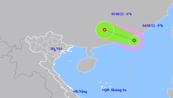
At 7 a.m. on August 4, the eye of the tropical depression was located on the southeast coast of the Chinese province of Guangdong, with the strongest wind speeds near its centre reaching between 40km and 50km per hour.
Moving forward, the tropical depression is projected to move west-northwest at speeds of between 10km and 15km over the next 24 hours before making landfall in China’s Guangdong Province and weakening into a low-pressure area.
The NCHMF has issued warning of strong winds, high waves, and rough seas hitting the north of the East Sea, with all vessels operating in the danger zone being at high risk of being impacted by the weather event.
Furthermore, due to the impact of the southwest monsoon, there will be showers and thunderstorms hitting coastal localities such as Binh Dinh, Ca Mau, Kien Giang, and the Gulf of Thailand.
Meanwhile, the northern region and Thanh Hoa Province are anticipated to experience heavy downpours over the coming days, with rainfall in many areas measuring as high as 200mm.
Source: VOV