Hanoi is planning to widen a series of major inner-city transport corridors. The question is not merely how many additional meters the roads will gain, but how the city will reorganize its urban space to avoid falling back into the familiar cycle of “expand today, congest tomorrow.”
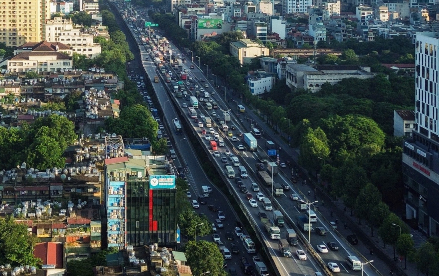
The city is studying the expansion of several key arteries. National Highway 1 through Le Duan - Giai Phong - Ngoc Hoi is being considered for a cross-section of up to 90 meters. Ring Road 2, from Nga Tu So to Cau Giay, has been proposed to include an elevated section aligned with the centerline of the existing road, with a width of about 53.5 meters at ground level and 19 meters for the elevated portion.
Meanwhile, Ring Road 1 between Hoang Cau and Voi Phuc is being accelerated after site clearance was completed.
These moves suggest Hanoi is no longer addressing isolated bottlenecks but is approaching the challenge of reorganizing urban space on a broader scale.
Completing the inner ring roads is long overdue
Associate Professor Ho Anh Cuong, senior lecturer at the University of Transport and Communications, noted that the concepts of Ring Roads 1, 2 and 3 were introduced in the 1990s, yet remain incomplete and discontinuous.
“Finishing the missing sections of Ring Road 1 from Hoang Cau to Voi Phuc and Ring Road 2 from Nga Tu So to Cau Giay is inevitable. This is work that should have been done long ago to ensure planning coherence,” he said.
According to Cuong, ring roads function as the major arteries of a city. If they are clogged, the entire system suffers. Once unblocked, they can effectively channel traffic between radial routes and suburban areas, reducing pressure on hotspots such as Nga Tu So and the De La Thanh - Lang Ha corridor.
Experience over the years shows that whenever a ring road segment is completed or expanded, traffic conditions in surrounding areas improve, at least in the short term.
However, Cuong cautioned that if expansion is not embedded within a comprehensive and well-organized master plan, Hanoi could easily fall into a vicious circle: roads are widened, population increases, private vehicles multiply, and congestion returns.
Transport planning cannot be separated from urban planning and land use. If construction density continues to intensify along newly expanded corridors, and piecemeal planning adjustments lack scientific grounding, infrastructure will soon be overwhelmed again, leaving authorities in perpetual crisis response mode.
Prioritizing space for public transport
Another urban transport planning expert stressed that infrastructure expansion is only a necessary condition. The sufficient condition lies in redistributing space to prioritize pedestrians and cyclists accessing mass transit systems such as urban rail and buses.
“If Hanoi simply adds lanes for cars and motorbikes without allocating adequate space for bus access, metro connectivity, park-and-ride facilities and safe pedestrian routes, the city risks repeating the lesson of wider roads but unchanged congestion,” the expert said.
Lessons from cities such as Paris and Seoul show that many urban centers once prioritized private vehicles, only to later narrow car lanes and expand pedestrian areas and public transport as vehicle numbers surged beyond control.
Space must be organized across multiple layers
Experts argue that the issue is not just how many additional meters of road surface are created, but how urban space is structured: at ground level, elevated, or underground.
For a metropolis of more than 10 million people like Hanoi, planning must adopt a multi-layered approach. Expanding ground-level space to improve bus access and interchange hubs should be integrated with long-term strategies for elevated and underground infrastructure.
Take the Ring Road 2 section from Nga Tu So to Cau Giay. Whether to build elevated sections, tunnels, or reorganize ground-level traffic requires a comprehensive cost-benefit analysis, including landscape impact, environmental considerations and long-term connectivity. “Each option carries consequences that last decades. Decisions cannot be made solely under immediate pressure,” the expert emphasized.
Underground planning is not limited to metro lines. It also encompasses parking facilities, technical infrastructure, water supply and drainage systems, and groundwater protection. These elements form the foundation of sustainable urban development.
Expanding inner-city roads is necessary. Yet every infrastructure investment must be closely aligned with the development of high-capacity public transport, particularly the urban railway network. Only by shifting people from private vehicles to public transport can Hanoi achieve lasting congestion relief, rather than merely enlarging space for cars and confronting gridlock once again.
Vu Diep