Ho Chi Minh City and several provinces along the lower reaches of the Saigon and Dong Nai rivers are preparing for a significant tide during the mid-autumn lunar period, with water levels expected to surpass alert level 3.
On October 15, the Southern Regional Hydro-Meteorological Center reported that in the past 12 hours, water levels at stations along the lower Saigon-Dong Nai river system had risen quickly due to the mid-autumn lunar tide.
As of 7 a.m. this morning, the highest water levels at some stations were approaching alert level 3, including Thu Dau Mot station (Saigon River), Nha Be station (Dong Dien Canal), and Phu An station (Saigon River).
According to the center, water levels at these stations will continue to rise over the next five days. The peak of the tide is expected on October 19-20 (17-18th lunar month), with the highest water levels projected to reach 1.7-1.75m at Phu An and Nha Be stations, surpassing alert level 3 by 0.1-0.15m. These levels are expected between 4-7 a.m. and 4-7 p.m. At Thu Dau Mot station (Saigon River), water levels may reach 1.75-1.8m, surpassing alert level 3 by 0.15-0.2m, while Bien Hoa station (Dong Nai River) could see levels of 2-2.1m, just over alert level 2 by about 0.1m.
The Southern Regional Hydro-Meteorological Center has classified the flood risk in the lower Saigon-Dong Nai river system as level 2.
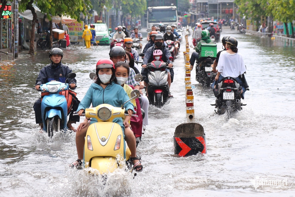
“This is one of the highest tides of the year, and heavy rainfall combined with high tides could lead to flooding in low-lying areas and along rivers, disrupting transportation and economic activities in Ho Chi Minh City,” the center warned.
Some low-lying roads and areas along rivers and canals in Ho Chi Minh City, such as Huynh Tan Phat, Tran Xuan Soan (District 7), Le Van Luong, Dao Su Tich, Pham Huu Lau (Nha Be District), and National Highway 50 (Binh Chanh District), are expected to experience flooding.
In addition, the National Center for Hydrometeorological Forecasting predicts that the afternoon and evening of October 15 will see more rain, thunderstorms, and isolated heavy showers in the Southern region, with some areas potentially receiving up to 100mm of rain. A warning has been issued for localized downpours with intensities exceeding 100mm in just six hours.
The Southern Regional Hydro-Meteorological Center explained that the current pattern of rain and thunderstorms in Ho Chi Minh City and the Southern region is due to weakening cold air masses and the influence of the equatorial low-pressure trough, which remains stationary. High-altitude easterly winds continue to drive moisture into the region, sustaining thunderstorms.
In the coming days, Ho Chi Minh City and the Southern region will experience scattered showers and thunderstorms in the late afternoon and evening, with some areas seeing heavy rain.
Thunderstorms may also bring tornadoes, lightning, and strong winds. Authorities are urging caution as heavy rain could lead to localized flooding in low-lying areas with poor drainage.
Bao Anh