 |
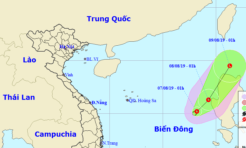
The centre of the tropical low pressure was located at 15.2 degrees north latitude and 118.2 degrees east longitude at 1am on August 7, approximately 570km from east south-east of Hoang Sa (Paracel) archipelago.
During the next 20 hours, the tropical depression is predicted to move north-east at a speed of 5-10 km per hour.
By 1am on August 8, it is thought that the eye of the tropical low pressure will be located at 16.3 degrees north latitude and 119.3 degrees east longitude, roughly 30km west of the Philippines with maximum sustained winds of between 40 to 50 km per hour near the centre of the depression.
Over the course of the next 48 hours the tropical depression will continue to track north north-east at a speed of 10 to 15km.
Due to the impact of the tropical convergence zone and the south-west monsoon, there will be heavy showers, thunderstorms, and whirlwinds in the waters from Binh Thuan to Kien Giang, the Gulf of Thailand, and the East Sea including the waters around Hoang Sa and Truong Sa (Spratly) archipelagoes.
According to forecasters, strong winds and rough seas are expected in the waters from Binh Thuan to Ca Mau, with the middle and southern parts of the East Sea seeing waves of between 2.0 and 4.0 metres in height. VOV