Mai Van Khiem, Director of the National Center for Hydro-Meteorological Forecasting, reported intense downpours across Hue, Da Nang, and neighboring central provinces.
Between 7 a.m. on October 27 and 3 a.m. on October 28, several areas received over 440mm of rain. Bach Ma station in Hue recorded 994.2mm, Trung Loc reservoir station in Da Nang measured 473.4mm, and Ba Dien station in Quang Ngai logged 442.2mm.
From October 26 to 27, Bach Ma set a new national rainfall record, registering more than 1,600mm within 24 hours - the highest single-day rainfall ever recorded in Vietnam. Between the night of October 25 and the morning of October 27, total rainfall reached 2,272mm. Nam Dong station also recorded 1,065mm in 24 hours, surpassing its 1999 historical record.
Major floods were observed across Hue and Da Nang, with river levels exceeding the third and highest alert threshold. On the afternoon of October 27, water levels at Phu Oc station (Hue) surpassed the record set in 2020.
Khiem explained that the extreme weather resulted from a combination of a low-level cold air mass, an intensifying intertropical convergence zone moving northward, and strong easterly winds at altitudes of 1,500 to 5,000 meters - a typical pattern behind prolonged downpours in central Vietnam.
From the morning of October 28 through the night of October 29, continued heavy to very heavy rainfall is forecast for southern Quang Tri, Da Nang, and eastern Quang Ngai.
Expected rainfall totals include 150–300mm in southern Quang Tri and eastern Quang Ngai (locally over 500mm), 200–400mm in Hue and Da Nang (locally over 600mm), and 80–150mm in Ha Tinh to northern Quang Tri (locally exceeding 300mm).
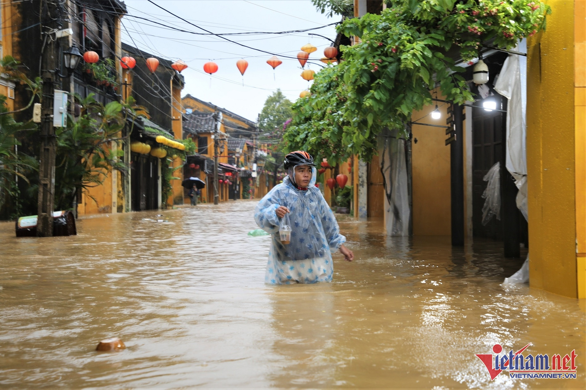
The floods have turned Hoi An’s ancient town into a vast lake, prompting residents to evacuate and scramble to protect their belongings.
Heavy rain is also expected in the Central Highlands and southern regions, especially in areas from Gia Lai to Lam Dong, with 20–40mm of rainfall and localized totals exceeding 100mm. Thunderstorms may bring hail, lightning, and strong gusts. There is a high probability of intense rain exceeding 80mm within 3 hours.
Looking ahead, Khiem warned that central Vietnam may experience multiple rainstorms through mid-December, particularly from Ha Tinh to Da Nang, Khanh Hoa, and eastern parts of Quang Ngai to Dak Lak.
In November, rainfall across most of the country is expected to be 10–30% higher than average. Northern regions may see rainfall close to seasonal norms, except for the far north, which could experience 10–20% less.
Authorities urge residents to follow official weather bulletins and prepare appropriate responses to ensure safety amid increasingly severe natural disasters.
Major floods exceed historical levels in Hue and Da Nang
According to the meteorological agency, water levels on the Huong River (Hue) peaked at 5.05 meters at Kim Long station at 8 p.m. on October 27, surpassing Alert Level 3 by 1.55 meters.
The Vu Gia–Thu Bon River system in Da Nang remains at flood peak levels, while water levels on the Bo River (Hue) and Tra Khuc River (Quang Ngai) have started to recede.
Over the next 12 hours, the Vu Gia River at Ai Nghia is expected to peak at 1.2 meters above Alert Level 3, before beginning to fall. The Thu Bon River at Cau Lau will peak at 5.3 meters, or 1.3 meters above Alert Level 3. The Huong River at Kim Long is receding but remains 0.6 meters above Alert Level 3. The Bo River at Phu Oc is forecast to dip just below Alert Level 3 by 0.2 meters, and the Tra Khuc River is expected to stay under Alert Level 2.
In the following 12 to 24 hours, all rivers are forecast to gradually recede. Flood levels on the Bo River at Phu Oc will fall to 0.6 meters below Alert Level 3, while the Huong River at Kim Long is expected to remain at Alert Level 3. The Vu Gia River at Ai Nghia will drop just below Alert Level 3, while the Thu Bon River at Cau Lau is forecast to stay 0.6 meters above Alert Level 3. The Tra Khuc River is expected to hover just above Alert Level 1.
Authorities warn of deep, widespread flooding in Hue and Da Nang, and localized inundation in Quang Ngai. There is a very high risk of flash floods and landslides along rivers and slopes from Quang Tri to Quang Ngai.
Bao Anh