 Vietnamnet.vn

 Podcast


Super Typhoon Champi could strengthen to level 17
According to Vietnam's National Center for Hydro-Meteorological Forecasting (NCHMF), Champi reached super typhoon intensity at level 16 on the afternoon of October 18.
The storm weakened to level 15 overnight and into the morning of October 19 before regaining level 16 strength around midday, with wind gusts exceeding level 17 on Vietnam's wind scale.
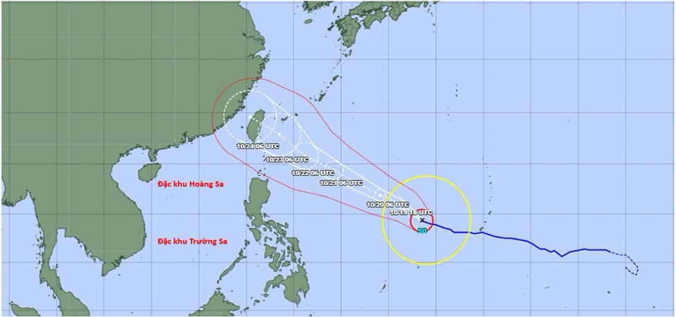
At 1 p.m. on October 19, the center of Super Typhoon Champi was located near 14.3 degrees north latitude and 138.5 degrees east longitude, approximately 1,700 kilometers east-southeast of Luzon Island in the Philippines and more than 2,000 kilometers southeast of Taiwan (China).
Meteorological analysis showed that Champi was positioned south of a subtropical high-pressure ridge, over waters with sea surface temperatures of around 29-30 degrees Celsius. These conditions were favorable for further intensification.
Over the following 24 hours, the storm was forecast to move mainly west-northwest, potentially strengthening to level 17 with gusts exceeding that level.
Champi could maintain level 16-17 intensity, with gusts above level 17, until the afternoon of October 22.
From the evening and overnight hours of October 22, sea surface temperatures along its projected path were expected to fall to around 27-28 degrees Celsius, while the subtropical high-pressure ridge weakened.
These changes could cause the storm to gradually lose strength and turn northwest, taking a more northerly track.
Forecasters remain divided over Champi's path
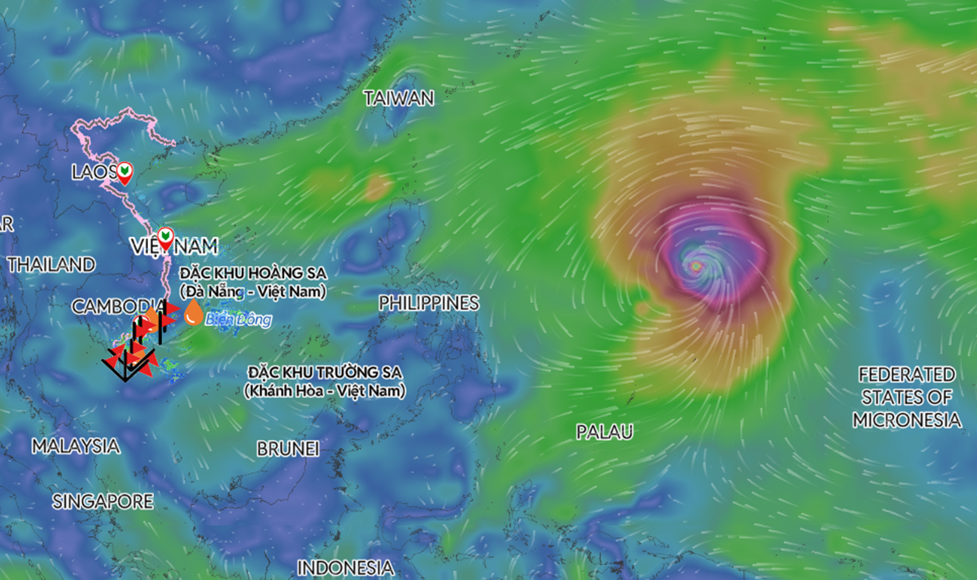
International meteorological agencies have yet to reach a consensus on where Super Typhoon Champi may make landfall or pass closest to land.
Japan's meteorological agency forecast that the storm could make landfall in Taiwan (China) around October 24, with winds at approximately level 15 and gusts exceeding level 17.
Meanwhile, meteorological agencies in China and the United States predicted that Champi could move into waters north of Taiwan before heading toward China's Fujian and Zhejiang provinces, rather than striking the island directly.
Taiwan's meteorological agency also projected a track north of the island.
The Hong Kong Observatory, meanwhile, suggested that the storm could skirt northern Taiwan before moving toward mainland China.
These differing forecasts indicate that considerable uncertainty remains over Champi's eventual track and the areas most likely to experience its direct impact.
However, the forecasts generally agree that the storm is unlikely to enter the East Sea.
Vietnam's NCHMF estimated the probability of Champi entering the northeastern East Sea at less than 10%.
By contrast, the likelihood of the storm moving northwest and subsequently affecting Taiwan and China's coastal areas was assessed at more than 80%.
Northern East Sea could face gusts of level 10
Although Champi is unlikely to enter the East Sea, its outer circulation could still affect weather conditions across the northern waters.
Around October 21, the storm's western circulation was expected to reach the northeastern part of the northern East Sea, bringing winds of level 6.
By October 23-24, northeasterly winds across the northern East Sea could strengthen to levels 6-7, with gusts reaching levels 9-10.
Waves were forecast to rise to 3-5 meters, creating rough sea conditions.
The NCHMF said it would continue closely monitoring Super Typhoon Champi and issue updated forecasts and warnings as the storm develops.
Bao Anh

