A tropical depression over the East Sea is unlikely to intensify into a storm but is forecast to make landfall directly in central Vietnam, specifically in areas recently affected by Storm No. 5 (Kajiki).
Although winds are not expected to be strong, heavy rainfall is forecast across the North Central Coast and northern regions.
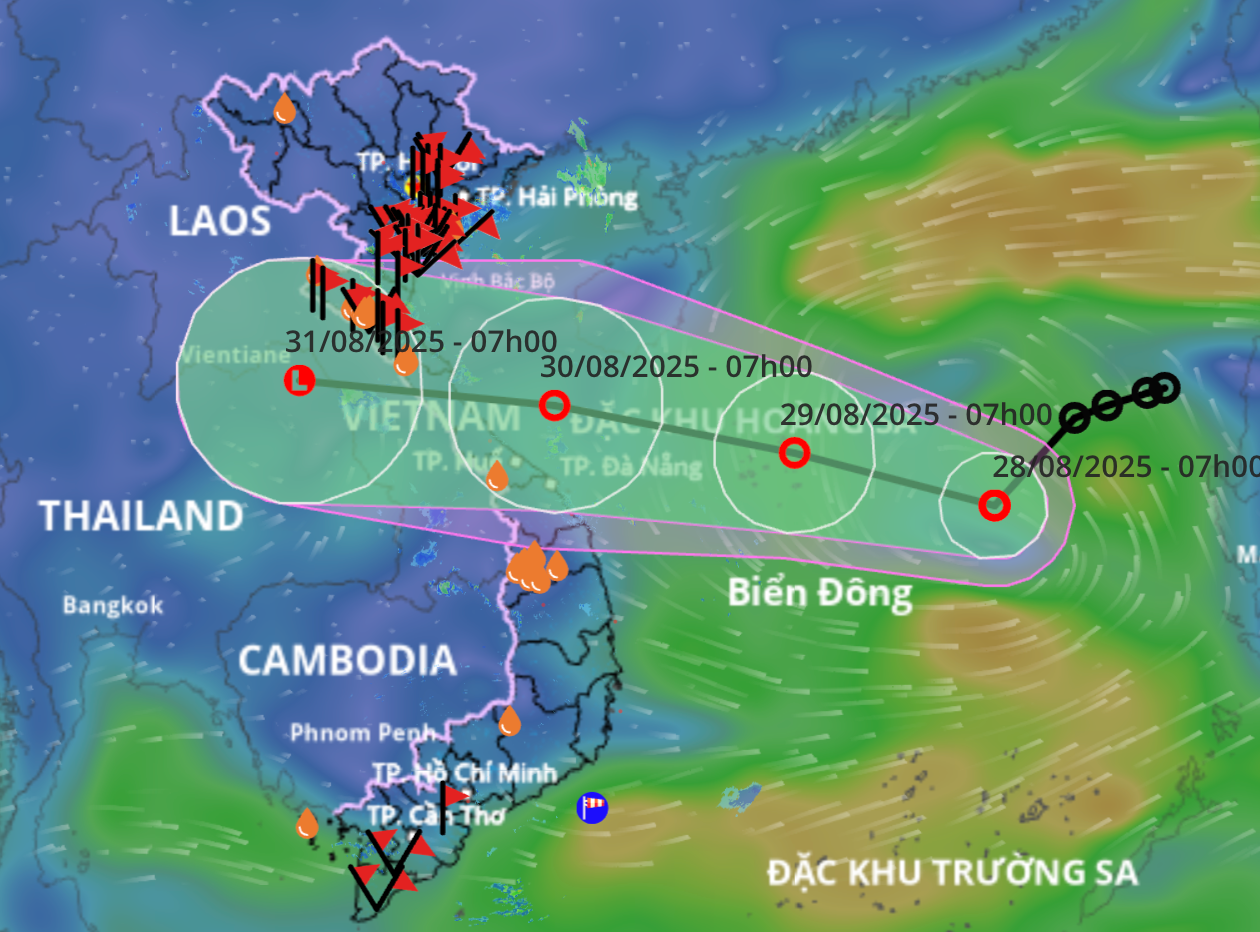
According to the National Center for Hydro-Meteorological Forecasting, as of 7:00 a.m. today, the center of the tropical depression was located over the eastern waters of the northern East Sea, with wind speeds of 39–61 km/h (level 6–7), gusting up to level 9.
The system is expected to move southwest at a speed of approximately 15 km/h over the course of today and tonight, continuing to strengthen. By 7:00 a.m. on August 29, the center of the depression will be located near the Hoang Sa (Paracel) archipelago, with wind speeds reaching level 7 and gusts at level 9.
On August 29, the tropical depression is forecast to shift rapidly in a west-northwesterly direction at about 20 km/h. By 7:00 a.m. on August 30, it will be positioned over coastal waters from Nghe An to Da Nang with wind speeds maintaining at level 7, gusting to level 9.
Over the next 48 to 72 hours, the system is expected to track westward, moving quickly inland over provinces from Quang Tri to Ha Tinh, where it will gradually weaken.
Due to the tropical depression’s impact, the northern East Sea region (including the Hoang Sa special zone) will experience strong winds at levels 6–7, gusting up to level 9, with sea waves reaching 2–4 meters in height, causing rough sea conditions.
Mai Van Khiem, Director of the National Center for Hydro-Meteorological Forecasting, warned that the depression may affect northern central provinces - from Thanh Hoa to Hue - between August 30 and 31, with moderate to heavy rainfall expected, and localized torrential rain in the North and in the Thanh Hoa–Hue region.
PV