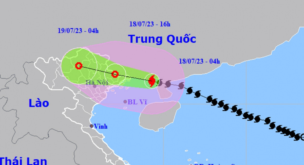

At 04:00 July 18, TALIM was centred about 140km east and south-east of Mong Cai city of Quang Ninh province, with maximum sustained winds decreasing to 117kph just before landfall a couples of hours later.
In the next 24 hours, the storm is forecast to move west and north-west at a speed of 20kph and pound localities in the north.
At 16:00 July 18 TALIM is anticipated to lose strength further to a tropical depression, move further inland and dissipate in northern mountainous localities.
Though TALIM is said to lose its grade before landfall, it remains a strong tropical storm, bringing the possibility of life-threatening storm surge flooding.
The coastal localities of Quang Ninh and Hai Phong are forecast to have storm surge of 0.3-0.5m. They will face a high risk of flooding in low-lying areas and estuaries due to the combined impact of high tide and storm surge on July 18 afternoon.
Northern provinces will endure a long spell of heavy rain on July 18-19, receiving 200-300mm of rainfall or even more than 350mm in some places.
Weather experts warned about the possibility of flashfloods and landslides to occur in the mountainous provinces of Quang Ninh, Lang Son, Cao Bang, Ha Giang, Lao Cai and Yen Bai.
In the face of the storm’s devastation, tens of thousands of residents have been ordered to evacuate from danger areas before TALIM slams into the mainland.
The border guard commands of localities have also directed fishing vessels to seek nearby storm shelters or move ashore.
Relevant forces and residents have reinforced public works and houses to minimize property damage during the height of the storm.
Residents have been advised to avoid going out when the storm hits.
TALIM is the first storm that has hit the East Sea in this year’s stormy season. It is also considered a powerful storm that has struck the northern region for the past few years.
Source: VOV