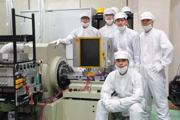
Vietnam is strengthening the national capacity for Earth observation based on a system of small high-resolution and ultra-high-resolution satellites using optical sensor technology and radar, combined with unmanned flying devices.
According to the Vietnam National Space Center (VNSC), the Japanese Embassy in Vietnam and Ministry of Economy, Trade and Industry (METI) are supporting Vietnam to develop the project by setting up a research team.
The tasks of the research team are designing a roadmap for the application of small satellite beams and other technologies in Vietnam, investigating the possibility of effectively utilizing satellite data, and integrating existing satellites.
A representative of the research team said in the second half of the 2010s, the number of companies launching beams of satellite increased considerably. The advantages of satellite beams is that they have lower costs as they are small.
Experts believe that satellite beams can service many different fields. In agriculture, the data from satellites assists crop management, creates equal products and slashes farming costs.
Data from satellites can help observe heterogeneous developments in fields. Based on these data, UAV (unmanned aerial vehicles) will fertilize, water and spray chemicals if necessary.
The data from satellite beams also help predict, warn and estimate risks caused by natural calamities, drought, flood and landslides, thereby supporting decision-making.
In national defence, satellite beams can detect foreign ships operating illegally at any time. The satellites will also help detect foreign-built man-made structures in national territorial waters.
In terms of environment, images from satellites will help discover and assess the level of oil slicks on the sea, and watch and give earliest warnings about the quality of water.
The Japanese experts have suggested a roadmap with three options for development. The common point of the project is the maintenance and operation of facilities from LOTUSat and Vietnam Space Center.
They believe that Vietnam should continue to develop MicroDragon series. Also, it needs to own one or two satellites for IoT and next-generation AIS/VDES (Automatic Identification System/ VHF Data Exchange System), and develop small-sized GNSS (Global navigation satellite system).
METI believes that Vietnam can increase the localization ratio of the space industry in some fields, such as manufacturing and assembling print circuit board, producing electric cables, processing metal materials, manufacturing IoT equipment and developing embedded software.
Not only Vietnamese large corporations, but small and medium enterprises can join the space industry.
Vietnam can start with manufacturing satellite frame and treat metal components. In the next steps, it can make electrical cables, assembly and integrate printed circuit boards, embedded software and electronics.
Trong Dat