According to data from the Ministry of Natural Resources and Environment, land subsidence in the Mekong Delta region is occurring at three times the rate of sea level rise, with Can Tho experiencing the most severe sinking at an average rate of 1.31 cm per year. This alarming trend has made flood prevention a critical issue for the city.
In 2016, the Vietnamese government approved the Can Tho Development and Urban Resilience Project (Project 3), aiming to control flooding across nearly 2,700 hectares in Ninh Kieu and Binh Thuy districts, safeguarding over 420,000 residents. The project has a total investment of nearly $9.2 billion, with approximately $5.7 billion financed through a loan from the World Bank.
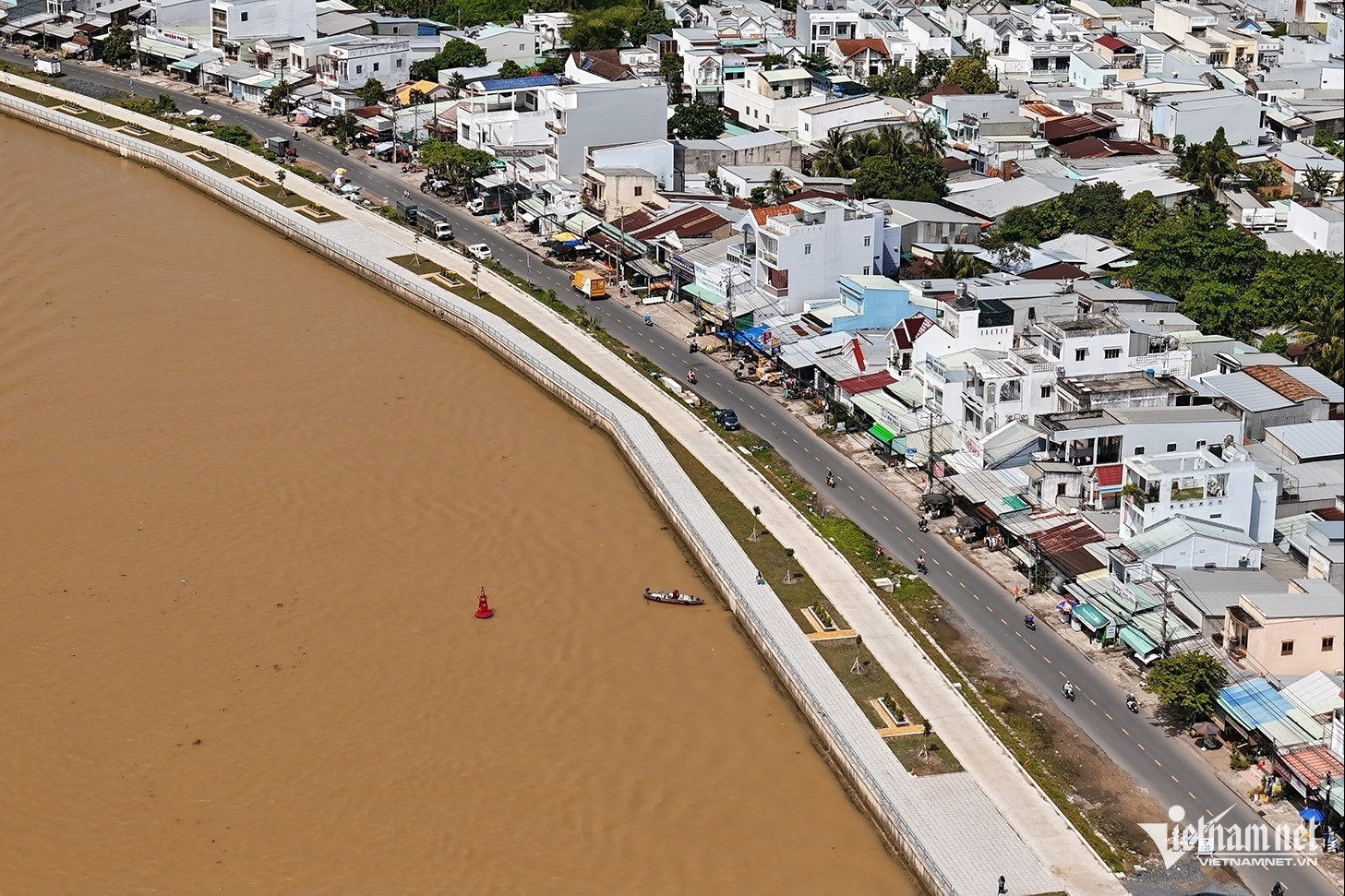
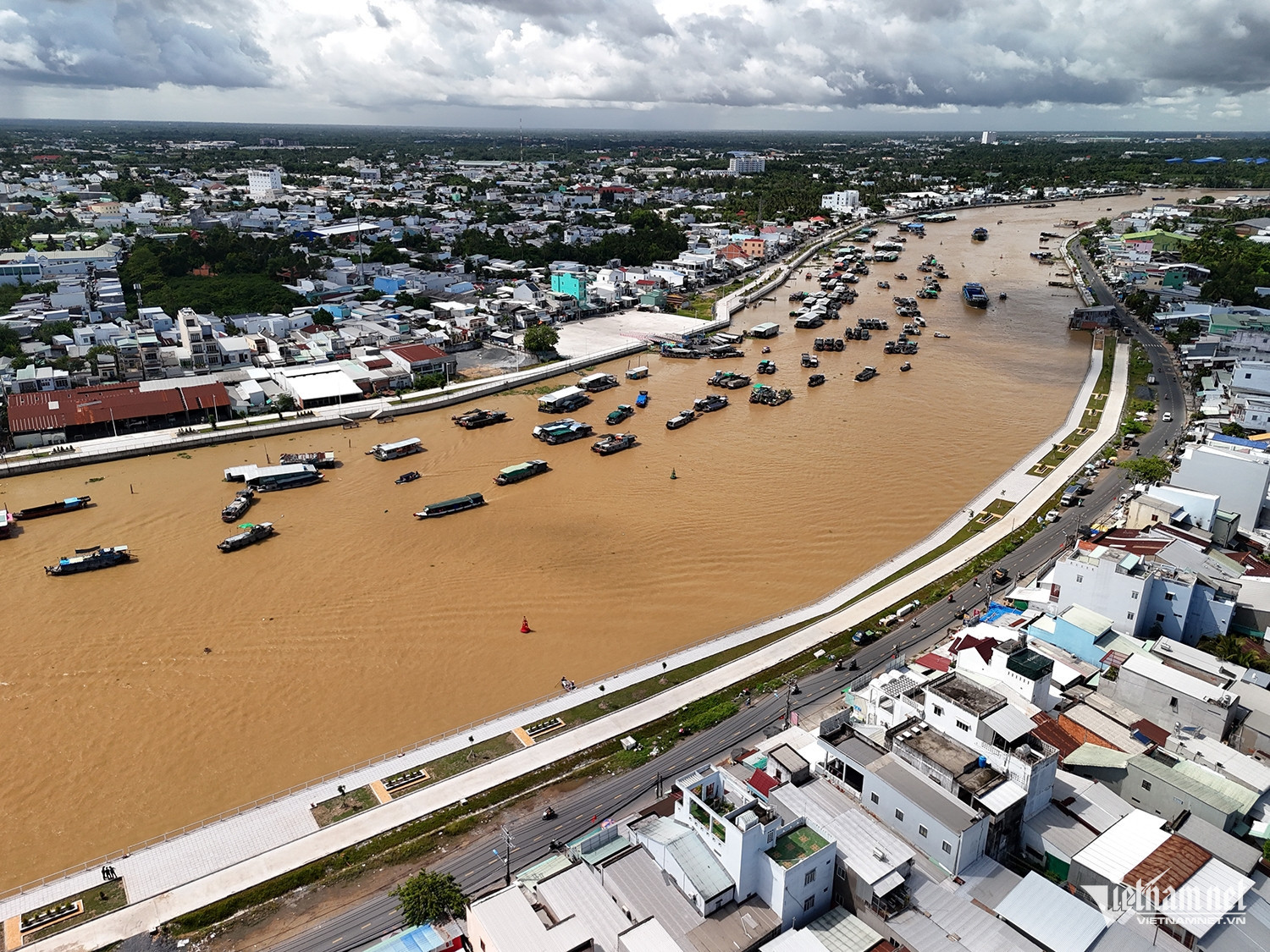
A highlight of this project is the construction of a 5.2 km river embankment along the Can Tho River, with an investment of nearly $1.1 billion. This embankment, stretching through Ninh Kieu District, Phong Dien District, and the opposite bank in Cai Rang District, not only prevents erosion and protects lives and property but also creates a beautiful riverside walkway.
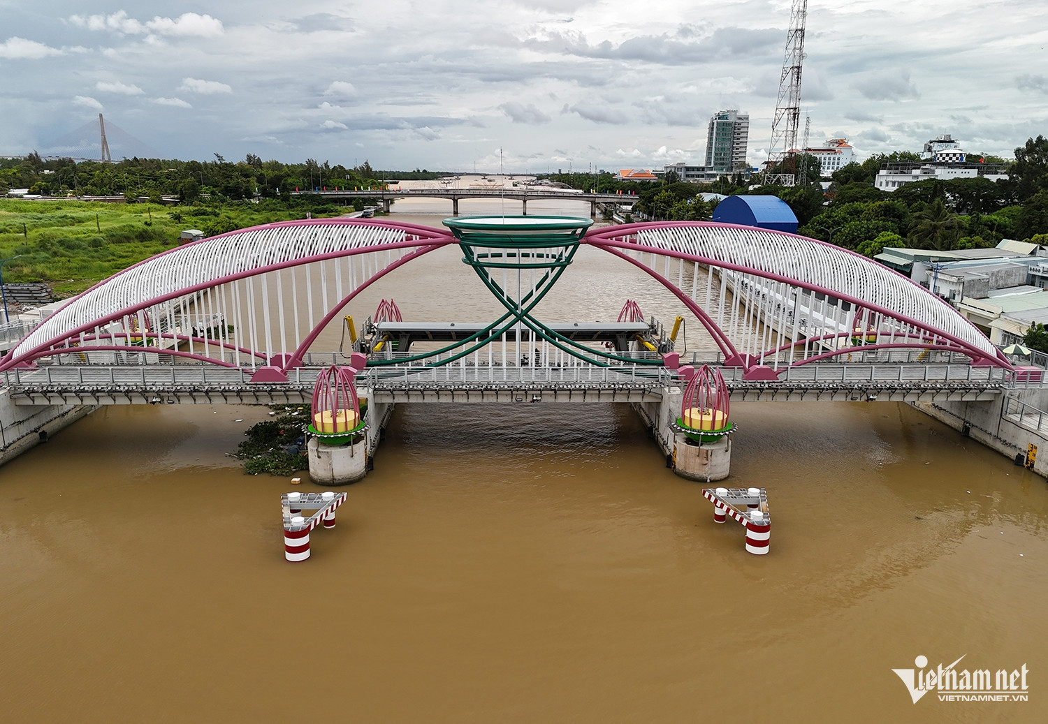
In addition to the embankment, the project includes the construction of 10 tidal gates and two boat locks to regulate water flow and significantly reduce flooding in the city center. The Cai Khe boat lock, with an investment of $436 million, was completed after 22 months of construction.
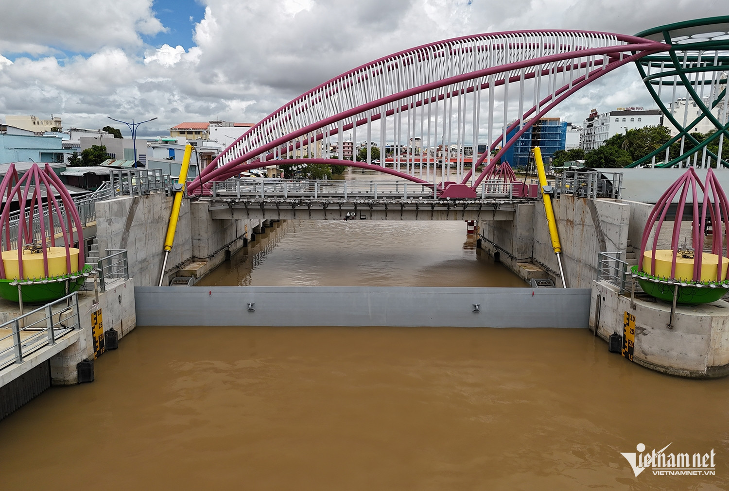
It features three main gates (each weighing 35 tons, 20 meters wide, and 6 meters high) and a smaller 5-meter gate (weighing 5 tons), strategically placed at the head of Khai Luong Canal in Ninh Kieu District. This lock system is designed to regulate water flow during the rainy season, with the ability to close off sections to prevent flooding from the Can Tho River.
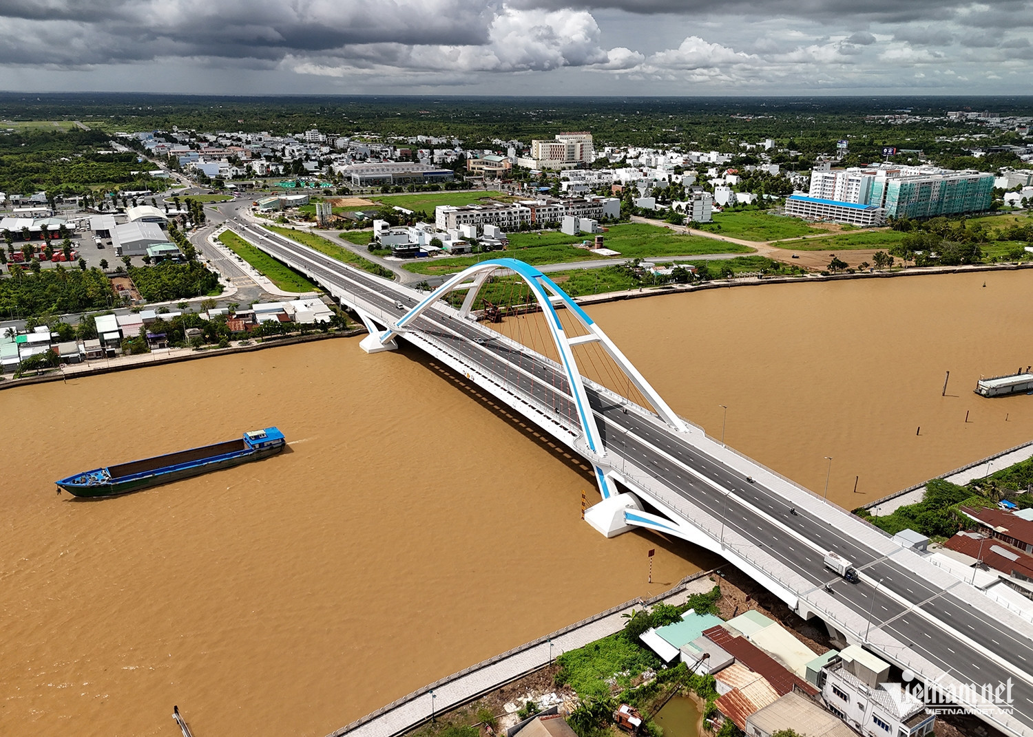
After several delays, the Tran Hoang Na Bridge, which spans the Can Tho River and connects Ninh Kieu and Cai Rang districts, officially opened on April 26. This bridge not only improves access to the southern gateway of the city but also eases traffic on the Hung Loi and Cai Rang bridges.
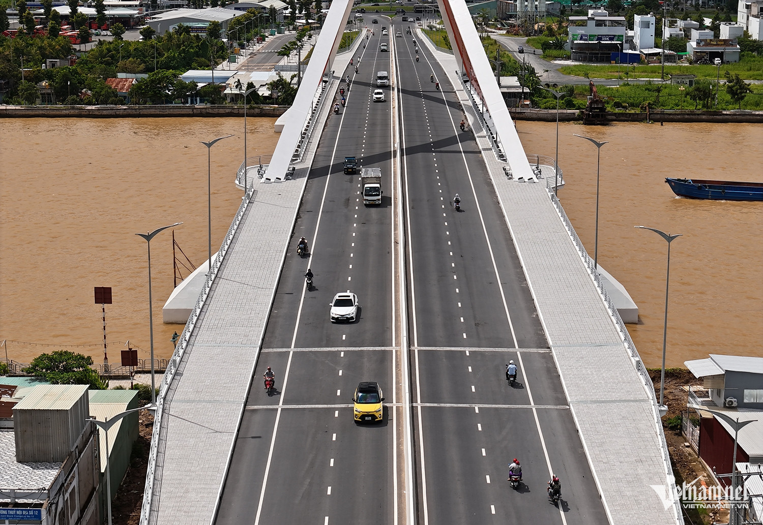
The bridge, which is 600 meters long and 23 meters wide, was completed at a cost of 791 billion VND after 3.5 years of construction. Alongside the Tran Hoang Na Bridge, the Quang Trung Bridge (Phase 2) was completed and opened to traffic at the end of 2021.

The project also includes the construction of a road connecting Cach Mang Thang Tam Street with Provincial Road 918. This 5.3 km road, with a cross-sectional width of 40 meters, links the city's key arterial routes.
According to the Can Tho ODA Project Management Board, Project 3 has been largely completed and plays a crucial role in sustainable urban development, enhancing the city’s resilience to climate change. The project also reduces the vulnerability of the central area to flooding and improves the transportation network within and between regions.
The project comprises three components: Flood Control and Environmental Sanitation (including the construction of the Can Tho River embankment, boat locks, tidal gates, and canal improvements); Urban Corridor Development (including the construction of the Quang Trung and Tran Hoang Na bridges, and infrastructure for resettlement areas); and Strengthening Urban Management to Adapt to Climate Change.
Tran Tuyen