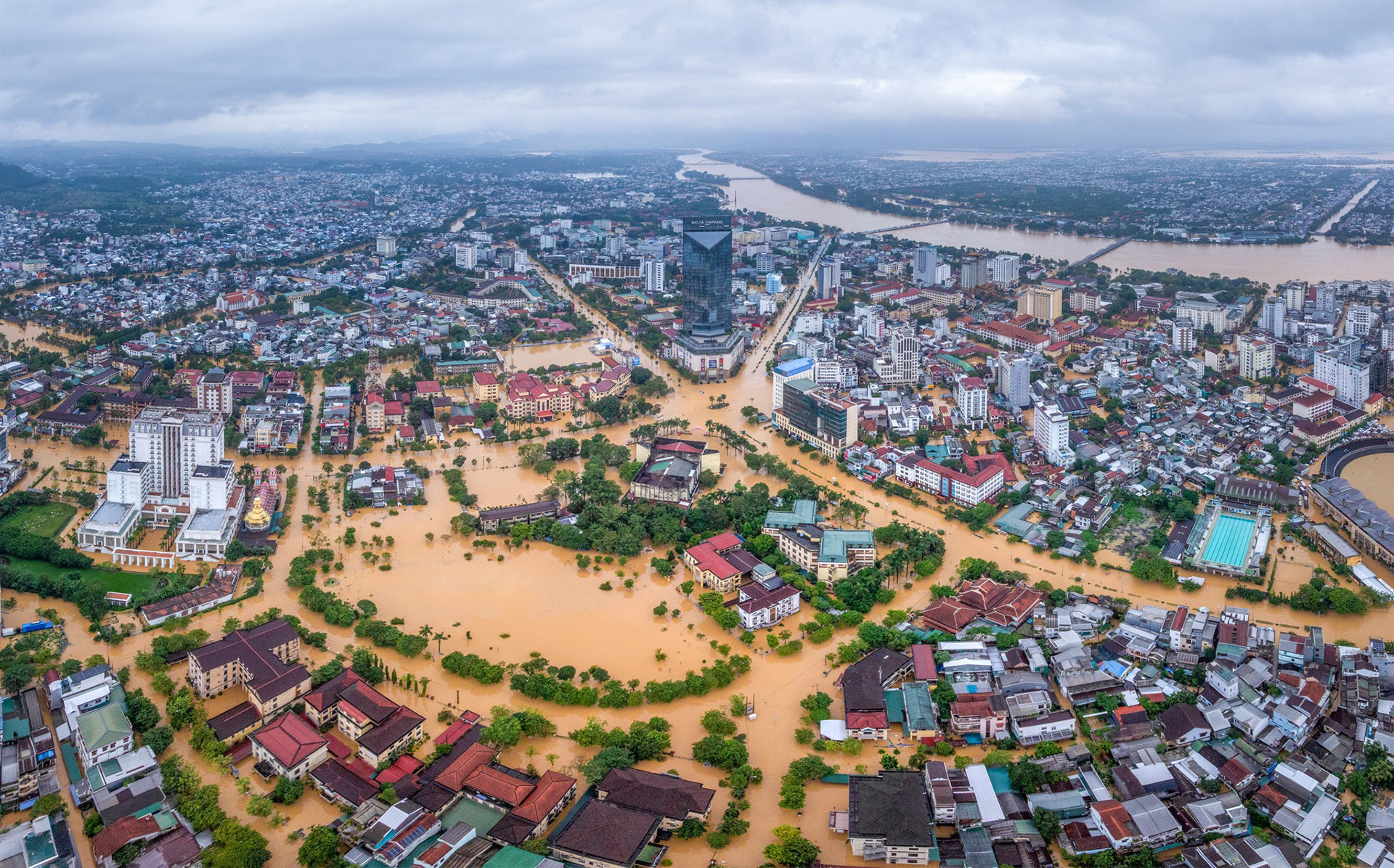
On the evening of November 1, the Hydrometeorological Authority released a report detailing the current flood situation in Central Vietnam and the potential formation of Storm No. 13.
According to the report, due to a cold air mass combined with an intertropical convergence zone connected to a low-pressure area in the mid-East Sea, and strong moist easterly winds in the upper atmosphere (1,500-5,000m), the region from Ha Tinh to Da Nang and eastern Quang Ngai experienced moderate to heavy rainfall from the night of October 31 to November 1.
Water levels on rivers from Quang Tri to Quang Ngai are rising again.
Cold air intensifies, triggering further downpours in the region

The Hydrometeorological Authority forecasts that from November 1-3, a continued cold air surge combined with the strong intertropical convergence zone passing through south-central Vietnam, as well as intensified moist easterly winds at altitudes of 1,500-5,000m, will lead to very heavy rainfall from Ha Tinh to Da Nang and eastern Quang Ngai.
Expected rainfall totals include 300-600mm in Hue, Da Nang, and eastern Quang Ngai, with some areas exceeding 800mm. Ha Tinh and Quang Tri may receive 200-350mm, with local areas surpassing 500mm.
Southern Nghe An and western Quang Ngai will see moderate to heavy rainfall of 70-150mm, and localized downpours over 250mm. Rainfall is expected to decrease in Central Vietnam around November 5-6.
Storm No. 13 may form over the East Sea
A tropical depression is currently active east of the Philippines.
According to current projections, this depression is expected to strengthen into a storm by the night of November 1 or early November 2. By November 5, the system is forecast to enter the East Sea and become Storm No. 13 (international name: Koppu).
It is projected to be a strong storm, potentially reaching Category 12 when passing near the Spratly Islands. By November 7, it may make landfall in Vietnam.
The area most likely to be affected lies between Da Nang and Khanh Hoa. The storm could bring powerful winds and heavy rainfall across the central and south-central regions and the Central Highlands between November 6 and 9.
However, forecasters caution that the storm has not yet fully formed and will be influenced by large-scale weather systems and terrain interaction as it crosses the Philippines. Therefore, its intensity, path, and impact zone remain uncertain and require further observation and updated forecasting.
Large-scale flood warnings issued for Central Vietnam
Due to prolonged rain, flooding is expected between November 2 and 5 in rivers across Ha Tinh, Quang Ngai, and Dak Lak. Predicted peak water levels include:
Ha Tinh: Ngan Sau and Ngan Pho rivers rising to Alert Levels 2-3
Quang Tri: Gianh River at Alert Level 2-3; Kien Giang and Thach Han Rivers above Alert Level 3
Hue City: Bo and Huong Rivers at and above Alert Level 3
Da Nang: Vu Gia and Thu Bon Rivers reaching Alert Levels 2-3 and above
Quang Ngai: Tra Khuc and Ve Rivers at Alert Level 2-3; Sesan River at Alert Level 1-2
Smaller rivers and headwaters in Gia Lai, Dak Lak, and Khanh Hoa will also reach Alert Levels 1-2 and possibly higher.
There is a high risk of flash floods in rivers and streams, as well as landslides on steep slopes in mountainous regions from Ha Tinh to Quang Ngai and Gia Lai. Particularly vulnerable locations include:
Ha Tinh: 47 wards/communes
Quang Tri: 30 wards/communes
Hue: 19 wards/communes
Da Nang: 62 wards/communes
Quang Ngai: 52 wards/communes
Gia Lai: 36 wards/communes
Forecasts suggest that the East Sea will likely experience frequent storm activity through October and November. Late-season storms are expected to impact the Central region most significantly.
Bao Anh