The Ngoc Linh Mountain range stretching four provinces, comprising Kon Tum, Quang Nam, Quang Ngai and Gia Lai, also boasts six peaks, Ngoc Linh, Muong Hong, Ngoc Phan, NgocLum Heo, Ngoc Ko-ring, and Ngoc Bon Son. Among them, Ngoc Linh is the highest one, more than 2,600 meters above sea level.
Tourists can catch a coach to Ngoc Hoi Town in Kon Tum, and then proceed to Ngoc Linh Commune via a transit vehicle. They reach the commune by noon, have lunch and prepare to conquer the Ngoc Linh Mountain peak.
First, they have to walk 30 minutes to an iron bridge leading to the foot of the mountain. Once they pass the bridge, the path is more difficult to walk, it’s steep, and wet and slippery on a rainy day.
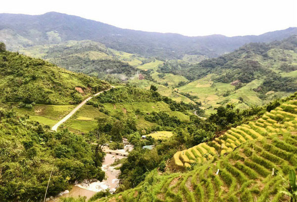
But in return, they can enjoy stunning views of terraced rice paddy fields awaiting the harvest and the villages of the Xo dang ethnic people on the hills. The view changes as one gets higher and vast forests replace the terraced rice fields.
After five hours, travelers reach a height of 2,100 meters where they camp overnight. Everyone gathers around the campfire, enjoys dinner and wishes each other a good night as they prepare for the next part of the trekking tour the next morning.
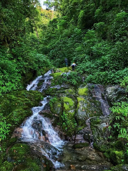
The path from the campsite to the Ngoc Linh Mountain peak is a challenge. Trekkers have to overcome steep streams and moss-covered rocks deep inside the forest. Sometimes, travelers have to walk on a narrow section covered with trees or a section overlooking an abyss.
Once again, gorgeous views on the way make the trek worth it, comprising age-old trees and crystal clear water streams. It takes about three hours to get to the peak.
Source: SGT