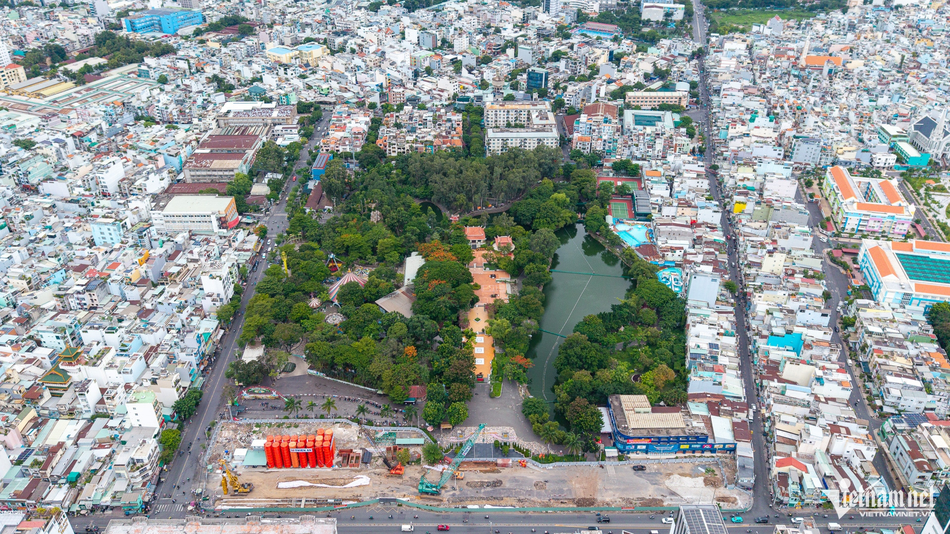
Following a field survey using ground-penetrating radar (GPR) from June 15 to 18, the Design Institute under the General Department of Logistics and Technical Services of the Ministry of National Defense, Ho Chi Minh City University of Technology, and Ho Chi Minh City University of Science identified several areas showing unusual subsurface characteristics at Le Thi Rieng Park in Hoa Hung Ward, Ho Chi Minh City.
Multiple anomalies detected beneath the ground
According to Lieutenant Colonel Pham Thi Thanh Van of the Design Institute, the survey faced numerous challenges due to the park's complex terrain, which includes a lake, walkways and various structures, while detailed maps were unavailable. The team first had to remap the site before deploying the radar equipment.

The rainy season raised groundwater levels, while concrete surfaces, vegetation and gravel layers weakened radar signals. Despite these obstacles, the survey still recorded multiple zones showing signs of unusual geological disturbance.
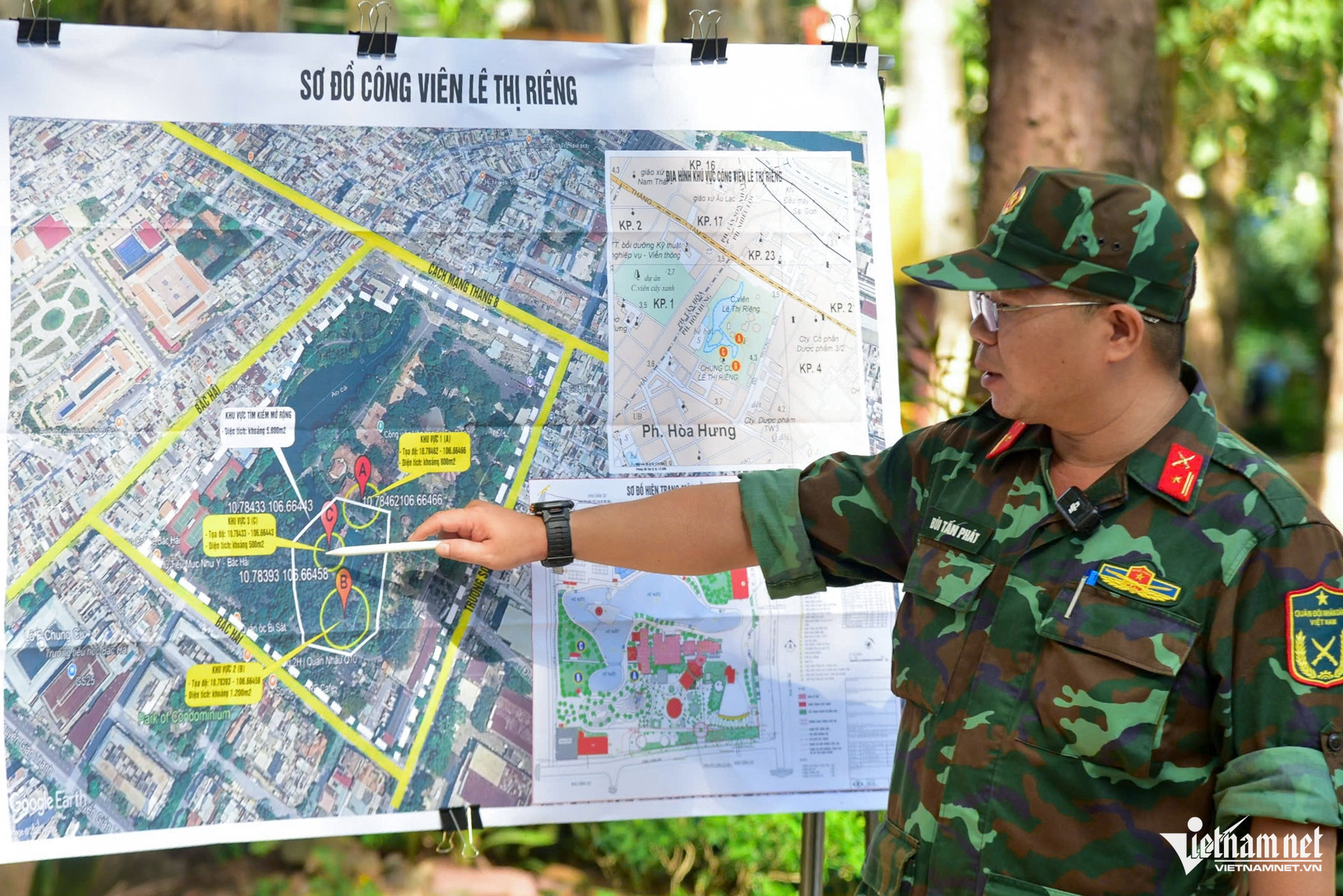
According to the survey report, the study area was divided into three sections - A, B and C - and further subdivided into individual survey points.
At point A1, experts identified three locations showing signs of geological disturbance or possible foreign objects. Most notably, a disturbed soil corridor was detected extending from the memorial stele area to the concrete bridge crossing the lake. The zone lies at a depth of 1.2-1.8 meters, is 2.5-3.5 meters wide and stretches for more than 10 meters.
Based on these findings, surveyors expanded data collection into section C. Results indicated that this area contained the most prominent signals, with a disturbed zone approximately 1.1 meters deep, 2.5-4.5 meters wide and extending further into the park. When data from points A1 and C1 were combined, experts observed a continuous disturbance pattern interrupted only by the existing lake and bridge.
According to the Design Institute, although ground elevations differ on either side of the area, the recorded signals show similar geological characteristics.
The institute recommended that any excavation work include slope reinforcement to prevent landslides, careful drainage planning to dry excavation pits without affecting materials within the disturbed zones, and measures to prevent surface water intrusion during heavy rainfall.
Military personnel conducted field surveys at Le Thi Rieng Park on June 15.
Associate Professor Le Van Anh Cuong, head of the Department of Geophysics at Ho Chi Minh City University of Science, said the research team combined electrical resistivity measurements with ground-penetrating radar and built a three-dimensional model to analyze the data.
In Area A, near the traditional house, two parallel survey lines produced similar results from both radar and resistivity measurements, suggesting the possible presence of underground objects.
Particularly noteworthy was an anomalous zone within the traditional house area itself. The feature measures roughly eight meters in length and one to two meters in width and lies at a depth of 2.5-3 meters, possibly deeper.

According to Cuong, the anomaly appears to consist of two separate sections, one near the lakeside and the other closer to Cach Mang Thang Tam Street. As there is not yet sufficient scientific evidence to determine whether the two sections are connected, only part of the feature was shown on the map.
He also noted that geological subsidence could not be ruled out as a possible factor influencing the signals. However, the upper soil layers still displayed relatively consistent boundaries. In addition, the team identified several smaller anomalies in the flower garden behind the historical site, including a zone approximately eight meters long, two meters wide and two meters deep.
At Area B, near the bird café, surveyors recorded a continuous anomalous zone extending across several survey lines. Meanwhile, Area C displayed relatively uniform geological structures with few underground objects at depths of two to three meters, leading researchers to temporarily suspend further surveys there.
According to Cuong, the consistency between electrical resistivity and radar data helped rule out the possibility of shallow sinkholes at several locations. Nevertheless, the data remained affected by multiple sources of interference resulting from the site's complex terrain and the lack of comparative information from boreholes.
The research team concluded that combining ground-penetrating radar and electrical resistivity surveys can effectively support the search for fallen soldiers' graves, but findings must be verified through field measures such as exploratory excavations at locations where anomalies have been detected.
Representatives from the Faculty of Geology and Petroleum Engineering at Ho Chi Minh City University of Technology said their survey results largely matched those of the Design Institute. Areas A and C were identified as priority locations where test pits should be excavated to clarify the unusual underground signals.
Priority zones identified as authorities prepare for field excavations
Survey results from the independent teams showed a high degree of consistency. Areas near the traditional house and the plaza in front of the memorial monument were identified as the two locations displaying the clearest anomalous signals, providing the basis for the next phase of field investigations.
Experts emphasized that ground-penetrating radar can help identify areas requiring further examination, but it only detects disturbances in soil layers and cannot confirm whether human remains or buried structures are present. As a result, exploratory excavations are needed to verify the anomalies.
To clarify the identified anomalies, the Ho Chi Minh City High Command said it will conduct field excavations at the suspected locations. Before work begins, the park management authority will fence off several areas to ensure construction safety.
The excavation program will be carried out in phases to minimize disruption to the park landscape and will be supervised by professional agencies, military forces and geophysical experts.
If burial evidence or human remains are discovered, the Ho Chi Minh City High Command and Steering Committee 515 will continue the required procedures to determine their origin and identity.
A sacred and meaningful mission
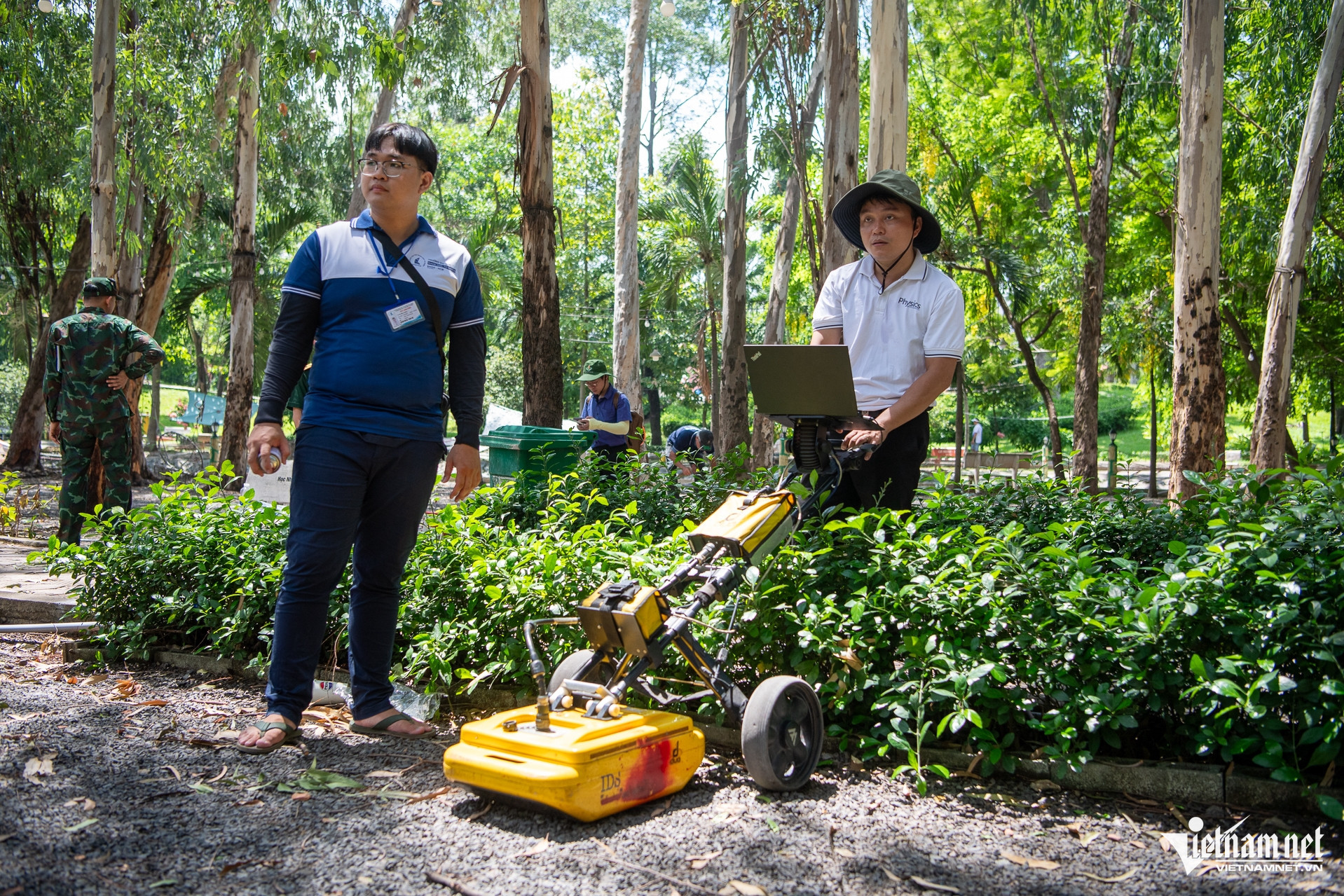
Speaking to VietNamNet, Associate Professor Le Van Anh Cuong said the survey at Le Thi Rieng Park used three specialized devices, including two ground-penetrating radar systems and one electrical imaging system. These modern tools are commonly used to map underground structures, detect sinkholes and identify subsurface objects.
According to Cuong, ground-penetrating radar works by transmitting electromagnetic waves into the ground. When the waves encounter objects or structures with properties different from the surrounding environment, the signals are reflected back to the receiving equipment.
"Depending on the equipment frequency and actual geological conditions, electromagnetic waves can penetrate deep into the ground and interact with the targets being investigated. Experts then analyze the data to identify and map suspicious locations," he explained.
The recorded geological anomalies may represent underground infrastructure such as power lines, fiber-optic cables and water supply or drainage systems, natural sinkholes, or areas potentially associated with graves and burial sites of fallen soldiers.
Discussing the personnel involved in the project, Cuong said the team includes faculty members from the Department of Physics, industry specialists and students.
"Every member understands that searching for the remains of fallen soldiers is a sacred and meaningful mission. The entire team is committed to contributing to efforts that support authorities in accelerating the search and recovery of the remains of Vietnam's fallen heroes," he said.
Phuoc Sang - Nguyen Hue