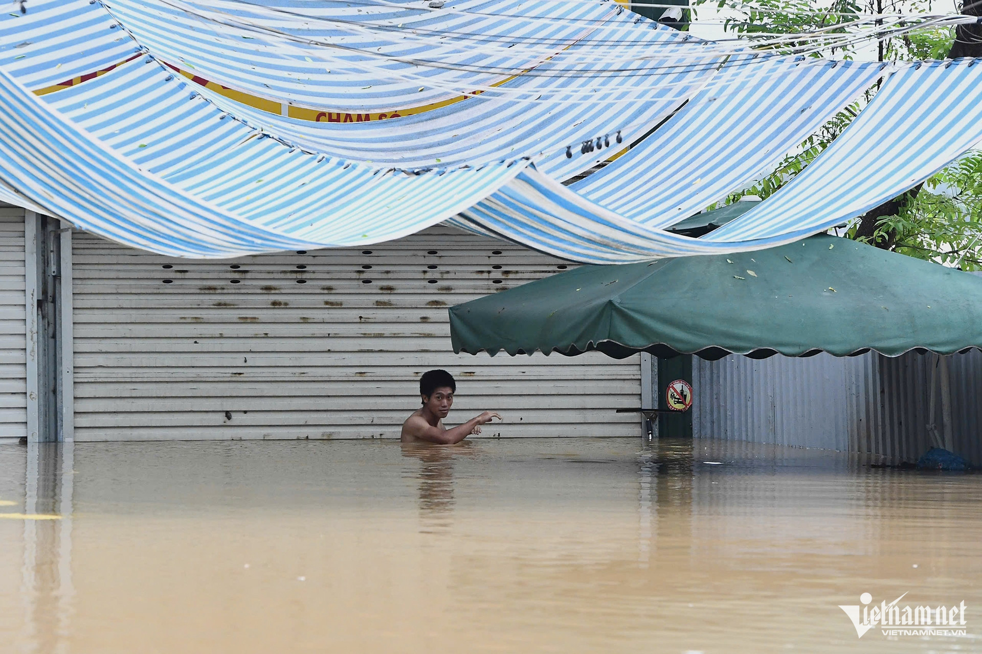
Floodwaters from the Red River have rapidly engulfed the middle islet near Hanoi, submerging entire areas as local residents face the threat of rising water levels. The situation has forced many people living along the riverbanks to evacuate to safer locations.
The flooding is a result of heavy rainfall from Typhoon Yagi (Storm No. 3), which has led to hydroelectric plants releasing water to manage the surge, causing the Red River’s levels to climb dangerously high. The current is particularly fierce, posing risks for communities living nearby.
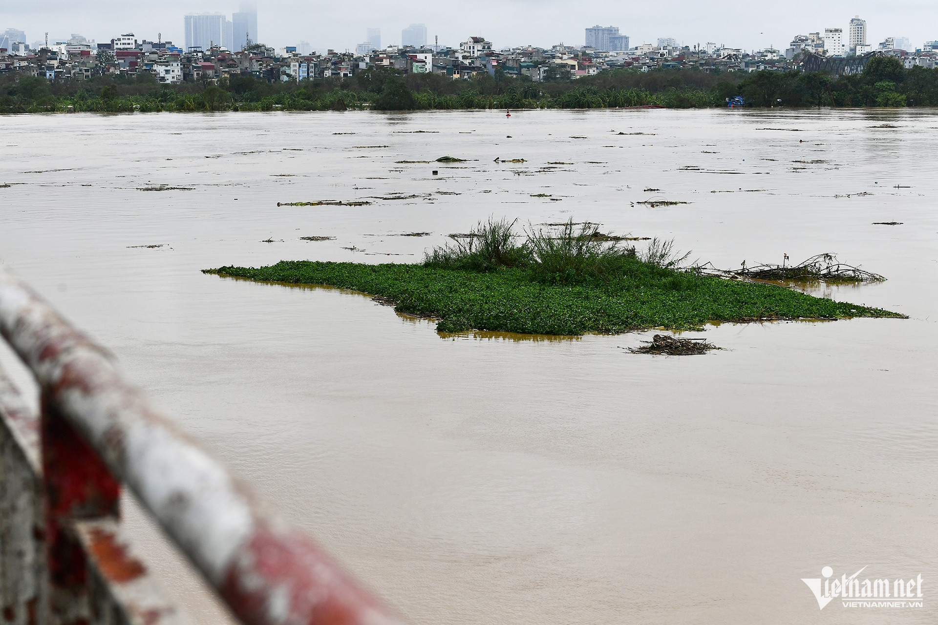
At the iconic Long Bien Bridge, water levels have reached a historic peak, a sight not seen in recent years. Large amounts of debris, along with waste from upstream, have become trapped against the anti-collision piers at both Long Bien and Chuong Duong bridges, adding to the hazards in the area.
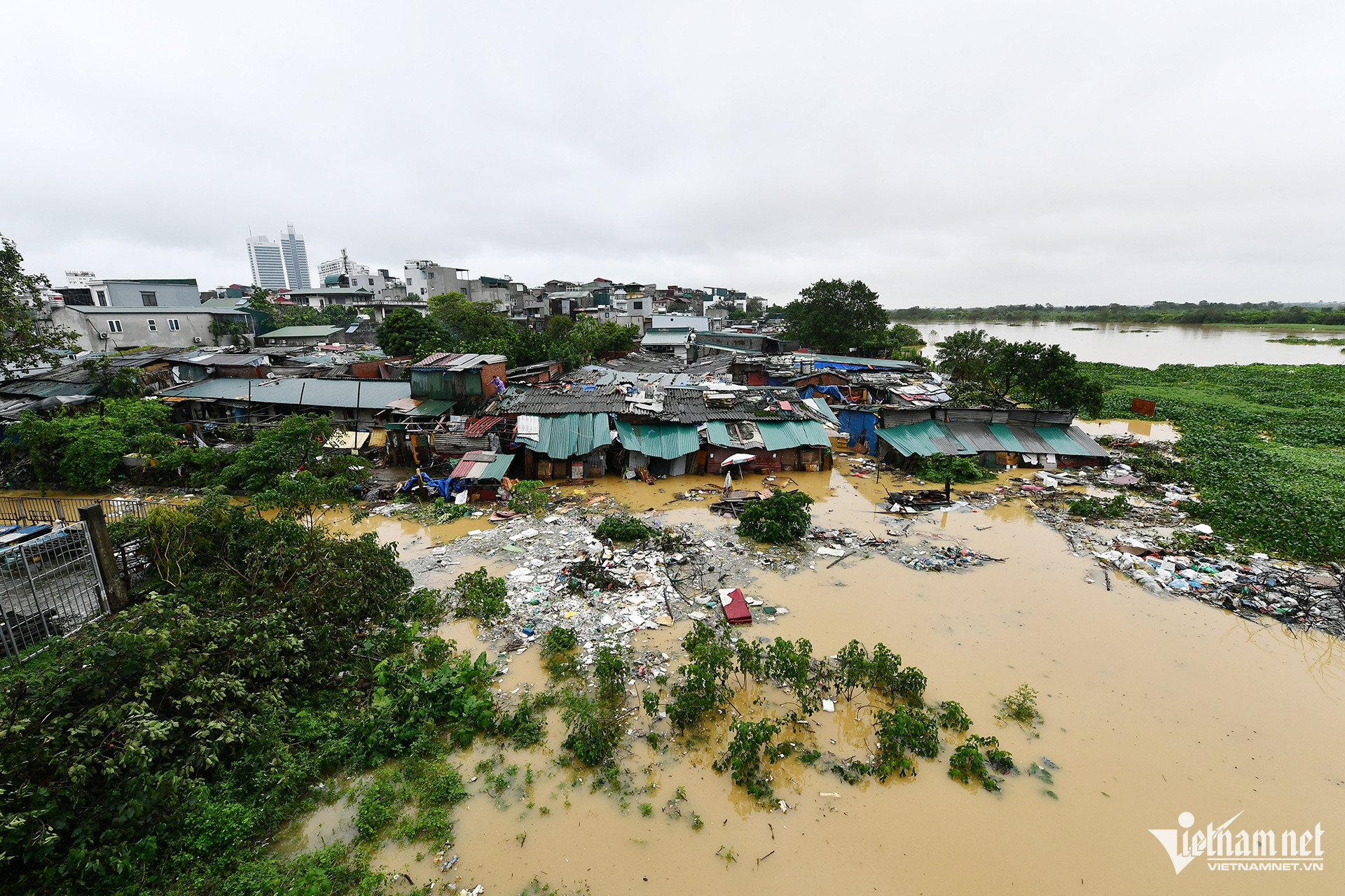
The floodwaters have risen sharply at the Phuc Xa islet, where residents rely on the land for cultivating various crops. Now, the fields and homes in this area are slowly being submerged, leaving entire neighborhoods struggling to save what they can.
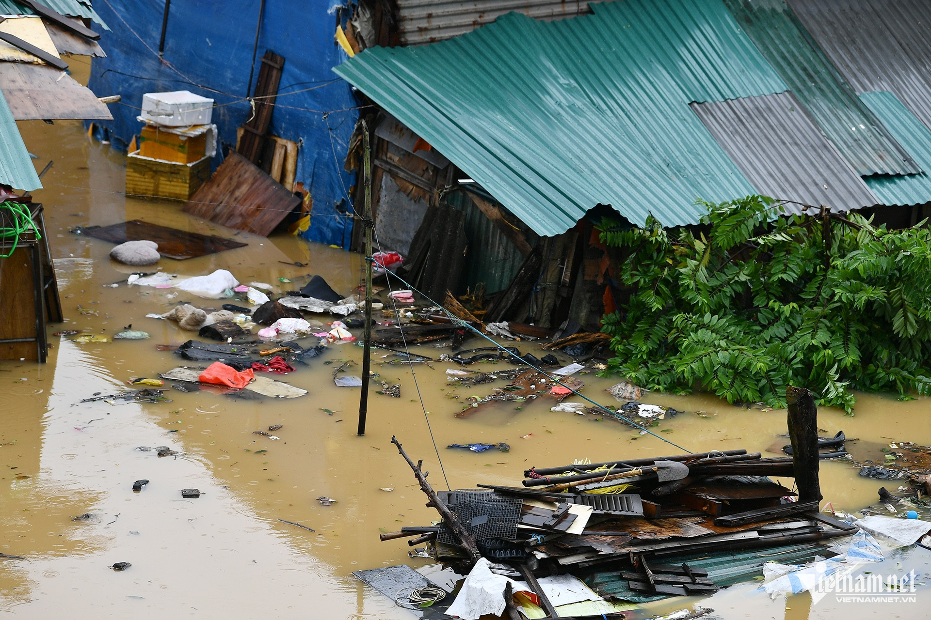
In Phuc Xa, rows of rental houses have been severely flooded, prompting residents to hastily evacuate their belongings overnight.
Many homes have been abandoned, with residents seeking refuge elsewhere as the floodwaters show no signs of receding.
The government has mobilized rescue teams to assist those affected, particularly in Ba Dinh and Hoan Kiem districts, where the impact of the floods has been most severe.
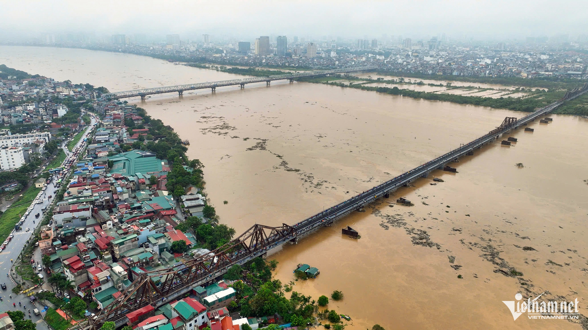
Due to the impact of Typhoon Yagi, hydropower plants are releasing floodwater, causing the water level of the Red River to rise and the current to become stronger.
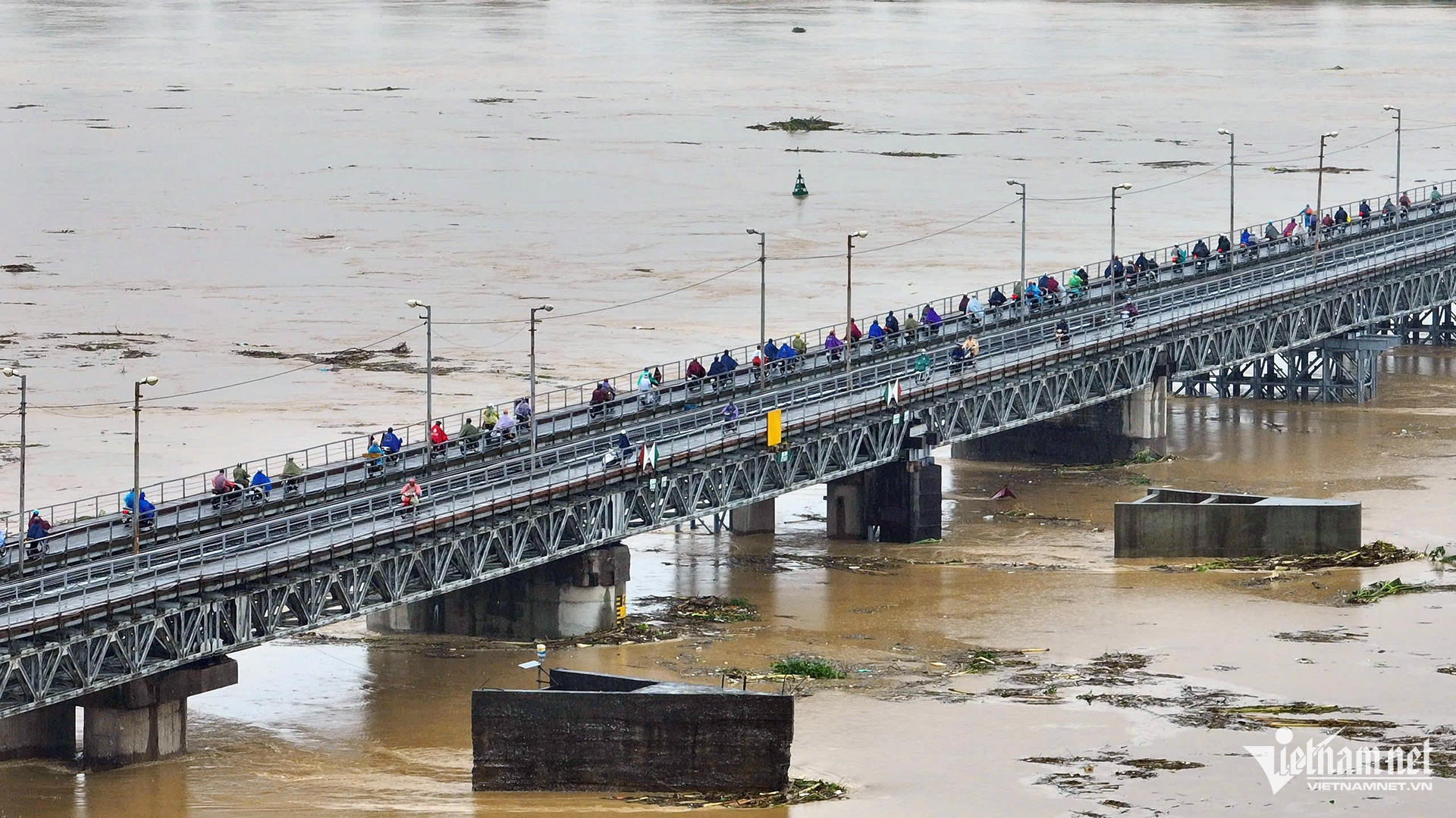
At the Long Bien Bridge area, the river has reached a record high. This level is rarely seen in recent years.
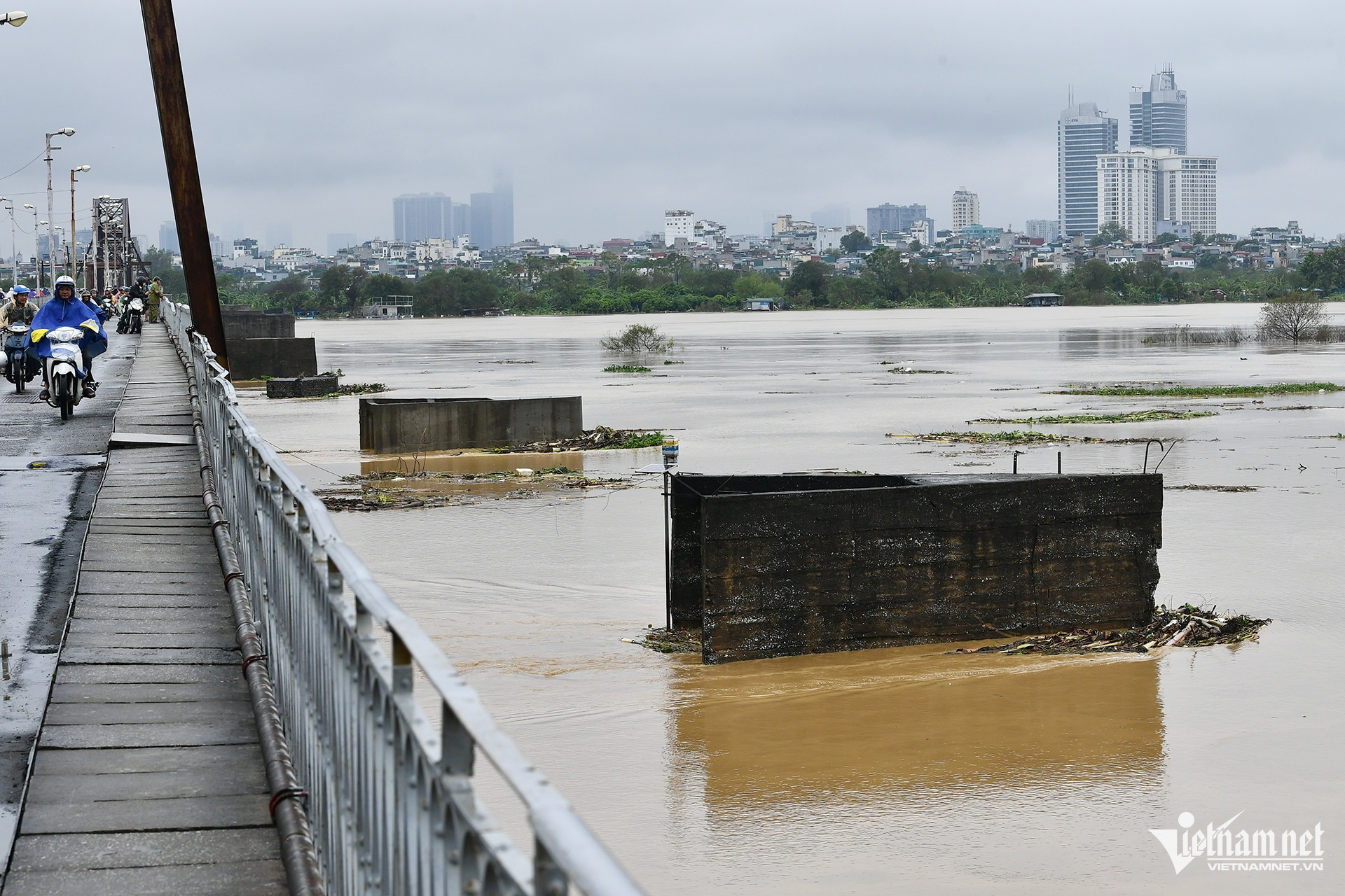
Waste and various items from upstream are drifting and getting caught on the impact protection piers of Long Bien and Chuong Duong bridges.
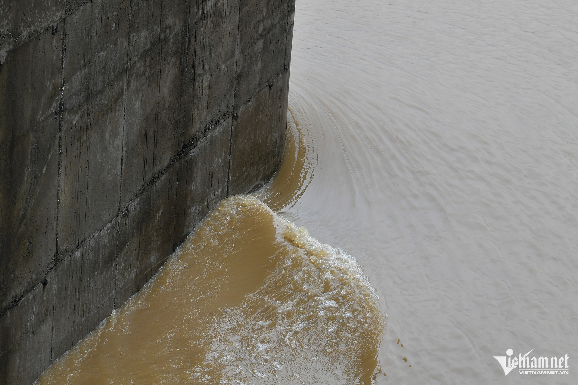
The strong current beside the bridge piers is clearly visible. It is forecasted that the water level of the Red River downstream will rise even further.
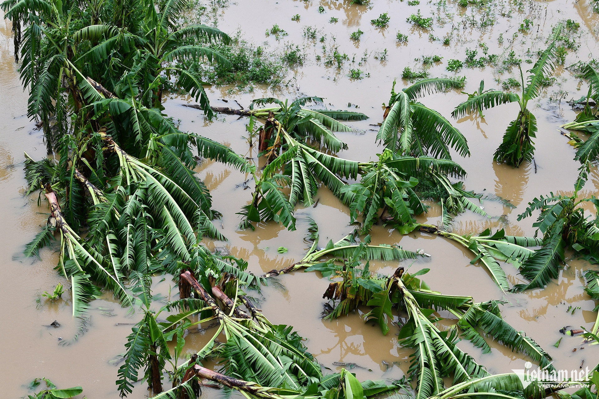
The sandbanks in the Red River, where people grow various fruits and vegetables, are gradually being submerged.
 |
 |
Houses on the Red River sandbanks are deeply submerged in water.
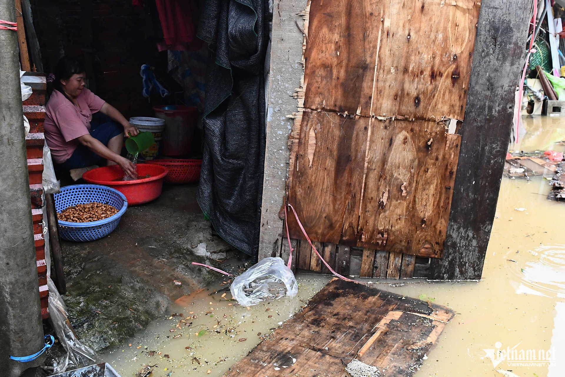
At Phuc Xa sandbank, the row of rented rooms outside has been heavily flooded. Residents have been moving their belongings since last night as the water continues to rise. Sitting in a house 20 meters from the riverbank that is about to be flooded, Mrs. Nguyen Thi Lan said she has finished packing and will move elsewhere if the water level rises further. "I work at Long Bien Market and have been renting in this area for over 10 years. I've never seen the water rise this high. Previous floods only reached the edge of the road," she said.
Many houses have closed, and residents have moved to stay elsewhere since the previous night.
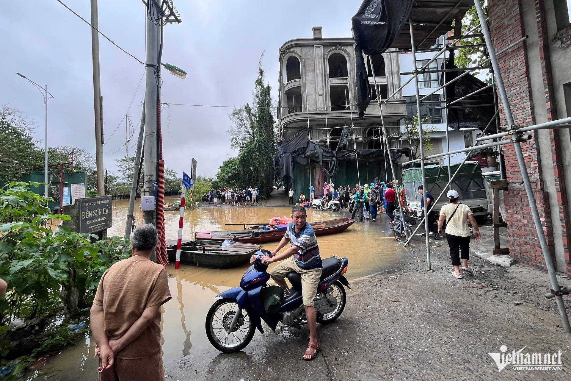
The water is also rising in higher areas, and residents are trying to find ways to cope. Authorities have mobilized rescue forces to assist residents in the affected wards of Ba Dinh and Hoan Kiem districts.
Thach Thao - Hoang Ha