 Vietnamnet.vn

 Podcast


On October 18, the Earthquake Information and Tsunami Warning Center under the Institute of Earth Sciences, part of the Vietnam Academy of Science and Technology, issued successive notices about four earthquakes recorded in Mang But commune, Quang Ngai province.
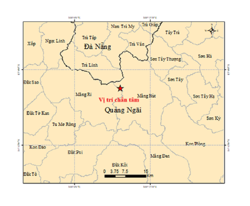
The first earthquake occurred at 1:48 a.m., measuring 3.3 in magnitude. Its epicenter was located at 14.985 degrees north latitude and 108.188 degrees east longitude, with a focal depth of approximately 8.2 kilometers.
At 2:58 a.m., another earthquake measuring 2.7 in magnitude was recorded in the same area, at a depth of approximately 8.8 kilometers.
At 9:14 a.m., a third earthquake struck Mang But commune, measuring 2.6 in magnitude, with a focal depth of approximately 6.8 kilometers.
Just 41 minutes later, at 9:55 a.m., the area experienced a magnitude 3.5 earthquake, the strongest of the four tremors. Its focal depth was approximately 8.6 kilometers.
According to the Earthquake Information and Tsunami Warning Center, all four earthquakes were classified at natural disaster risk level 0, the lowest level on Vietnam's disaster risk scale.
The center is continuing to monitor seismic activity in the area.
Mang But commune was previously part of Kon Plong district in the former Kon Tum province and is now administratively part of Quang Ngai province.
Since 2021, the former Kon Plong district has recorded more than 1,000 earthquakes of varying magnitudes.
Experts consider the area to have experienced frequent seismic activity in recent years.
The Institute of Geophysics has deployed a network of 11 seismic monitoring stations across the former Kon Tum area to support the monitoring, research and assessment of earthquake activity.
Ha Nam

