 Vietnamnet.vn

 Podcast


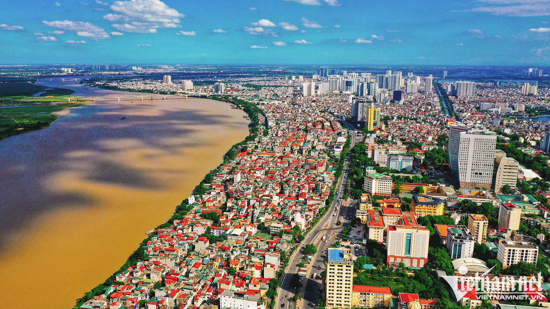
The Hanoi People's Committee has issued Decision No. 6075/QD-UBND approving a comprehensive revision of the Red River Urban Zoning Plan at a scale of 1:5,000, covering the section between Hong Ha Bridge and Me So Bridge.
The planning area spans approximately 11,418.96 hectares across 16 wards and communes: Thuong Cat, Dong Ngac, Phu Thuong, Hong Ha, Bo De, Long Bien, Linh Nam, O Dien, Me Linh, Thien Loc, Vinh Thanh, Dong Anh, Bat Trang, Thanh Tri, Nam Phu and Hong Van.
The area extends along both sides of the Red River, with its boundaries generally reaching the dikes on the left and right banks.
Under the revised plan, Hanoi aims to transform the riverbanks into a central green corridor integrating cultural, commercial, service and urban functions.
The projected population of 800,000 to 1.2 million is intended to guide calculations of urban land demand and infrastructure capacity.
However, the actual population will depend on whether the area can meet flood drainage and dike safety requirements approved by the relevant authorities.
Riverside communities divided into three planning categories
The revised plan establishes a layered urban structure, with building density and height generally decreasing toward the river.
Areas closest to the water will be designated as flood-prone zones, followed by partially floodable spaces accommodating parks, greenery and public squares.
Less flood-prone areas will accommodate tourism services and low-rise structures designed for possible dismantling.
Land closer to the dikes will be developed for mixed-use functions, including commercial facilities, services, offices, housing, healthcare and education.
The overall urban structure will follow a linear development model, supported by a continuous riverside transport corridor and interconnected roads arranged in a fishbone pattern.
Bridges linking the two riverbanks will serve as major cross-river transport routes, connecting urban centers and functional zones on both sides.
All new development must comply with flood prevention, drainage and dike safety requirements.
The plan also addresses long-established residential communities, traditional craft villages, historical and cultural sites, and community facilities along the Red River.
Rather than applying a uniform redevelopment policy to all settlements outside the dikes, Hanoi will classify them according to their specific conditions.
Three main categories have been identified:
Areas retained for conditional renovation and upgrading: Existing communities that can remain in place, subject to infrastructure improvements and development controls.
Areas requiring partial relocation: Communities affected by flood prevention requirements or essential infrastructure needs, including fire safety and environmental sanitation.
Areas designated for urban redevelopment: Locations where existing settlements must be reorganized or rebuilt to accommodate the new urban structure.
Classification will depend on several factors, including flood safety, drainage capacity, the impact of planned boulevards and transport infrastructure, and whether traditional village structures can be maintained after road construction.
Authorities will also consider the historical, architectural and cultural value of each area, traditional occupations, existing infrastructure quality and its role in the broader urban development plan.
For traditional craft villages and long-established settlements with significant heritage value, the plan prioritizes preserving their historic cores, upgrading infrastructure and controlling new development.
Relocation and redevelopment planned for selected areas
Areas subject to relocation and redevelopment include locations that fail to meet flood drainage safety requirements and those affected by planned transport infrastructure.
These include land required for a major landscaped boulevard, road intersections and other infrastructure projects.
The plan identifies a central development zone intended to serve as a key driver of the entire Red River landscape corridor.
This zone includes the area within Ring Road 2, between Nhat Tan Bridge and Vinh Tuy Bridge, along with several other residential communities specified in the planning documents.
Resettlement projects will be developed in designated urban areas, including resettlement and multipurpose urban developments in Linh Nam, Long Bien and Bo De wards and Bat Trang commune.
These projects are intended to support the reorganization of residential communities affected by redevelopment and infrastructure construction.
Historical and cultural heritage to be preserved
Alongside urban restructuring, Hanoi's revised plan emphasizes the preservation of historical and cultural heritage sites, including places commemorating revolutionary events and wartime resistance.
Both officially recognized and unclassified heritage sites will be considered, with preservation measures linked to their surrounding communities.
The city will continue reviewing individual locations to determine whether they should undergo conditional renovation, infrastructure upgrading or relocation for redevelopment.
Detailed solutions will be incorporated into specific planning, architectural and infrastructure regulations.
These requirements will be further defined through the management regulations accompanying the urban zoning plan, detailed plans at a scale of 1:500 and subsequent investment projects.
Thanh Hue

