According to the Southern Regional Hydrometeorological Center, the rain and storms affecting Ho Chi Minh City and neighboring provinces are caused by a weak cold front combined with a tropical convergence band extending across Central Vietnam and linked to Typhoon No. 6, which is moving southwest towards the coastal areas from Thua Thien Hue to Da Nang. The prevailing southwest winds range from moderate to strong.
Satellite images, radar data, and lightning detection at 1:40pm on October 27 indicated developing storm clouds accompanied by rain, thunder, and lightning over areas such as Binh Chanh, Binh Tan, Tan Phu, Hoc Mon, and Cu Chi.
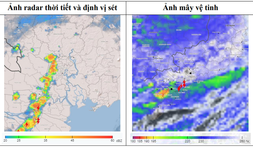
Storm clouds are also forming in Long An Province and moving in a southwest-to-northeast direction towards Ho Chi Minh City.
The meteorological center warned that within the next 0-3 hours (from 1:40 PM), storm clouds will continue to develop, bringing heavy showers, thunder, and lightning to the aforementioned districts, and later extending to nearby areas, including central districts, Thu Duc City, Districts 7, 12, Go Vap, Nha Be, and Can Gio. Rainfall levels are expected to range from 10-25mm, with some areas exceeding 30mm. The storms may bring localized flooding, as well as risks of whirlwinds, hail, and gusts of wind reaching speeds of 8-17 m/s (Beaufort scale 5-7).
Earlier this morning, heavy rain hit Ho Chi Minh City and various areas in Southeast Vietnam, causing flooding in several roads and residential areas.
A poinciana tree with a diameter of 0.8 meters uprooted inside Nguyen Thi Dinh Primary School (Tan Thoi Nhat Ward, District 12, Ho Chi Minh City), falling onto the road and crushing a car.
Bao Anh