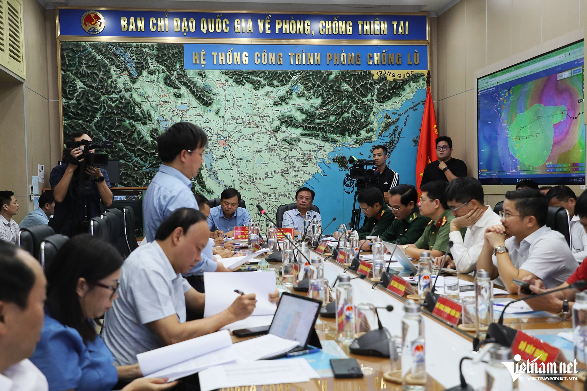
On October 25, Le Minh Hoan, Minister of Agriculture and Rural Development, chaired a meeting, both in-person and online, with various ministries and 19 provinces and cities to discuss preparations for Storm Trami.
During the meeting, Mai Van Khiem - Director of the National Center for Hydrometeorological Forecasting - shared that at 2 PM on the same day, the storm was located about 600 km east of the Hoang Sa archipelago, with wind speeds reaching level 10, gusting to level 13, moving relatively slowly.
"The storm has changed direction four times since forming and entering the East Sea. Its circulation is extensive, though it has yet to form an eye. The affected area causing rain stretches between 500 to 600 km. Since October 24, cloud formations on the western part of the storm have begun affecting our country, bringing rain and strong winds," he explained.

He further clarified that earlier forecasts from meteorological agencies varied but have now converged, predicting that the storm will likely impact the central coastal regions of Vietnam.
In the northern East Sea area, wind speeds could reach level 12, gusting to level 15, with waves between 5 to 7 meters high, and 7 to 9 meters near the storm's core. By the morning of October 27, coastal areas from Quang Binh to Quang Ngai, including Ly Son Island, will see winds strengthening to levels 8-9, gusting to levels 10-11.
"Given the current movement and forecast, the storm might make landfall and then turn back out to sea. Coastal regions from Quang Tri to Quang Ngai could see winds between levels 6-8. However, if it moves further inland, wind speeds might increase to level 9, with gusts up to levels 11-12," said Khiem.
The storm's vast circulation on its western side could cause significant rainfall, particularly from Quang Tri to Quang Ngai, where totals could range from 300 to 500mm, with isolated areas seeing over 700mm. Meanwhile, Ha Tinh, Quang Binh, and the northern Central Highlands could experience between 100 to 200mm of rain.
Khiem advised residents not to focus solely on the storm's eye, as its wide circulation could cause impact even before landfall.
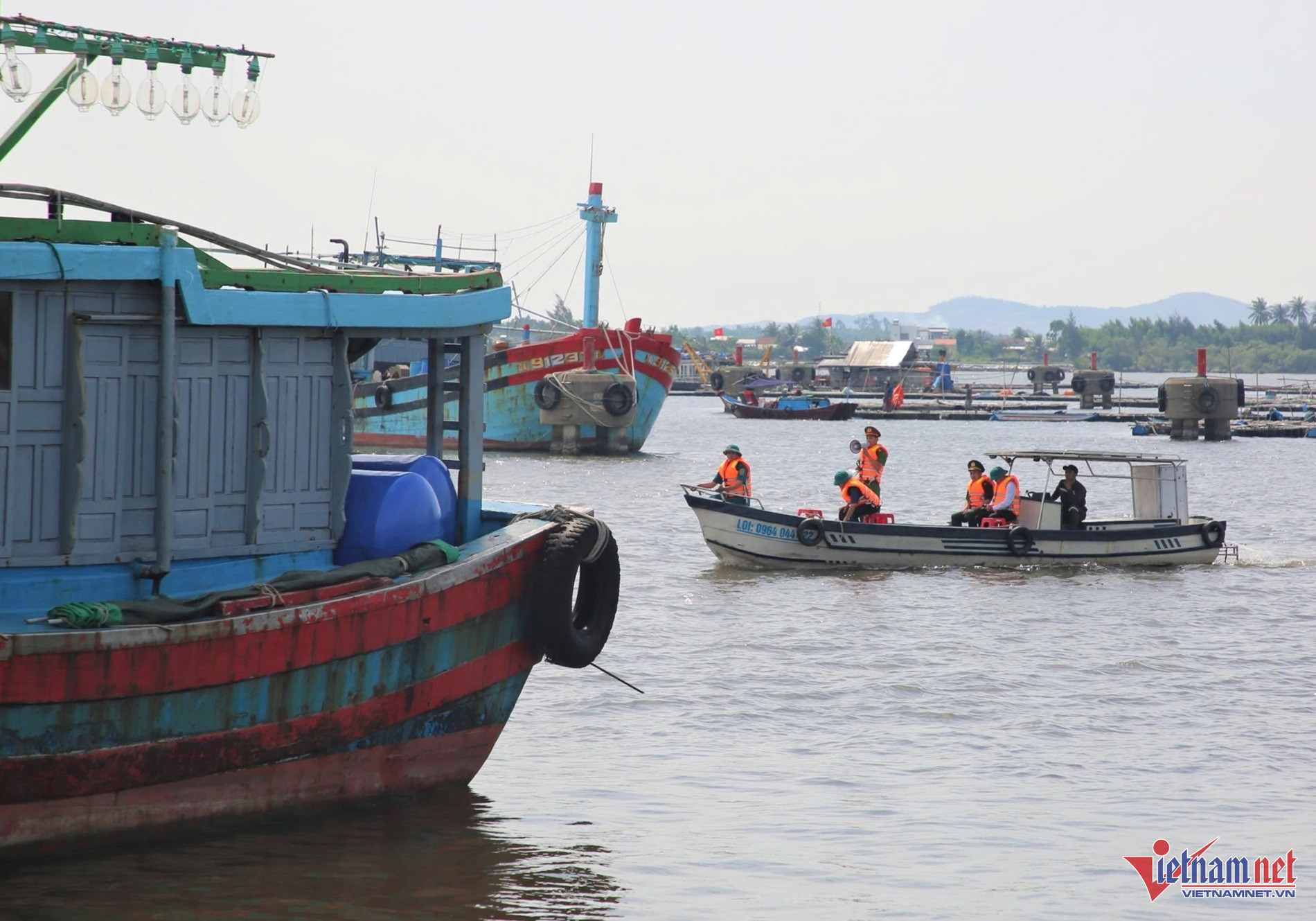
The Border Guard Command reported that they had accounted for and guided 67,212 vessels, involving 307,822 people, about the storm's path and developments. Currently, 35 vessels with 184 people (from Quang Ngai) are operating in the northern East Sea and around the Hoang Sa archipelago, avoiding the dangerous zones.
A representative from the Ministry of Transport noted that within the maritime jurisdictions from Quang Ninh to Binh Thuan, there are 940 vessels, including 469 sea vessels and 471 inland watercraft.
The military has also mobilized 285,480 personnel, including 86,019 soldiers, 199,461 militia, and 12,503 military vehicles, ready to respond to the storm's impact.
Specific deployments include:
- Military Region 3 mobilizing 51,075 personnel, 582 vehicles.
- Military Region 4 deploying 135,781 personnel, 1,195 vehicles.
- Military Region 5 assigning 55,163 personnel, 1,660 vehicles, and three aircraft.
- The Air Defense and Air Force Command preparing 4,600 personnel, 206 vehicles, and eight planes.
- Corps 18 has mobilized 30 personnel, two helicopters, and four vehicles.
Dinh Hieu