Photos by Hoang Dieu De
Thao Trinh
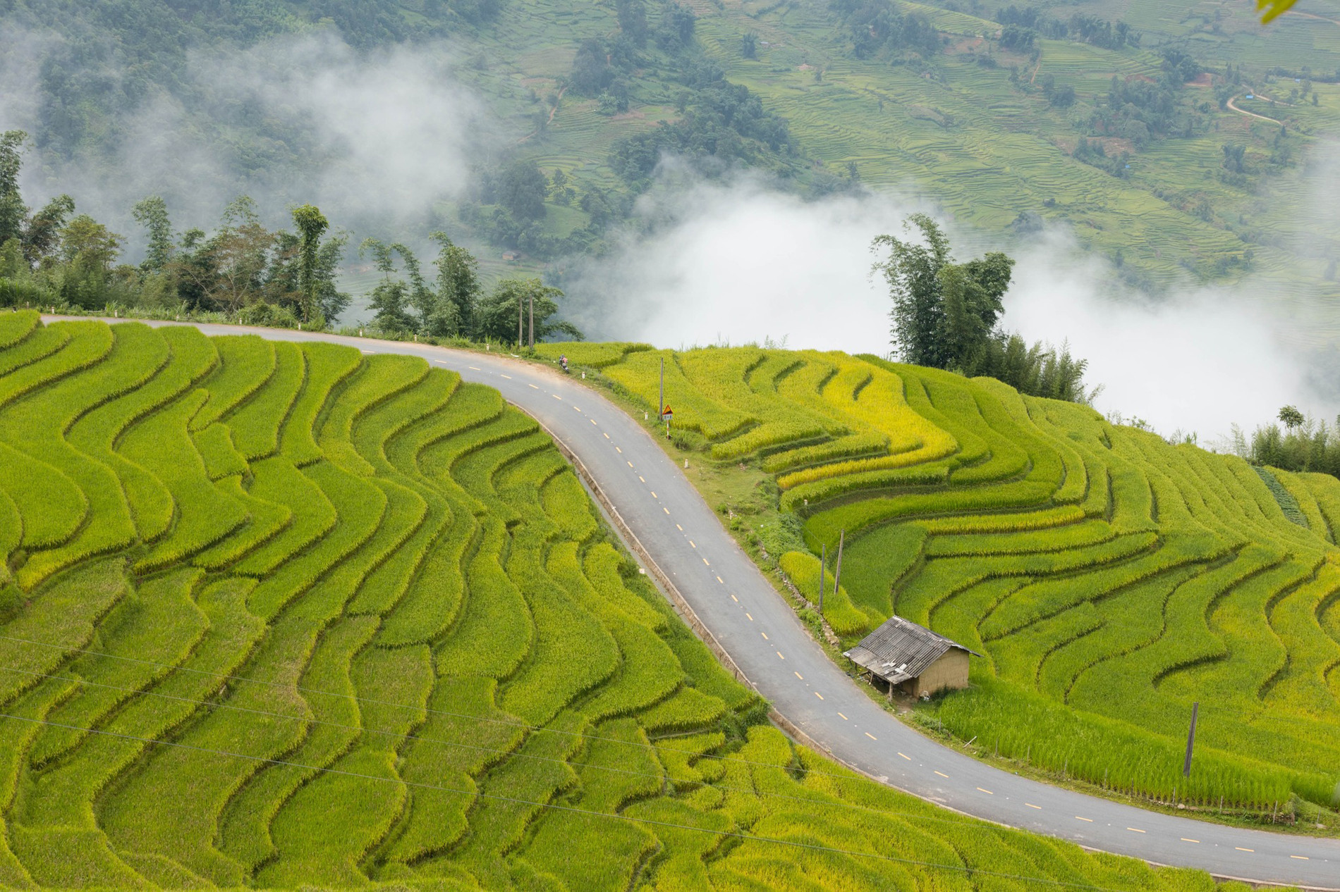
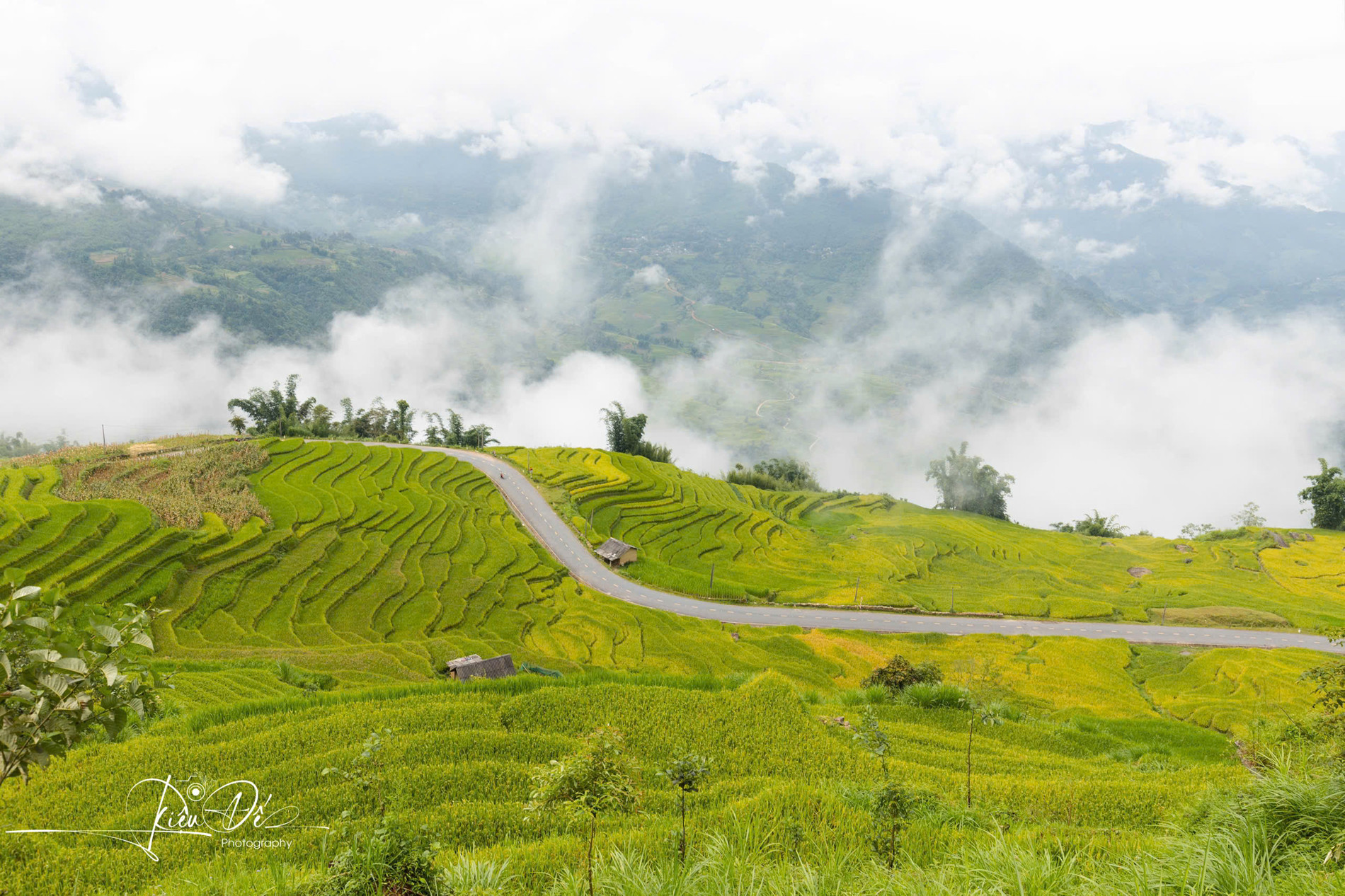
Tucked between layers of terraced rice fields, a particularly picturesque curve in A Lu Commune, Bat Xat District, has recently gained fame on social media, drawing attention from travelers far and wide. This road, part of the DT 156 route connecting Lao Cai City to Y Ty Commune, provides a stunning landscape that seems like it belongs in a dream, especially during the golden harvest season.
Hoang Van Huy, a Hanoi native and travel enthusiast now working in the tourism industry in Cao Bang and Ha Giang, was among the first to share the beauty of this hidden gem. On his visit to Y Ty on August 19th, Huy was immediately taken by the natural charm of the area. Armed with a drone, he captured breathtaking aerial shots that quickly caught the public’s eye.
"The air here is refreshingly cool, and the scenery is untouched by time," Huy remarked. "When I arrived, the rice fields flanking the road had turned a brilliant gold, filling the air with a sweet fragrance."
Huy also noted a nearby milestone indicating the curve’s proximity to Y Ty, just 7 kilometers away. This stretch of the road offers countless photo opportunities, including the iconic "sunset tree," a favorite among photographers.
Locals informed Huy that by the end of August, the rice would be fully ripe, marking the peak of the golden season and making it the perfect time for visitors. Although it was Huy’s first visit to this particular curve, he was profoundly impressed by the unique beauty of the landscape. He believes that this spot has the potential to become a new attraction for travelers, offering a golden season experience in the Northwest that rivals well-known destinations like Nam Cang (Sa Pa) or Muong Hum (Bat Xat) in Lao Cai.
As the September 2nd holiday approaches, visitors have the opportunity to explore Y Ty and witness the breathtaking beauty of this curve, where terraced fields are blanketed in golden tones.
To reach this scenic spot on the DT 156 road, travelers can start from Sa Pa Town, head towards Ban Xeo, Muong Hum, and finally A Lu Commune. Alternatively, the route from Lao Cai City via Kim Thanh, Trinh Tuong, Lung Po, and A Lu Commune also leads to this enchanting curve, with both routes spanning roughly 90 kilometers.
The months of August and September are when the rice fields in Bat Xat District reach their peak, transforming the landscape into a vibrant tapestry of yellow that attracts numerous visitors. While Y Ty is already well-known as a "cloud hunting" destination, this season allows visitors to marvel at the magnificent rice fields while enjoying the area’s fresh and pleasant atmosphere.
However, as this period coincides with the rainy season in the mountains, travelers should be cautious of potential landslides and flooding. It is advisable to monitor weather forecasts to ensure a safe journey to this and other tourist destinations.
Given the increasing popularity of Lao Cai and the Northwest region during the rice harvest season, especially on weekends, travelers are advised to book accommodations early or hire local guides for a more comfortable and organized trip.
 |
 |
Photos by Hoang Dieu De
Thao Trinh