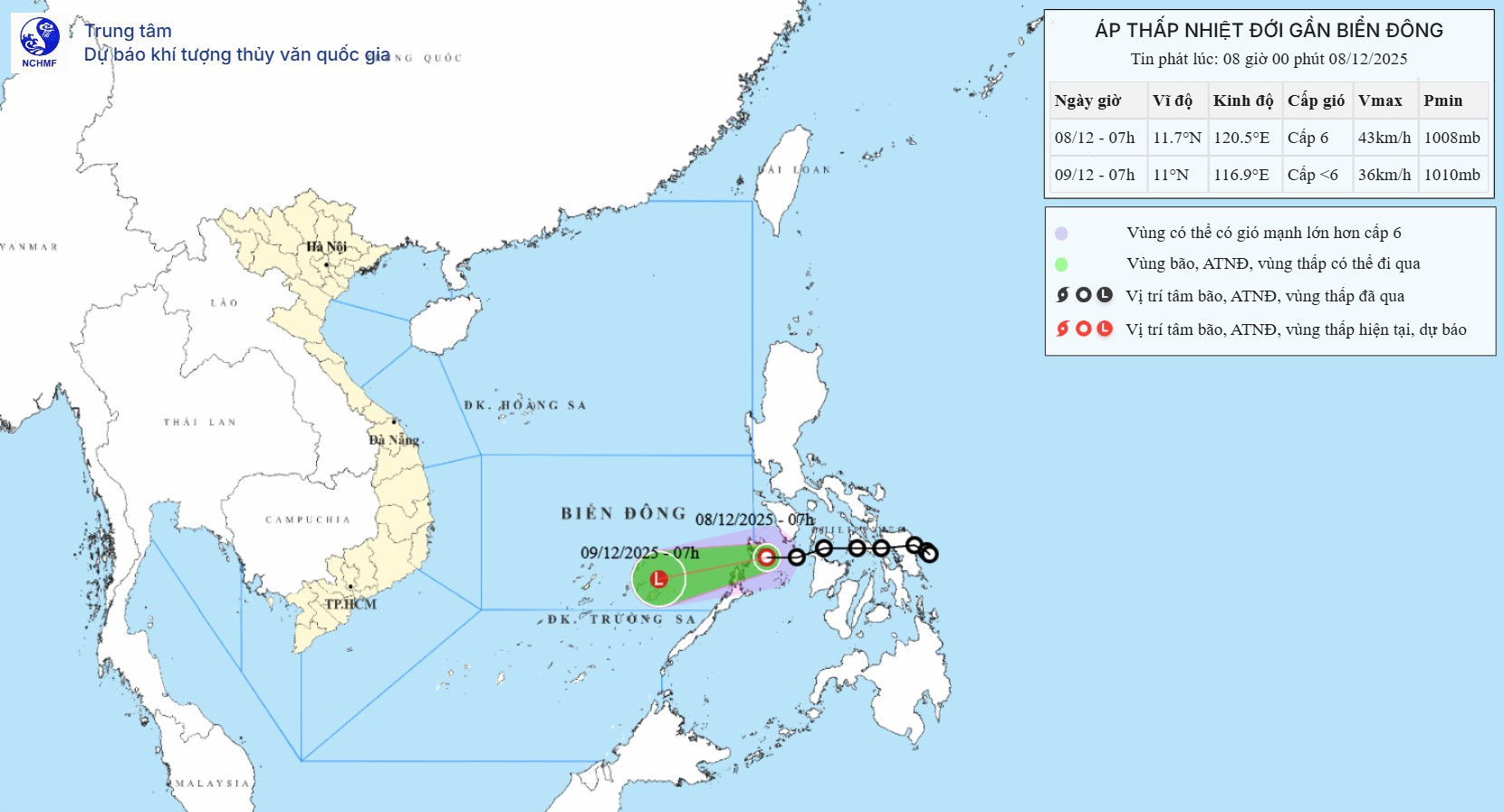
According to the National Center for Hydro-Meteorological Forecasting (NCHMF), as of 7 a.m. this morning (December 8), the center of the tropical depression was located off the eastern coast of Palawan.
The strongest winds near the center were recorded at level 6, with gusts up to level 8, moving westward at a speed of 15–20 km/h.
In the next 24 hours, the tropical depression is expected to shift direction, heading west-southwest at 15–20 km/h and weakening into a low-pressure area (below level 6). By 7 a.m. on December 9, its center is forecast to be located over the southeastern waters of the central East Sea.
Due to the influence of the tropical depression, the southeastern waters of the central East Sea - including the northeastern area of the Truong Sa (Spratly) archipelago - will experience winds of level 6, gusts of level 8, waves of 2–4 meters, and rough seas. Vessels operating in these dangerous waters may be affected by thunderstorms, gales, and high waves.
However, by this afternoon, the tropical depression over central Philippines had already weakened into a low-pressure area, earlier than previously forecast.
As of 1 p.m., the center of the low-pressure area was located near the eastern coast of Palawan. Maximum wind speeds in the center had dropped below level 6 (under 39 km/h).
Forecasts for the next 12 hours indicate that this low-pressure system will continue moving west-southwest at 10–15 km/h, gradually dissipating.
As a result, the tropical depression is no longer capable of producing strong winds at sea.
This is the final bulletin issued on this tropical depression.
Bao Anh