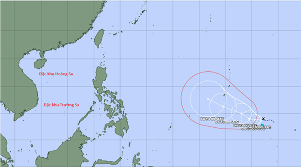
According to the National Center for Hydro-Meteorological Forecasting, as of 7 a.m. on April 9, the system was located nearly 3,000 km east of the Philippines, with winds reaching level 7 and gusts up to level 9.
The depression is currently positioned east of the subtropical high-pressure ridge. Under its influence, the system is forecast to move slowly westward and may intensify into a storm within the next day. If it develops as expected, this would be the fourth storm to form in the Northwest Pacific in 2026, following Nokaen, Penha and Nuri.
However, after strengthening, the storm is projected to shift direction, moving northward before turning west-northwest toward southern Japan.
Weather analyses and forecasting models consistently indicate a very low likelihood that the system will enter the East Sea.
According to meteorological experts, this trajectory is typical for early-season storms in the Northwest Pacific, which often follow a parabolic path.
The Japan Meteorological Agency, designated by the World Meteorological Organization to monitor and issue warnings for storms in the region, also expects the system to intensify and track northward.
The National Center for Hydro-Meteorological Forecasting will continue to closely monitor the development of the tropical depression and its potential evolution into a storm in the coming days.
Bao Anh