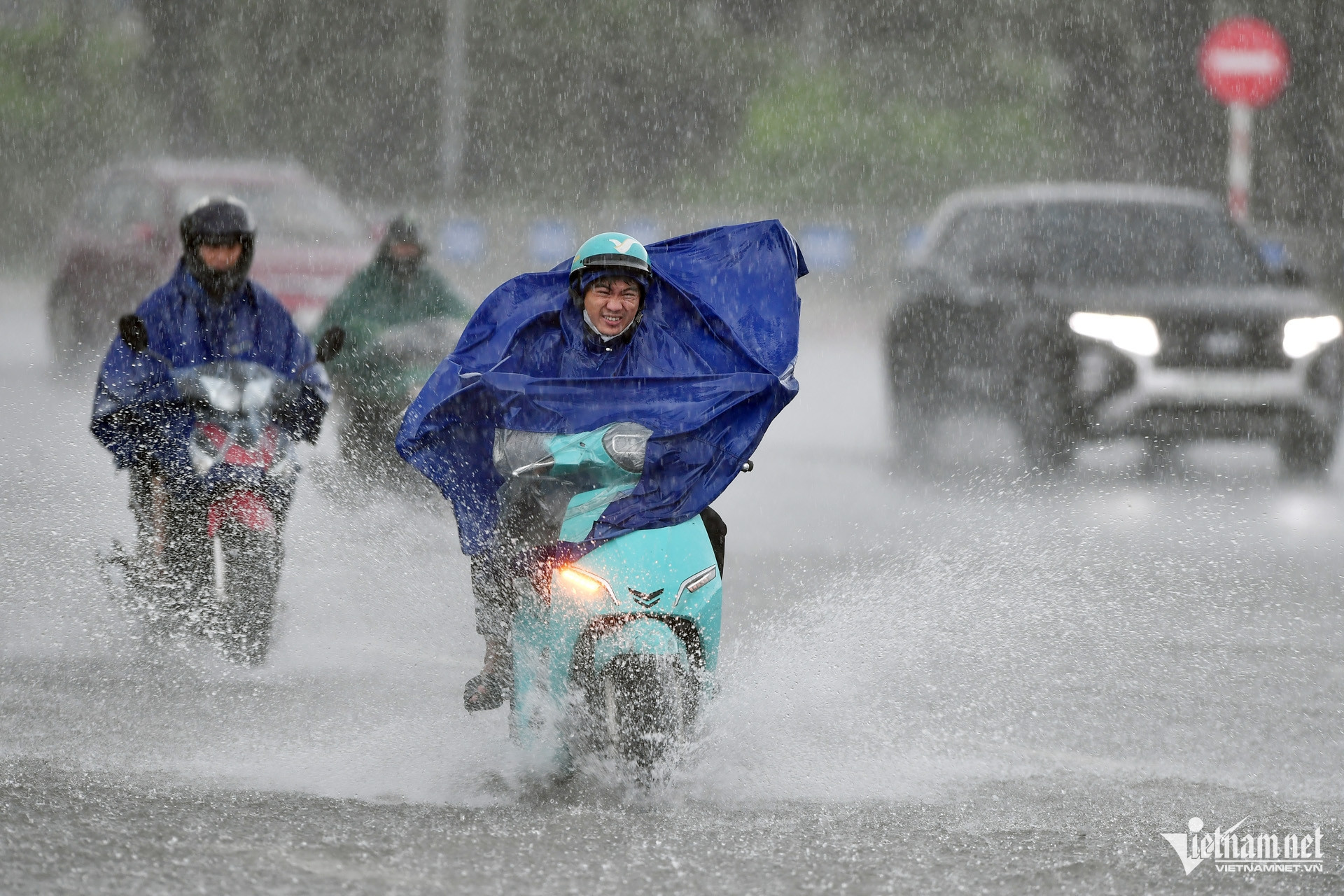
Northern Vietnam is forecast to experience two consecutive spells of heavy rain between June 29 and July 5, with some mountainous and midland areas expected to receive more than 300mm of rainfall, raising the risk of flash floods and landslides, according to the National Center for Hydro-Meteorological Forecasting.
Speaking on June 28, Nguyen Van Huong, head of the center's Weather Forecast Department, said the first round of rain will affect northern Vietnam from the night of June 28 through June 30.
Rainfall will be widespread, with showers concentrated mainly overnight and during the morning.
The heaviest rainfall is expected in eight provinces - Thai Nguyen, Cao Bang, Tuyen Quang, Lao Cai, Lai Chau, Dien Bien, Son La and Phu Tho - where accumulated rainfall is forecast to range from 70mm to 150mm, with isolated areas exceeding 300mm.
A second round of showers and thunderstorms is forecast from July 1 to July 5, mainly during the night and early morning. Each rainfall event is expected to bring 50-100mm of rain, with isolated locations receiving more than 250mm.
Authorities have warned that Lang Son, Cao Bang, Thai Nguyen, Tuyen Quang, Lao Cai, Lai Chau, Dien Bien, Son La and Phu Tho face an elevated risk of flash floods and landslides over the coming days.
Meanwhile, the Red River Delta is expected to see scattered rain and thunderstorms from the evening of June 28 through June 29, with rainfall generally ranging from 15-30mm and isolated totals exceeding 70mm.
Central Vietnam remains under intense heat
While northern Vietnam braces for heavy rain, central provinces will continue to endure hot weather.
Temperatures of 36-38 degrees Celsius are forecast across Nghe An, Da Nang and eastern parts of Quang Ngai, Gia Lai and Dak Lak on June 29 and 30. The heat is expected to gradually ease from July 1.
In the Central Highlands and southern Vietnam, a strengthening southwest monsoon is forecast to bring moderate to heavy rain and thunderstorms between June 28 and July 5.
Tropical depression may enter the East Sea
Weather authorities are also closely monitoring a low-pressure area east of the Philippines.
As of June 28, the system was located near 10 degrees north latitude and 132 degrees east longitude and moving west-northwest. It is expected to strengthen into a tropical depression within the next 24 hours.
Forecasters estimate there is around a 70% chance that the tropical depression will enter the East Sea by around July 1.
The National Center for Hydro-Meteorological Forecasting said it is continuing to monitor the system closely and will issue updated forecasts and warnings as necessary.
Experts advised residents, particularly those living in northern mountainous provinces and coastal areas, to closely follow official weather bulletins and prepare appropriate response measures in the coming days.
Bao Anh