According to the Southern Regional Hydrometeorological Center, ENSO conditions are currently in a neutral phase. However, from June 2026, the climate is projected to shift into an El Nino phase with a probability of around 60%, increasing further in the following months.
Based on historical data, strong El Nino years have often had negative impacts on southern Vietnam, notably during 2015-2016, 2019-2020, and 2023-2024. These periods were marked by rising temperatures, prolonged heatwaves, and severe saltwater intrusion in the Mekong Delta.
Experts also note that 2026 shows similarities to years such as 2009, 2012, 2014, and 2018. Under the influence of ENSO trends, this year’s rainy season is expected to display notable variations.
Specifically, the rainy season is forecast to begin earlier than the multi-year average, likely within the first 10 days of May, or even from late April. Despite the early onset, total rainfall is expected to be at or slightly below average, comparable to levels recorded in 2025.
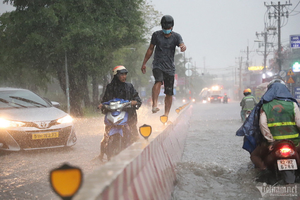
However, even with moderate overall rainfall, short-duration heavy downpours exceeding 100mm could still occur, posing a risk of urban flooding. Areas such as Lam Dong and Dong Nai provinces are particularly vulnerable to flash floods and landslides.
Storm warnings and the possibility of past scenarios repeating
From May to December 2026, around 12 storms and tropical depressions are expected to form in the East Sea, with approximately 4 to 5 potentially affecting Vietnam’s mainland.
Notably, there is a possibility that some storms or tropical depressions may track toward southern Vietnam later in the year. Given that 2026 shares characteristics with 2012 and 2018 - years when storms such as Pakhar (2012) and Usagi (2018) made landfall in the South - disaster preparedness efforts in southern provinces need to be strengthened.
Proactive response from early stages
Alongside forecasts on rainfall and storms, meteorological authorities have issued specific recommendations for residents and local governments.
Although peak salinity intrusion has passed and conditions are not expected to be as severe, the period from late April to early May may still see limited rainfall. Residents are therefore advised to store freshwater for both production and daily use.
Transitional months such as May, June, and November are likely to see frequent thunderstorms, whirlwinds, and lightning. Toward the end of the year, strong winds and high waves could pose risks to maritime activities.
In addition, during September, October, and November, high tides combined with rainfall may cause widespread flooding in low-lying areas and riverside urban zones.
Meteorological authorities emphasize that closely monitoring short-term forecasts will enable both local authorities and residents to respond proactively, minimizing damage to lives and property throughout 2026.
Bao Anh