For many decades, for most Vietnamese people, space was a story of historic missions and faraway dreams. But as the third decade of the 21st century unfolds, space is being redefined as a new development frontier, directly linked to economic growth, national security and defense, and the governance capacity of the Vietnamese state.
From the first 1kg satellite nicknamed the “Vietnamese dragon”, to quietly operating laboratories, to the Politburo formally assigning space technology a special role, a shift in mindset has taken place.
That turning point was marked by Resolution 57 of the Politburo, which for the first time defined space technology as a national strategic technology, placing outer space on equal footing with maritime and underground domains.
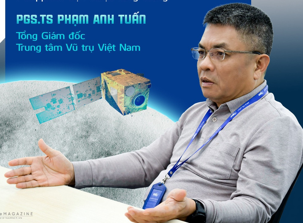
Associate Professor, Dr. Pham Anh Tuan, Director General of the Vietnam National Space Center - VNSC under the Vietnam Academy of Science and Technology, said the inclusion of space technology in a Party resolution for the first time carries profound significance, not only for the scientific community but for the country’s entire development strategy.
“Scientists in the space technology field were truly delighted when Resolution 57 was issued. The Government later promulgated Resolution 1131, listing 11 technology groups and 35 key strategic product groups to drive spearhead industries. Three products in the space technology field were selected: low-orbit remote sensing and telecommunications satellites, ground stations and satellite control systems, and unmanned aerial vehicles - UAVs,” Tuan shared.
He noted that competition today is no longer confined to the ground but extends into outer space. Given its economic capacity, Vietnam cannot cover every segment, nor compete with Internet satellite constellations like Starlink or large telecommunications satellites. Instead, the chosen strategy focuses on Earth observation satellites and small satellites.
“That is a choice aligned with our national capacity. More importantly, it directly addresses essential needs: data serving research, governance, development and national protection,” he said.
In 1980, Vietnam became the first Asian nation to send a person into space. The flight of hero Pham Tuan was not only a source of pride but also planted a larger dream of space exploration across generations.
Yet it was not until after 2006, when the space technology strategy was relaunched, that this dream began to be translated step by step into policies and concrete programs.
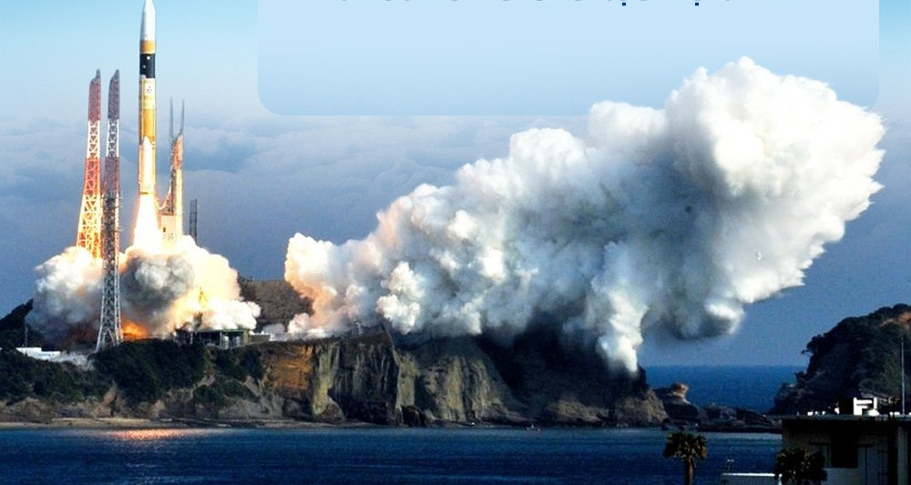
Between 2006 and 2020, VNSC set the goal of gradually mastering satellite design and manufacturing technologies. A development roadmap was established, progressing from 1kg, 4kg and 50kg satellites to the current LOTUSat-1 weighing approximately 600kg. Vietnam cooperated with France to launch the optical satellite VNREDSat-1 in 2013, and also manufactured PicoDragon, which was launched the same year.
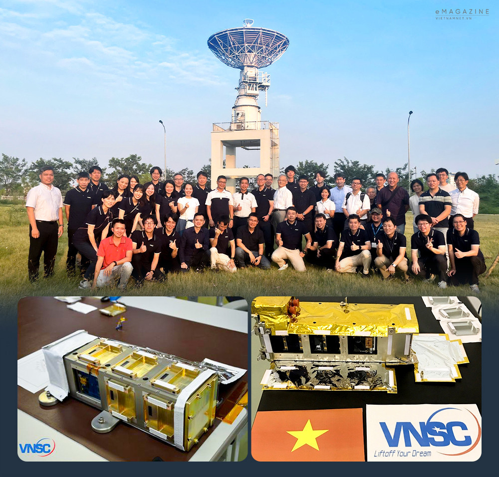
Alongside these milestones, Vietnam has built a workforce trained abroad and established infrastructure considered among the most advanced in Southeast Asia.
“We now operate the control system for LOTUSat-1, maintain research and development laboratories, and by the end of this year will complete an assembly, integration and testing facility for satellites under 200kg. With this infrastructure, we are fully confident in producing small ‘Make in Vietnam’ satellites,” Tuan said.
Responding to the question of why small satellites were chosen as the breakthrough direction in this phase, the VNSC Director General pointed to frequency and data.
A single satellite takes about 90 minutes to orbit the Earth once. But to return to the same target area for imaging can take up to one and a half days. In cases of natural disasters such as storms, floods or landslides, that time gap can make a critical difference.
To observe the Earth regularly and update information proactively, Vietnam needs a system that ensures frequent imaging and timely data, especially amid climate change and increasingly severe natural disasters.
“To truly master the field, we cannot keep purchasing satellites indefinitely. Our strategy is to focus on a constellation of small satellites to build an Earth observation system. With such a constellation, we will secure remote sensing data - an essential resource in the era of artificial intelligence. This data can be applied across sectors, from national security to socio-economic development, including land-use planning updates, forest monitoring and environmental management.”
He likened satellite data to crude oil. In its raw form, data does not create value. But once processed through application software, it becomes the foundation for a wide range of policy decisions and socio-economic activities.
In reality, the benefits of space technology do not lie in distant orbit, but are tangible on the ground.
In the past, when floods or natural disasters occurred, Vietnam had to request or purchase satellite imagery from abroad. The process was often slow and untimely. With autonomous satellite capacity, authorities can forecast landslide or flash flood risks earlier, reducing damage to lives and property.
In agriculture, VNSC research teams have used satellite imagery to assess growth rates and forecast rice yields in the Mekong Delta, achieving accuracy above 95 percent. For an agricultural nation, that figure carries considerable significance.
Authorities also require satellite images to monitor illegal logging or environmental destruction in remote areas difficult to access by road. At present, Vietnam still relies on foreign satellite imagery such as Europe’s Sentinel system, Japan’s ALOS and the US Landsat for routine purposes.
For matters related to national security and defense, satellite autonomy is imperative. “Foreign satellites may not provide images of sensitive areas,” Pham Anh Tuan said candidly. Data sovereignty is therefore inseparable from national sovereignty.
VNSC’s long-term goal is to build a national observation center based on remote sensing, integrating and processing data from satellites, aircraft and UAVs.
At that point, leaders could remain in one location yet have continuously updated data to direct responses to forest fires, floods or landslides nationwide.
“Vietnam is fully capable of doing this, thanks to our existing human resources and the combination of foreign-purchased satellites and domestically manufactured ones,” Tuan affirmed.
He added that those working in space must dare to dream and dare to act. Many young people are passionate, but inconsistent investment and salary scales under the state system create difficulties once they start families. Vietnam needs special mechanisms and bold reforms in selecting and utilizing talent in strategic technology fields.
Instead of requiring chief engineers to submit administrative applications to register for projects, the state should proactively invite and value them. A salary coefficient equivalent to that in the security and defense sector - around 1.8 - would allow scientists to devote themselves fully to research.
“I have worked on space strategy since 2006 - nearly 20 years now. I hope that with Resolution 57, change will come faster. For a true breakthrough, we need a high-level leader to direct it personally, similar to how Kennedy declared the Apollo program to land humans on the Moon in the US, or how the Philippine space agency reports directly to the President,” the Director General emphasized.
By 2030, the global space economy is projected to reach about US$1.5 trillion. It is no longer solely about research but about generating revenue from satellite Internet, space tourism, GPS services and data. The world’s wealthiest billionaires are investing in space, calculating future opportunities tied to resource exploitation on the Moon and Mars.
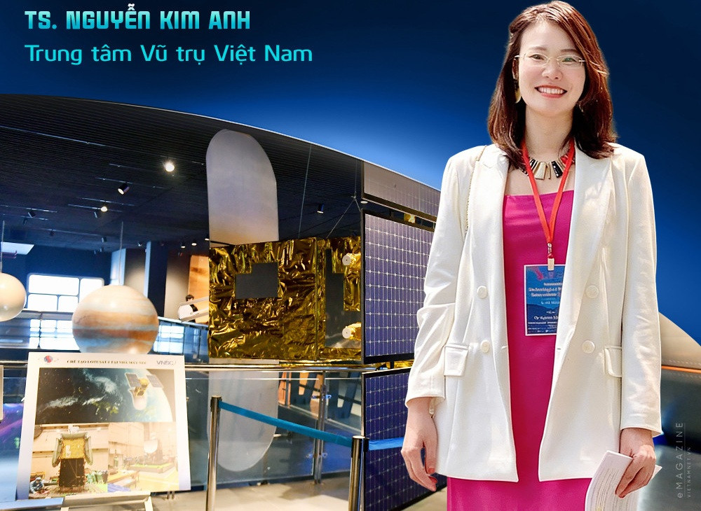
Dr. Nguyen Kim Anh of VNSC said mastering satellites carries clear practical implications for Vietnam.
In safeguarding sovereignty, proactiveness is key. With its own satellites, Vietnam can continuously monitor maritime activities. Unidentified vessels offshore, unusual signs near the coast or within the exclusive economic zone can be detected early thanks to high-frequency imaging with strong spatial and temporal resolution.
Satellite imagery also allows historical tracking of vessel movements. In cases of illegal discharge or oil spills, authorities must have images from before and after the incident to identify the source of pollution and determine responsibility. Relying solely on foreign data or open Internet sources often means incomplete information that fails to meet security requirements.
In environmental management and agriculture, satellite imagery enables rapid assessment of long-term land cover changes and analysis of ecosystem impacts. It is also used to classify and provide early warning of salinity intrusion across large areas. Instead of collecting isolated soil samples for laboratory analysis, satellite data allows the calculation of indices to identify areas with high or low salinity, providing a scientific basis for crop selection and appropriate farming practices.
According to Dr. Nguyen Kim Anh, the most important factor is synchronized and sustained investment. If space technology is implemented as a short-term project of five to ten years and then halted, the system will fracture. Proper recognition of the role of satellites and a long-term commitment to investment are decisive for maximizing their application in daily life, the economy, security and defense.
Thanh Hue