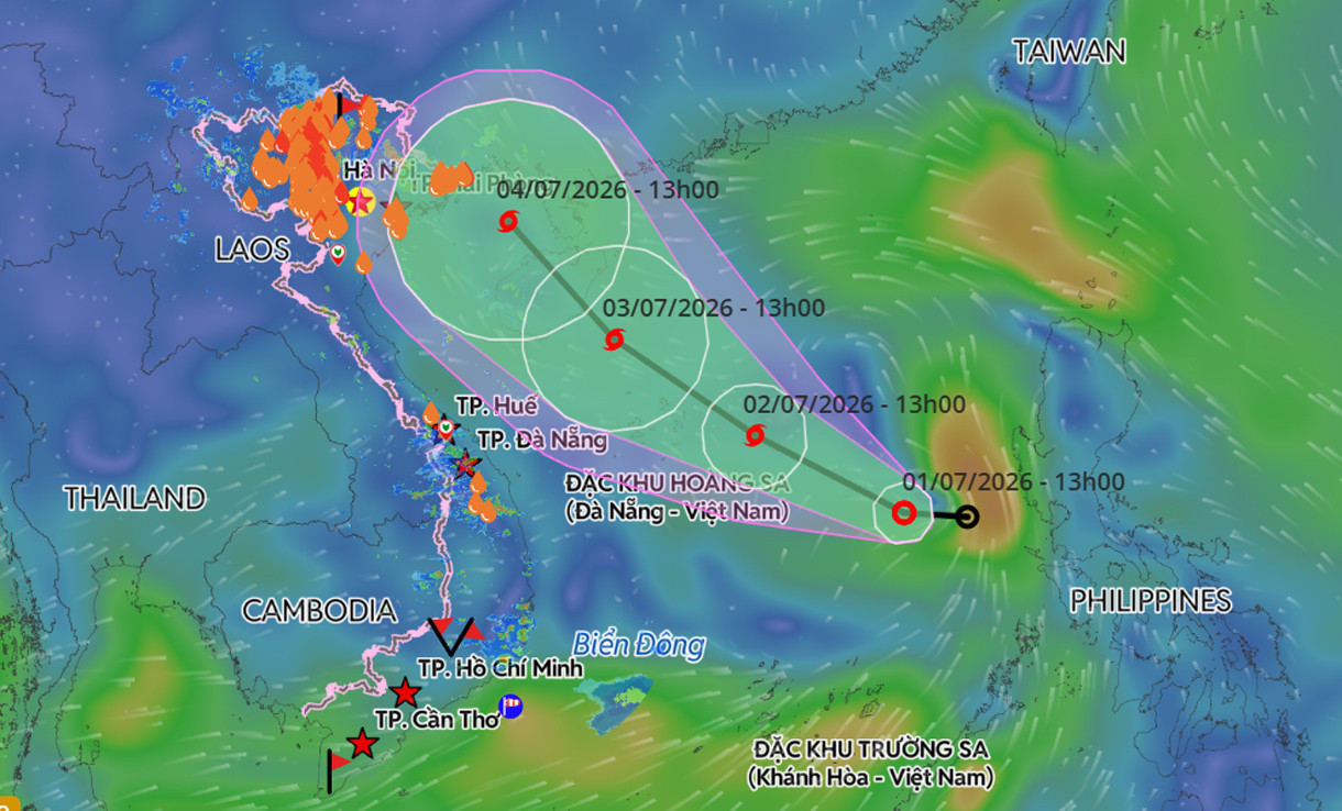
Over the next 24 hours, the tropical depression is expected to maintain both its direction and forward speed. By 1 p.m. on July 2, its center is forecast to be over the southern waters of the northern East Sea, approximately 290 kilometers east-southeast of the Hoang Sa (Paracel) Islands, where it is expected to strengthen into Storm No. 1.
At that stage, the storm is forecast to reach Level 8 intensity, with gusts up to Level 10.
The storm is then expected to move northwest at 15–20 kph. By 1 p.m. on July 3, its center is forecast to be over waters southeast of Hainan Island, China, with the potential to strengthen further to Level 8–9, accompanied by gusts up to Level 12.
Between 48 and 72 hours into the forecast period, the storm is expected to continue moving northwest at around 15 kph.
Meteorologists say current forecast data indicate a 70% chance that the storm will enter the Gulf of Tonkin, directly affecting Vietnam's northeastern coastal region on July 4.
Mai Van Khiem warned that the tropical depression, and its expected intensification into a storm, will bring strong winds to the eastern waters of the northern and central East Sea, including the Hoang Sa (Paracel) Islands.
Winds are forecast to strengthen from Level 6 to Level 7, with gusts of Level 9–10. Waves are expected to reach 2–3 meters, increasing to 3–4 meters near the storm's center, with rough seas.
Fishing vessels and other ships operating in these hazardous waters face risks from thunderstorms, waterspouts, strong winds and high waves.
Bao Anh