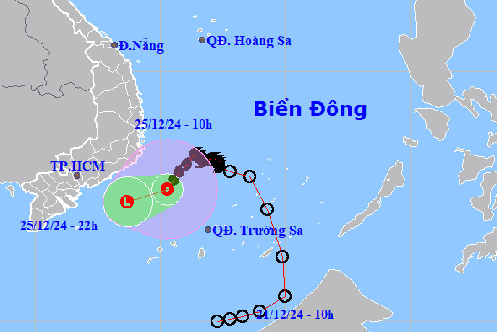
Storm Pabuk, the 10th storm of the year, has weakened into a tropical depression over the offshore areas between Khanh Hoa and Binh Thuan provinces, according to the National Center for Hydro-Meteorological Forecasting (NCHMF).
As of 10 a.m. on December 25, the tropical depression’s center was located off the coast of Khanh Hoa to Binh Thuan.
The strongest winds near the center reached level 7 (50-61 km/h) with gusts up to level 9.
The system is moving west-southwest at 10-15 km/h and is expected to further weaken into a low-pressure area within the next 12 hours as it approaches the coastal waters from Binh Thuan to Bac Lieu.
The tropical depression is generating strong winds of level 6-7, with gusts up to level 9, and rough seas with waves reaching 2-4 meters high.
Affected areas include the southwestern part of the central South China Sea, and coastal waters from Khanh Hoa to Ba Ria-Vung Tau, including the Phu Quy Island district.
These conditions pose risks of thunderstorms, waterspouts, strong winds, and high waves to vessels operating in these zones.
Additionally, heavy rain has been recorded from Quang Tri to Phu Yen provinces, with localized downpours exceeding 40mm in places such as Sa Huynh (Quang Ngai, 41.8mm) and Dai Lanh (Khanh Hoa, 43.8mm).
Through today and tonight, central and south-central provinces are expected to experience continued rain, ranging from 10-30mm, with localized areas receiving over 60mm.
Thunderstorms may bring risks of tornadoes, lightning, and strong gusts.
Heavy rainfall could cause flash floods in small rivers and streams, landslides on slopes, and urban flooding in low-lying areas.
Bao Anh