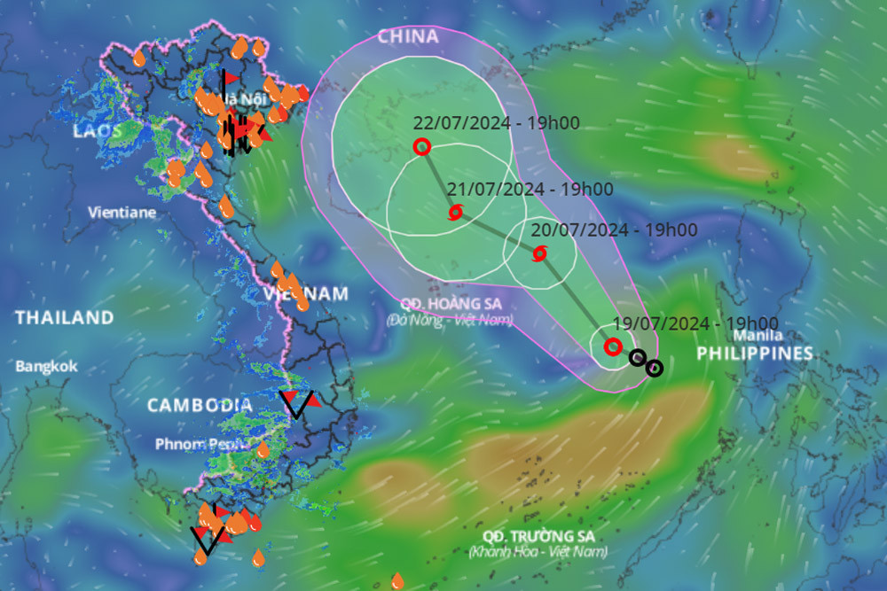
Meteorological experts predict that the tropical depression will continue to move west-northwest at about 15 km/h and may strengthen into a storm by tomorrow. By 7:00 PM on July 20, the storm's center is expected to be in the northern East Sea area. The maximum wind speeds near the storm's center could reach level 8, with gusts up to level 10.
In the following 24 hours, the storm's center is expected to be over the northern waters of the Paracel Archipelago, approximately 230 km southeast of Hainan Island, China.
From 48 to 72 hours later, the storm is forecast to continue moving northwest at about 10 km/h. Detailed updates will be provided by the National Center for Hydro-Meteorological Forecasting.
Due to the tropical depression's potential to intensify into a storm, the eastern waters of the northern and central East Sea will experience strong thunderstorms, with wind speeds of 6-7 (39-61 km/h), increasing to level 8 (62-74 km/h) and gusts up to level 10 (89-102 km/h). The sea will be very rough, with waves reaching heights of 2-4 meters.
Additionally, the southwest monsoon, which will be moderately to strongly active due to the tropical depression/storm, will cause continuous rain in the Central Highlands and Southern regions of Vietnam. Specifically, from the evening of July 19 to July 21, these areas will experience moderate to heavy rain and thunderstorms, with localized heavy rainfall of 40-100 mm, and some areas receiving over 150 mm of rain (mainly in the afternoon and evening).
- Northern Region: On the night of July 19 and during the day on July 20, there will be scattered showers and thunderstorms, with some areas experiencing heavy rain. On the night of July 20 and during the day on July 21, there will be scattered showers and thunderstorms in the northwest and northeast regions, with localized heavy rainfall in the evening and night.
- Central Region: There will be scattered showers and thunderstorms in the afternoon and evening, with localized heavy rain in some areas.
The meteorological agency warns of potential flash floods, landslides in mountainous areas, and flooding in low-lying and urban areas. During thunderstorms, there is a risk of tornadoes, lightning, hail, and strong winds.
Bao Anh