 Vietnamnet.vn

 Podcast



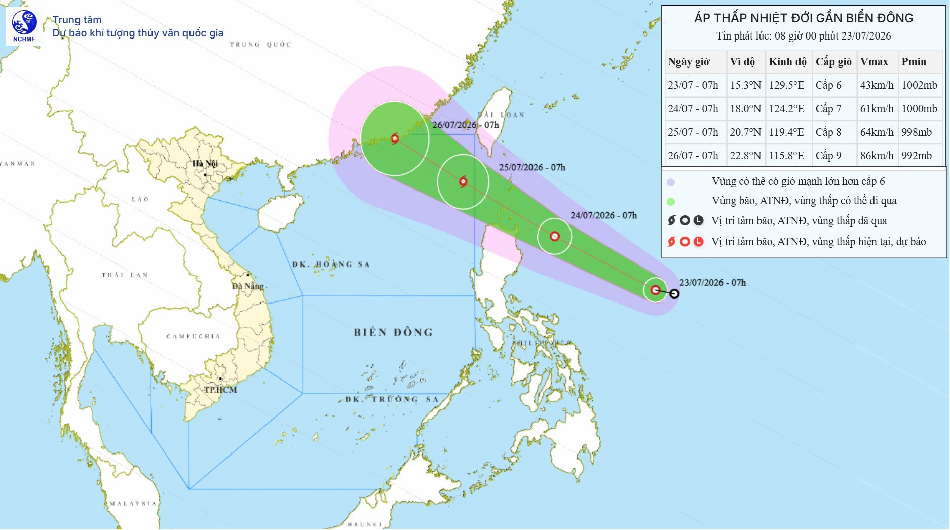
Over the next 24 hours, the tropical depression is forecast to continue moving west-northwest at 25-30 km/h while gradually strengthening.
By 7 am on July 24, its center is expected to be about 220 km east of Luzon Island, the Philippines, with maximum sustained winds increasing to Level 7 and gusts reaching Level 9.
During the following 24 hours, the system is forecast to continue moving west-northwest at around 25 km/h and could strengthen into a tropical storm.
By 7 am on July 25, the storm's center is forecast to be over the northeastern waters of the North East Sea, with sustained winds of Level 8 and gusts up to Level 10.
If this forecast materializes, it would become Storm No. 2 in the East Sea during the 2026 typhoon season.
Between 48 and 72 hours, the storm is forecast to continue moving mainly west-northwest at about 20 km/h and may strengthen further.
Under the influence of the tropical depression, and later the potential storm, winds over the northeastern waters of the North East Sea are expected to strengthen from the night of July 24 to Level 6-7, with Level 8 winds near the center and gusts up to Level 10.
Wave heights are forecast to reach 2-4 meters, with rough sea conditions expected.
The weather agency warned that vessels operating in hazardous waters could be affected by thunderstorms, waterspouts, strong winds and high waves.
Bao Anh
.svg)
