 Vietnamnet.vn

 Podcast



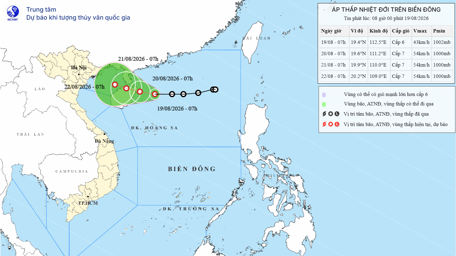
As of 7 a.m. today, August 19, the center of the tropical depression was over the northern waters of the northern East Sea, about 200 km east of Hainan Island, China. Maximum sustained winds near its center reached level 6, or 39-49 kph, with gusts at level 8.
The tropical depression was moving west at 20-25 kph.
Over the next 24 hours, the system is forecast to shift toward the west-northwest, slow to 5-10 kph and strengthen further. By 7 a.m. on August 20, its center is expected to be over waters northeast of Hainan Island, with winds strengthening to level 7 and gusts reaching level 9.
During the following 24 hours, the tropical depression is expected to maintain its west-northwest track while slowing further to around 5 kph. By 7 a.m. on August 21, its center is forecast to be over the northern part of Hainan Island, with winds remaining at level 7 and gusts at level 9.
Over the subsequent 48-72 hours, the system is expected to continue moving slowly west-northwest at around 5 kph.
Under the influence of the tropical depression, waters in the northwestern part of the northern East Sea are forecast to experience winds of level 6-7, gusting to level 9, with waves 2-3.5 meters high and rough seas. Vessels operating in the affected areas could face thunderstorms, tornadoes, strong winds and high waves.
Bao Anh
.svg)
