 Vietnamnet.vn

 Podcast



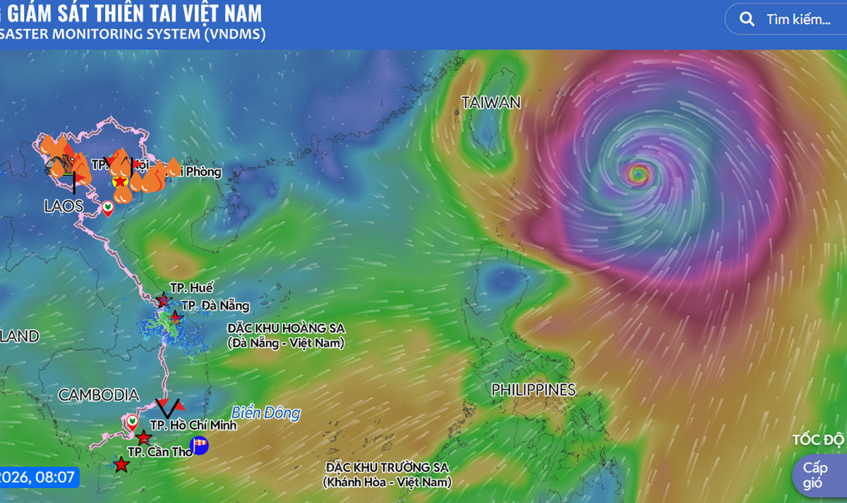
According to the National Center for Hydro-Meteorological Forecasting, as of 7 a.m. on July 10, the center of Typhoon Bavi was about 650 km southeast of Taiwan (China) and approximately 1,000 km southeast of Fujian Province, China. Compared with a day earlier, the storm had weakened by two categories to Category 14.
Over the next 24 hours, the typhoon is forecast to move mainly northwest at around 25 km/h while continuing to weaken.
Over the following two to three days, Bavi is expected to gradually turn northward, shifting farther toward the north. Forecasts indicate the storm will make landfall between Fujian and Zhejiang provinces late on July 11 or in the early hours of July 12. By the time it reaches land, it is expected to weaken to Category 10 - 12, with gusts up to Category 14.
Although Bavi is not forecast to enter the East Sea, its outer circulation will continue to affect waters from Khanh Hoa Province to Vinh Long Province, as well as the central and southern East Sea - including the Truong Sa Special Zone - bringing sustained winds of Category 6 with gusts of Category 7 - 8 and rough seas.
In the northeastern East Sea, winds are expected to strengthen to Category 6, with gusts reaching Category 8. Waves are forecast to reach 2 - 4 m, with rough sea conditions.
Authorities advised residents and vessels operating in the affected waters to closely monitor weather forecasts and warnings and take appropriate precautions.
Bao Anh
.svg)
