 |
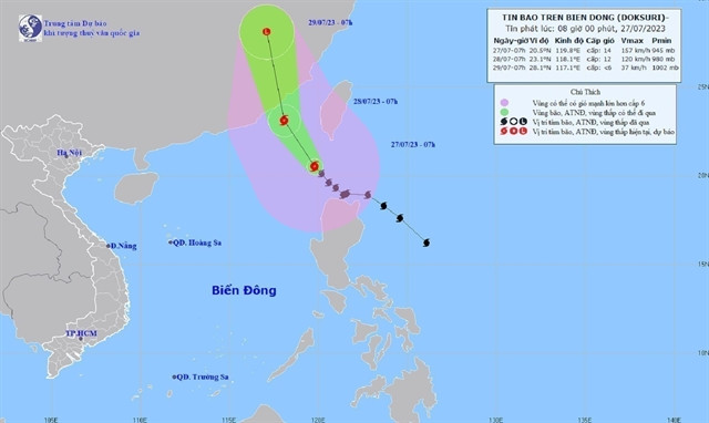
| The direction of the typhoon on Thursday morning.— Photo nchmf.gov.vn |
Nguyễn Văn Hưởng, head of the Weather Forecasting Office under the National Centre for Hydro-Meteorological Forecasting said on Thursday morning that the typhoon already passed the northern part of Luzon Island of the Philippines and entered the north-east section of the East Sea (internationally known as South China Sea).
Hưởng said the typhoon is expected to enter China’s Fujian Province and not affect the mainland of Việt Nam.
The centre said by 10am on Thursday morning, the typhoon was about 380km southeast of China’s Hong Kong with the strongest wind speed at its eye of up to 149km per hour.
By 10am on Saturday, the typhoon was moving northwest at a speed of 20km per hour and will gradually weaken as it makes landfall.
Hưởng said due to the influence of the typhoon, the northern part of the East Sea is seeing strong winds and seas have been rough. The eastern part of the East Sea had high waves of six to eight metres. — VNS