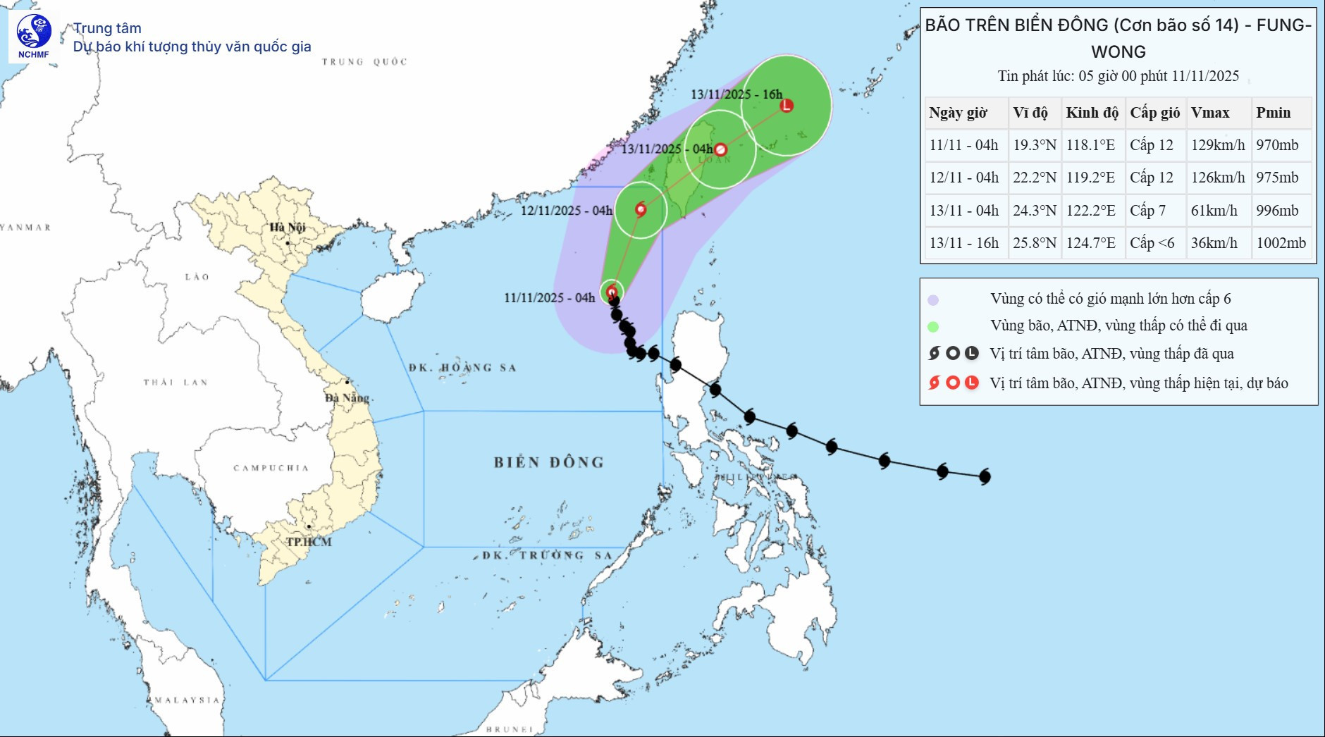
According to the National Center for Hydro-Meteorological Forecasting, as of 4:00 AM on November 11, the center of Typhoon Fung-Wong remained over the eastern waters of the northern East Sea.
Maximum sustained winds near the storm’s center were at Category 12 (118–133 km/h), with gusts reaching Category 15. The storm was moving northwest at about 10 km/h.
In the next 24 hours, the storm is forecast to change course toward the north-northeast at 10–15 km/h. By 4:00 AM on November 12, the storm center will still be located over the eastern waters of the northern East Sea, maintaining Category 12 strength with gusts at Category 15, and rapidly weakening.
In the following 24 hours, the storm will shift again, this time to the northeast at about 15 km/h. At that point, it will weaken into a tropical depression and exit the East Sea. By 4:00 AM on November 13, the tropical depression is expected to be over the eastern waters off Taiwan (China), with sustained winds at Category 7 and gusts at Category 9, continuing to weaken.
It is predicted that approximately 12 hours later, the tropical depression will maintain its northeastward direction, accelerating to 25 km/h. By 4:00 PM the same day, the system will be over the northeastern waters off Taiwan and will have downgraded to a low-pressure area.
Due to the effects of Typhoon Fung-Wong, the eastern region of the northern East Sea will experience strong winds of Category 7–9 today and tonight. Areas near the storm’s path may see winds of Category 10–12 with gusts at Category 15. Wave heights in this region will reach 4–7 meters, while areas near the storm center may experience waves up to 7–9 meters. The sea will remain extremely rough.
Additionally, this morning, the northeastern region of the central East Sea will see westerly to southwesterly winds at Category 5, occasionally reaching Category 6 with gusts at Category 7–8. The sea will be rough.
Tomorrow (November 12), the northeastern waters of the northern East Sea will experience sustained winds at Category 8 with gusts up to Category 11 and wave heights of 6–8 meters. Sea conditions will remain very rough.
All vessels operating in these hazardous areas are at risk of encountering thunderstorms, waterspouts, strong winds, and high waves.
Bao Anh