According to Vietnam’s National Center for Hydro-Meteorological Forecasting, by early afternoon on December 1, Koto had weakened significantly.
At 1:00 PM, the storm's center was located in the northwestern waters of the central East Sea, with maximum winds reaching level 7 (50–61 km/h) and gusts at level 9. The system showed little movement and continued to lose strength.
Over the next 12 hours, the tropical depression is expected to move southwestward at around 5 km/h. By 1:00 AM on December 2, it will be approximately 200 kilometers east of the coastal areas of Gia Lai and Dak Lak provinces. At that point, it is forecast to drop to level 6 with gusts at level 8.
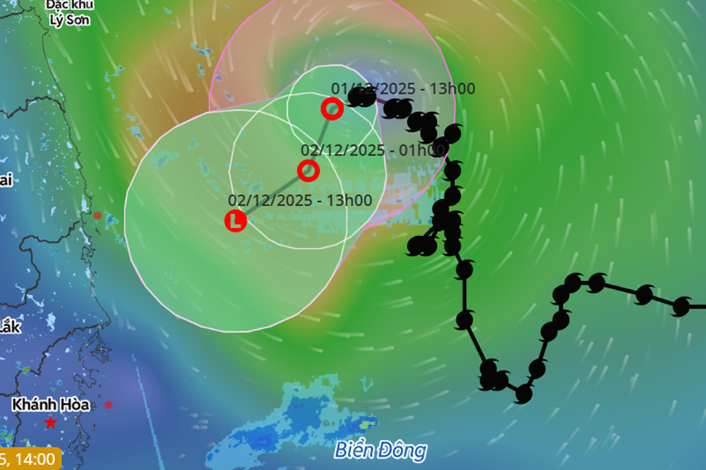
In the following 12 hours, the system will likely move further southwest at about 10 km/h and weaken into a low-pressure area offshore from Gia Lai–Dak Lak.
Koto originally developed from a tropical depression east of the Philippines’ central region. It strengthened into a typhoon and entered the East Sea on the night of November 25.
After nearly six days of fluctuating speeds - ranging from fast to nearly stationary - the storm has now begun to dissipate. Its weakening has come earlier than previous forecasts anticipated.
As a result, Typhoon Koto is no longer expected to impact Vietnam’s mainland directly.
However, the lingering effects of cold air, combined with residual circulation from the weakening depression and high-altitude disturbances, are projected to bring moderate to heavy rainfall across central regions.
Between December 2–5, the areas from Quang Tri to Da Nang, the eastern parts of Quang Ngai to Dak Lak, and Khanh Hoa may experience widespread rainfall.
In the immediate term, due to the tropical depression, strong winds of level 6–7 with gusts up to level 9 are expected over the northwestern part of the central East Sea and offshore Gia Lai–Dak Lak. Waves could reach 2–4 meters in height, with rough sea conditions. Boats in these areas are at risk of thunderstorms, squalls, and high waves.
Looking ahead, the meteorological agency forecasts that 1–2 more tropical storms or depressions may form in the East Sea during December 2025. The long-term average is one storm per December, with a low chance of landfall (0.2 storms).
Additionally, regions from Quang Tri to Da Nang and from eastern Quang Ngai to Dak Lak and Khanh Hoa may continue to face significant rainfall events in the first half of December.
Nationwide, there remains a risk of hazardous weather phenomena such as thunderstorms, whirlwinds, lightning, hail, and strong gusts.
Bao Anh