As a result, this unusual tropical depression no longer poses any threat of strong winds at sea. Updates on wind strength, high waves, and sea conditions will continue to be provided through advisories for Typhoon Koto and related marine forecasts.
This is the final bulletin regarding this tropical depression.
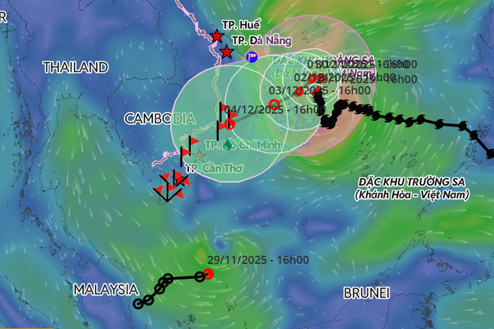
Meanwhile, at 4:00 p.m. the same day, Typhoon Koto was centered over the northwestern waters of the central East Sea. Wind speeds near the eye reached level 9 (75–88 km/h), with gusts up to level 11.
The storm is drifting north at approximately 5 km/h and is expected to continue its slow movement - just 3–5 km/h - in the coming days. It is forecast to track north through November 30, before shifting westward on December 1 and then southwestward by December 2, moving toward Vietnam’s south-central coast.
Beginning today, Typhoon Koto is also expected to rapidly weaken, from level 9 to level 8 by December 1, with further weakening afterward. It is likely that once it approaches the offshore area near Quang Ngai–Dak Lak (formerly Phu Yen), the typhoon will weaken into a tropical depression.
Due to the storm’s impact, the northwestern part of the central East Sea will experience winds at level 7, while areas closer to the typhoon’s center may see winds of level 8–9, with gusts reaching level 11. Waves in affected zones will reach heights of 3–5 meters, with localized peaks of up to 7 meters, creating extremely rough sea conditions.
All vessels operating in these danger zones are at risk of encountering thunderstorms, strong winds, and high waves.
Bao Anh