
After making landfall in Quang Ninh Province, Tropical Storm No. 2 (Prapiroon) has weakened into a tropical depression, causing strong winds and heavy rain across nine provinces.
As of the morning of July 23, the Department of Dykes and Flood Prevention (Ministry of Agriculture and Rural Development) reported that Prapiroon had downgraded to a tropical depression.
At 7am on the same day, the center of the tropical depression was located at approximately 21.3°N latitude and 107.6°E longitude, over the coastal areas of Quang Ninh - Hai Phong. The strongest winds near the center of the depression reached level 7 (50 - 61 km/h), with gusts up to level 9, and it was moving slowly northwest at 5 - 10 km/h.
Forecasts indicate that by 7pm the same day, the depression will be positioned at 21.6°N latitude and 106.4°E longitude, over the northeastern region of Northern Vietnam.
From 7pm on July 21 to 7am on July 23, rainfall measurements in Quang Ninh - Hai Phong ranged from 50-100mm. Specific areas reported significant totals: Cat Ba (Hai Phong) 276mm, Cat Hai (Hai Phong) 128mm, Cam Pha (Quang Ninh) 150mm, Long Dinh (Quang Ninh) 147mm, Hon Gai (Quang Ninh) 145mm, and Phong Coc (Quang Ninh) 143mm.
According to the Department of Dykes and Flood Prevention, from the morning of July 23 to 24, the Northeast region will experience moderate to heavy rain and thunderstorms, with localized areas receiving up to 300mm of rain. The Northwest region and Thanh Hoa will see rainfall between 50-100mm, with some areas exceeding 200mm.
In the afternoon and evening of July 23, heavy rain is expected in areas from Nghe An to Quang Tri, the Central Highlands, and the South, with rainfall ranging from 15-30mm, and some areas may see over 70mm.
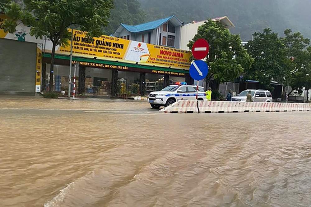
There is a risk of flash floods and landslides in mountainous regions, and flooding in low-lying areas and urban areas. In addition to thunderstorms, there may be strong winds, lightning, hail, and gusts. The disaster risk level for heavy rain, wind, lightning, and hail is level 1.
The Department of Dykes and Flood Prevention reported that Tropical Storm No. 2 has caused the sinking of a small cement ship and a small speedboat at a mooring site on Co To Island (Quang Ninh).
The Department and local authorities are continuing to inspect and ensure the safety of moored vessels, strictly implementing the maritime ban from Quang Ninh to Ninh Binh. They are also monitoring floating cages and aquaculture stations, ensuring safety for tourists remaining on the islands.
For low-lying areas, measures are being taken to protect critical sea dykes or those under construction. The drainage system is being checked to ensure effective water drainage, protecting agricultural production, low-lying areas, urban zones, and industrial zones.
In the northern mountainous areas, emergency teams are inspecting and reviewing residential areas near rivers, streams, and low-lying areas with a high risk of flooding, flash floods, and landslides to evacuate residents if necessary. Traffic control measures are being enforced at submerged and landslide-prone areas, with forceful restrictions on movement if safety cannot be guaranteed, and preparations are being made for repairing transportation routes.
Dinh Hieu