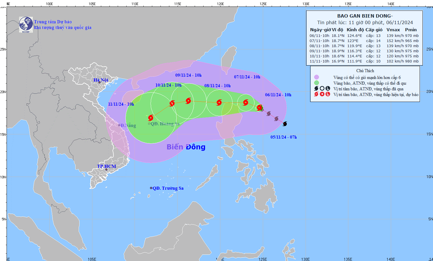
As of noon on November 6, Vu Anh Tuan, Deputy Head of Weather Forecasting at the National Center for Hydro-Meteorological Forecasting, provided an update on Typhoon Yinxing and the ongoing heavy rains in Central Vietnam.
Typhoon Yinxing, currently a powerful storm, is situated northeast of Luzon Island in the Philippines. At 10 a.m., it reached maximum wind speeds of 134–149 km/h, with gusts up to 184 km/h, moving northwest at approximately 15 km/h.
"Latest updates indicate that around November 8, the storm is likely to reach the northeastern area of the East Sea, officially becoming Typhoon No. 7 of the current season," Tuan reported.
When Yinxing enters the East Sea, it is expected to be a Category 12–13 storm. The storm’s strength may fluctuate due to the influence of cold air, cooler sea surface temperatures, and environmental changes as it approaches the northeastern Hoang Sa (Paracel) Islands.
In Central Vietnam, heavy rains have shifted southward beyond the Hai Van Pass overnight due to eastern wind disturbances and a southward-moving cold front. Regions from Thua Thien Hue to Binh Dinh are experiencing substantial rainfall, with totals between 50–100 mm. Some areas in Quang Nam, Quang Ngai, and northern Binh Dinh have recorded over 200 mm of rain.
The heavy rain zone is expected to extend further south to Khanh Hoa and will persist through November 7, with rain accumulations of 50–100 mm, and certain areas reaching 200 mm. Notably, some regions could experience rainfall intensity of up to 100 mm within six hours.
Residents are urged to stay updated as the typhoon’s trajectory and intensity could still change in the coming days.
Bao Anh