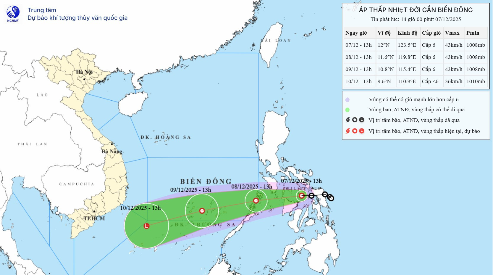
According to the National Center for Hydro-Meteorological Forecasting, as of 2:00 p.m. on December 7, the center of the tropical depression was still located over the central Philippine region. The strongest winds near the center were recorded at level 6, ranging from 39 to 49 km/h, with gusts reaching level 8.
The depression continues to move westward at a speed of around 15 km/h.
In the next 24 hours, the system is forecast to veer slightly to the west-southwest at a speed of 15 to 20 km/h. By 2:00 p.m. on December 8, its center is expected to be located to the east of Palawan Island (Philippines), maintaining level 6 wind speeds with gusts at level 8.
In the following 24 hours, the depression is expected to retain its direction, accelerate to around 20 km/h, and enter the East Sea. By 2:00 p.m. on December 9, the system's center will likely be located north of the Truong Sa (Spratly) Archipelago, approximately 140 kilometers southeast of Song Tu Tay Island. It will still maintain wind strength at level 6 with gusts at level 8.
Between 48 and 72 hours from now, the depression is expected to continue on a west-southwestward path, traveling at 20 to 25 km/h, while gradually weakening.
This means that after entering the East Sea, the tropical depression is likely to maintain its strength at level 6 with gusts at level 8 and has little chance of intensifying into a tropical storm, contrary to earlier projections.
Due to the system’s influence, from the morning of December 8, the southeastern waters of the central East Sea region (including the northeastern waters of the Truong Sa Archipelago) will experience winds at level 6, gusting to level 8, with waves reaching 2 to 4 meters in height and rough sea conditions.
Vessels operating in these hazardous zones are at risk of being affected by thunderstorms, squalls, strong winds, and high waves.
Bao Anh