Hon Hai Island (Lam Dong Province) stands out with its solid reinforced concrete pier and a tunnel system running beneath both sides of the jetty up to the island’s peak. It serves as a strategic stronghold for Naval Region 4.
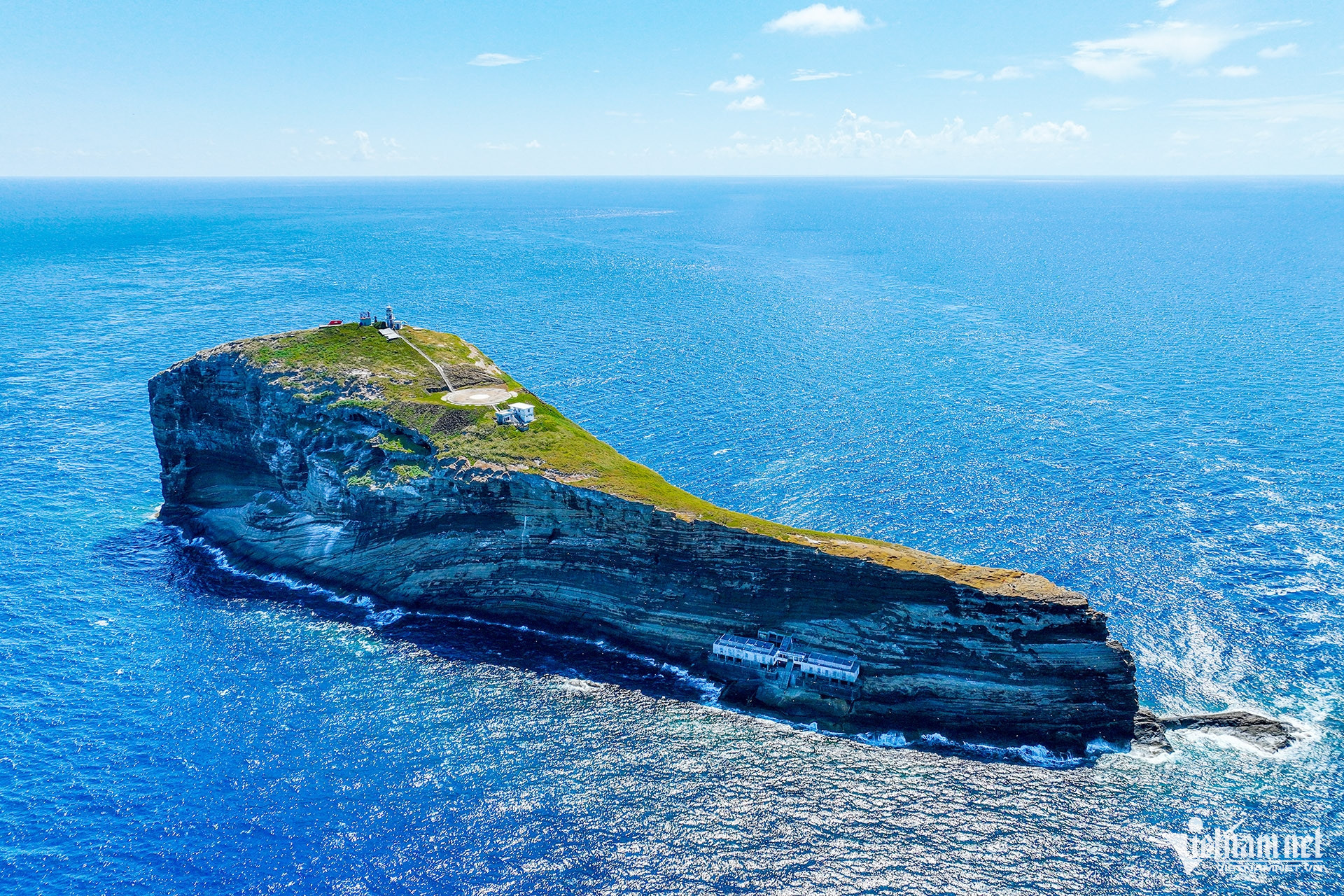
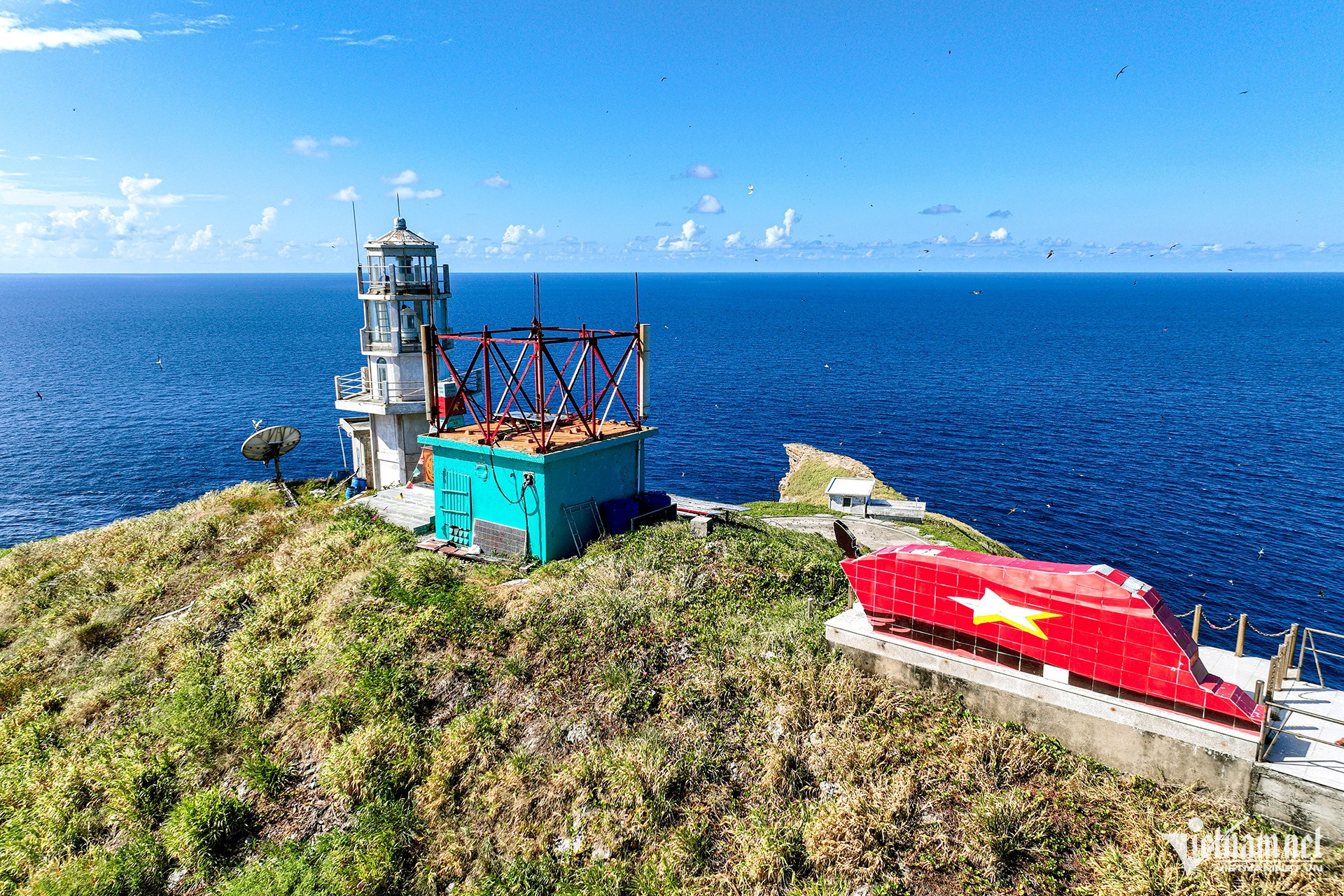
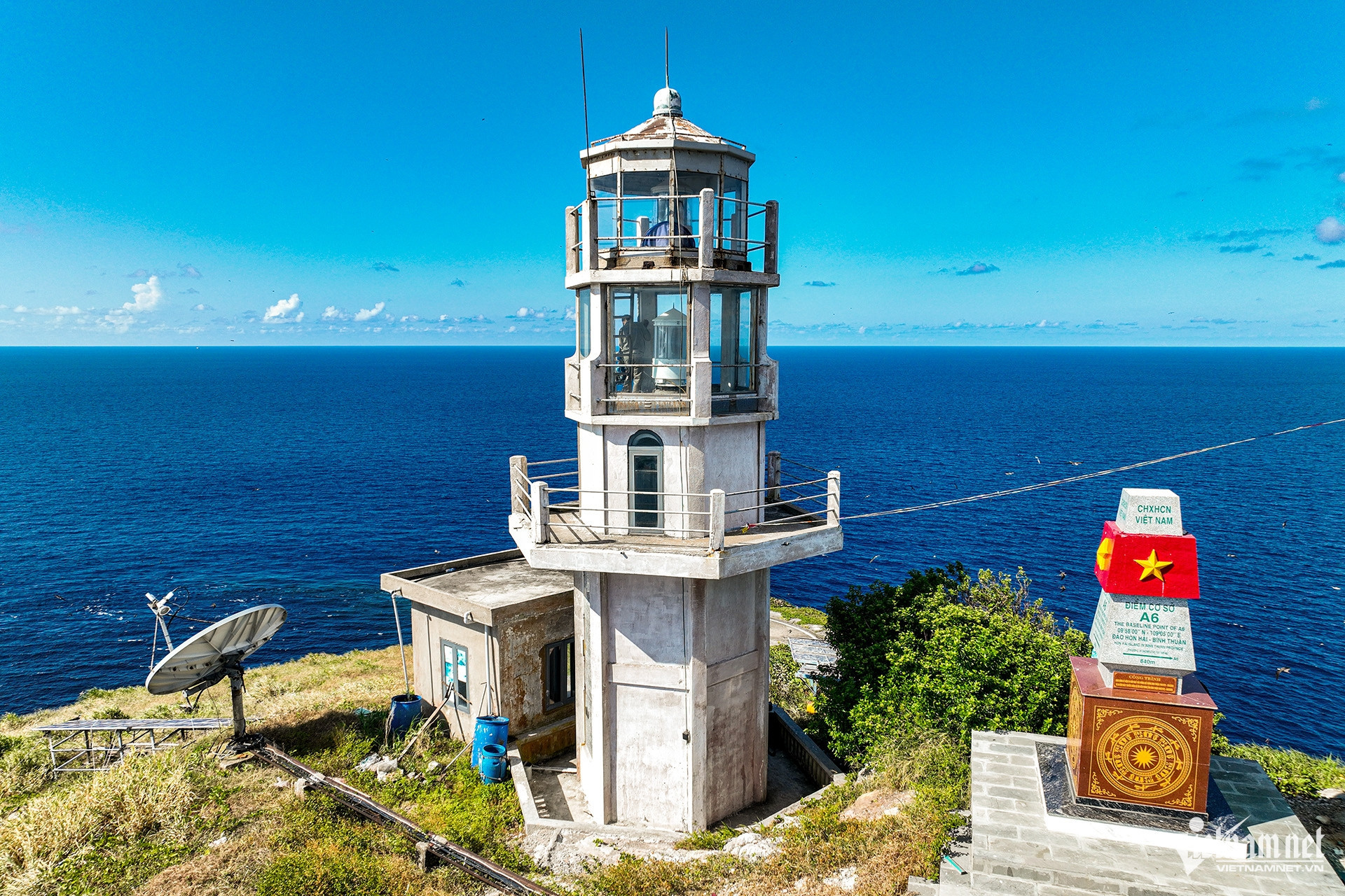
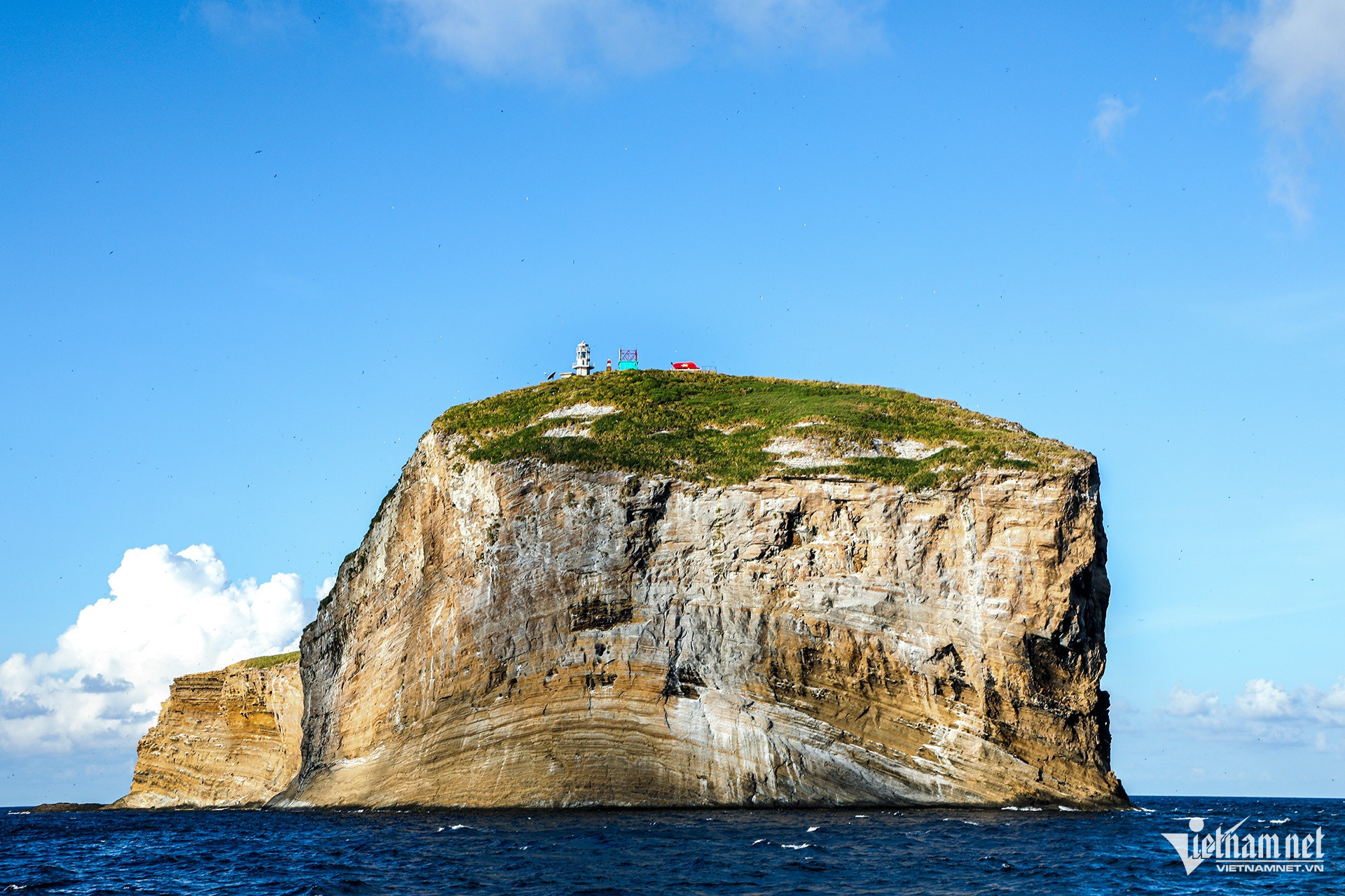
Seen from a distance, Hon Hai Island looks like a massive rock rising from the sea. Landmark A6 on the island serves as a base point for calculating the width of Vietnam's territorial waters.
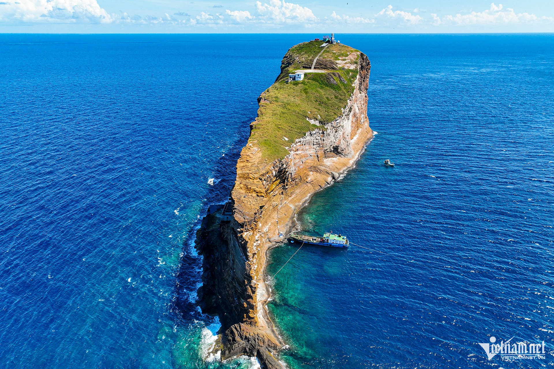
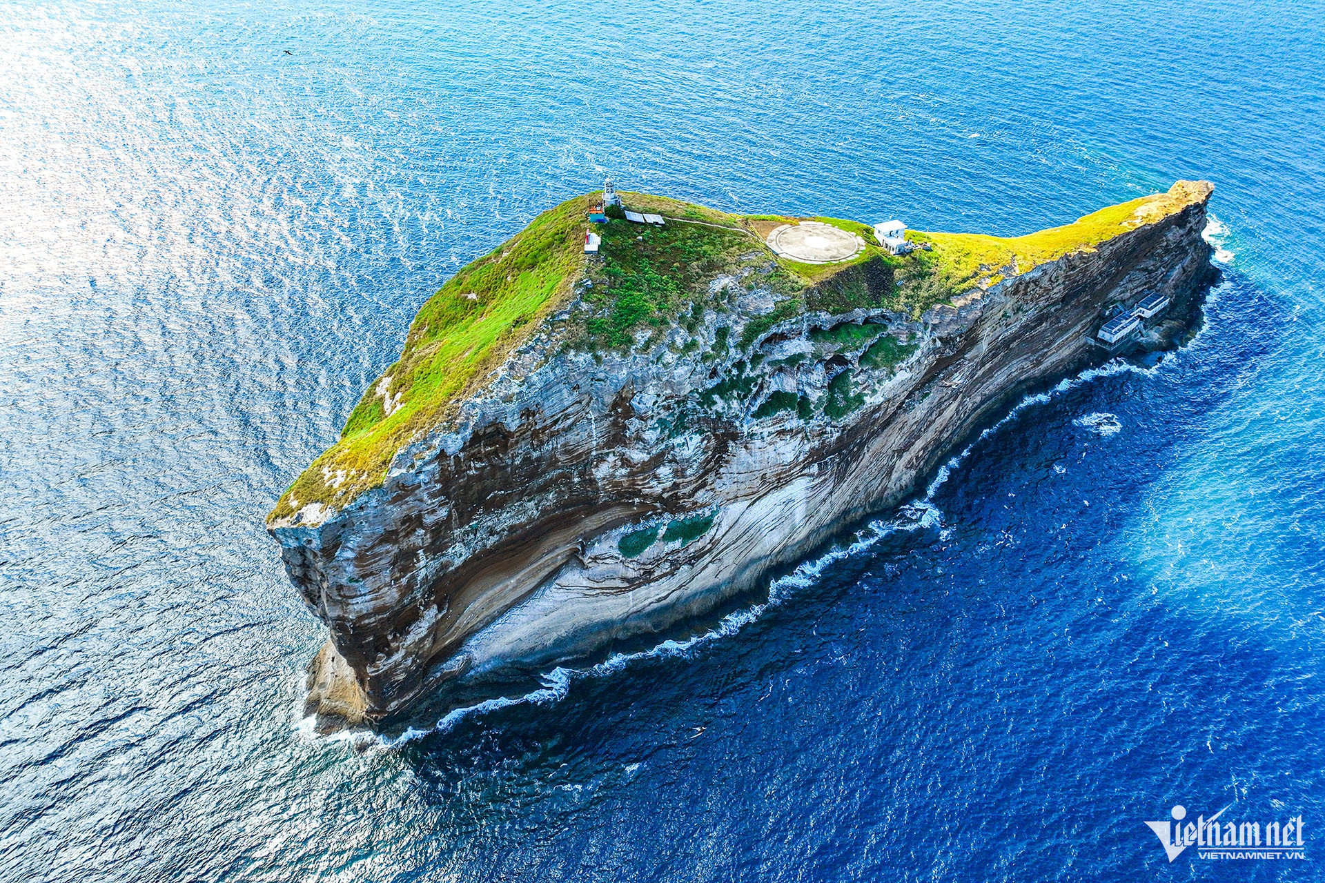
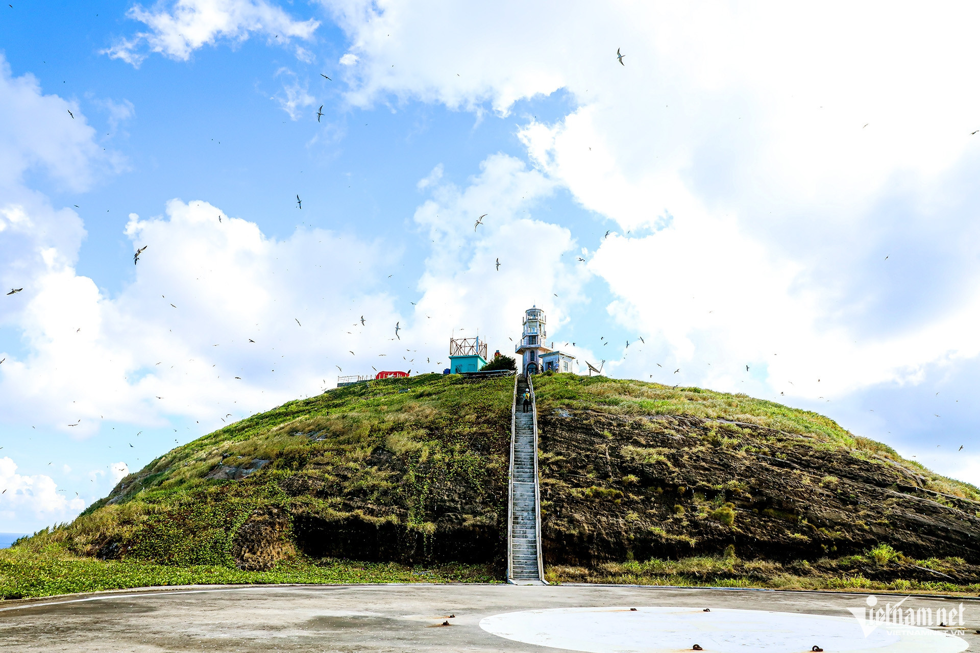
From an aerial perspective, the island resembles a giant whale or sperm whale surfacing from the ocean, creating a striking image. The island is tiny, made up of steep rocky terrain, and has no large vegetation. Coral reefs, deep waters, and strong waves surround the island. Two piers on either side allow vessels to dock depending on sea conditions.
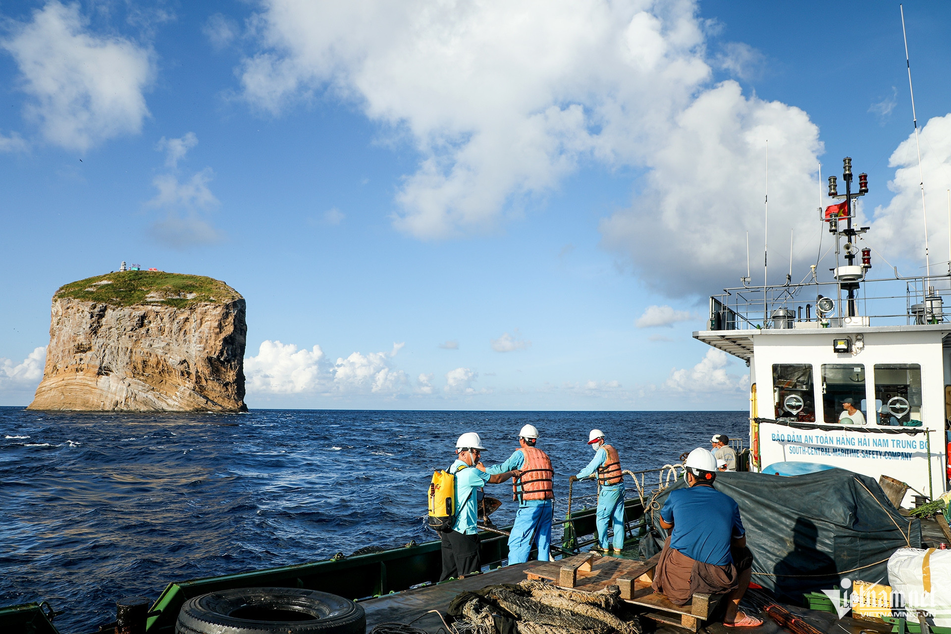
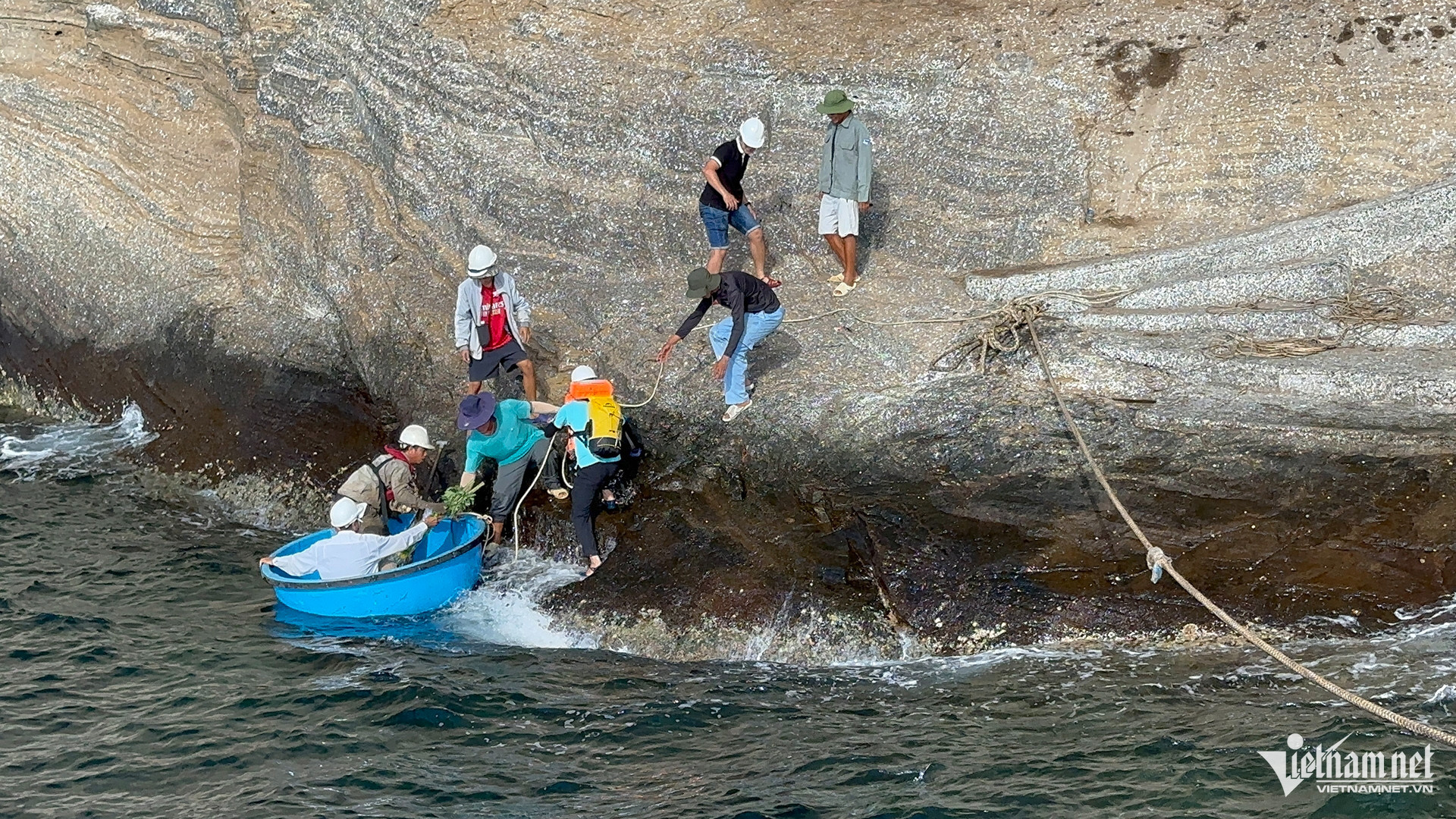
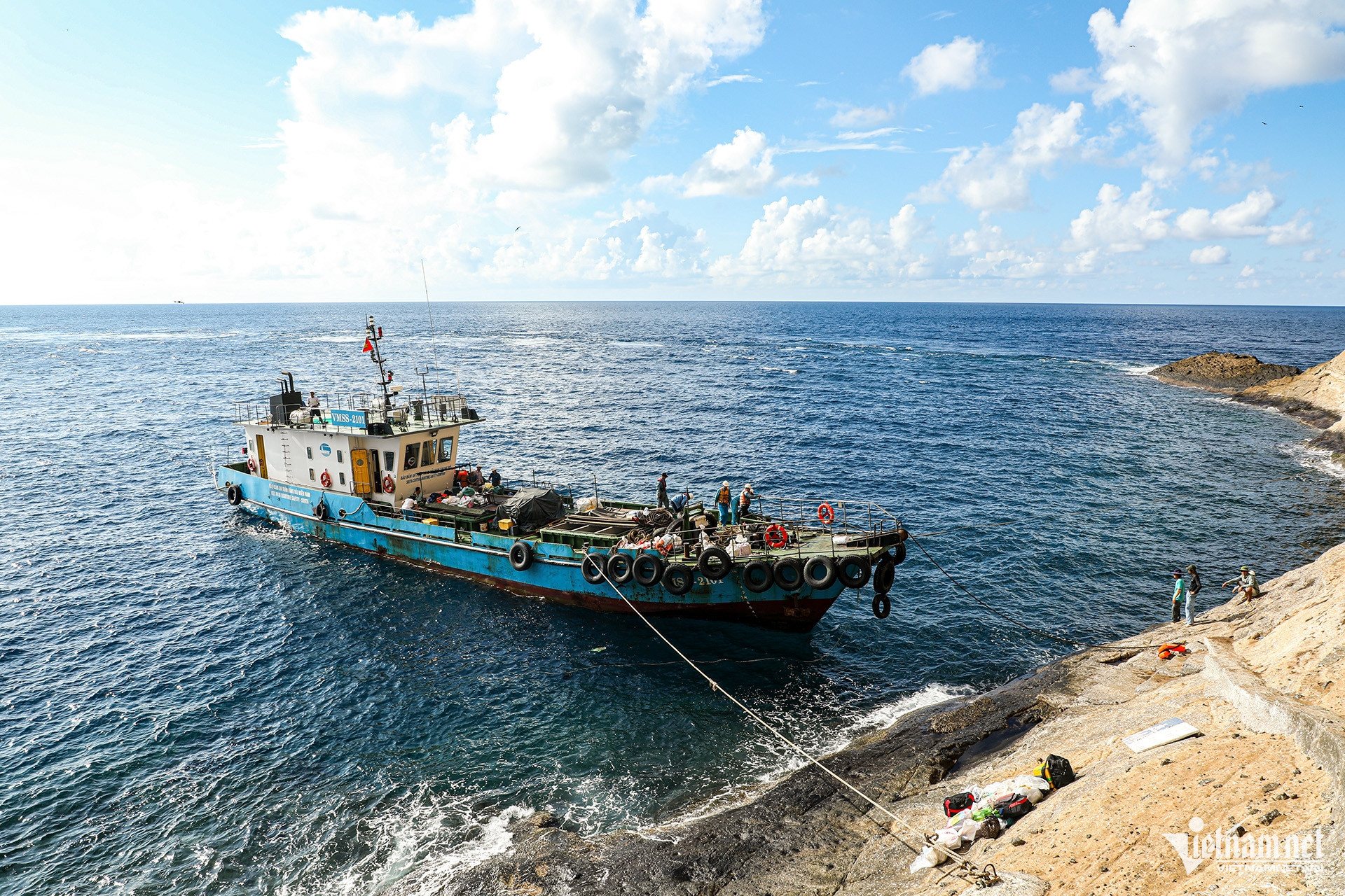
Because the area experiences intense wave activity, the captain decides which side to anchor based on tides and wind direction. In mid-August, heavy waves pounded the island’s shore, forcing the mission crew’s ship to anchor offshore and use round boats to transport personnel and supplies.
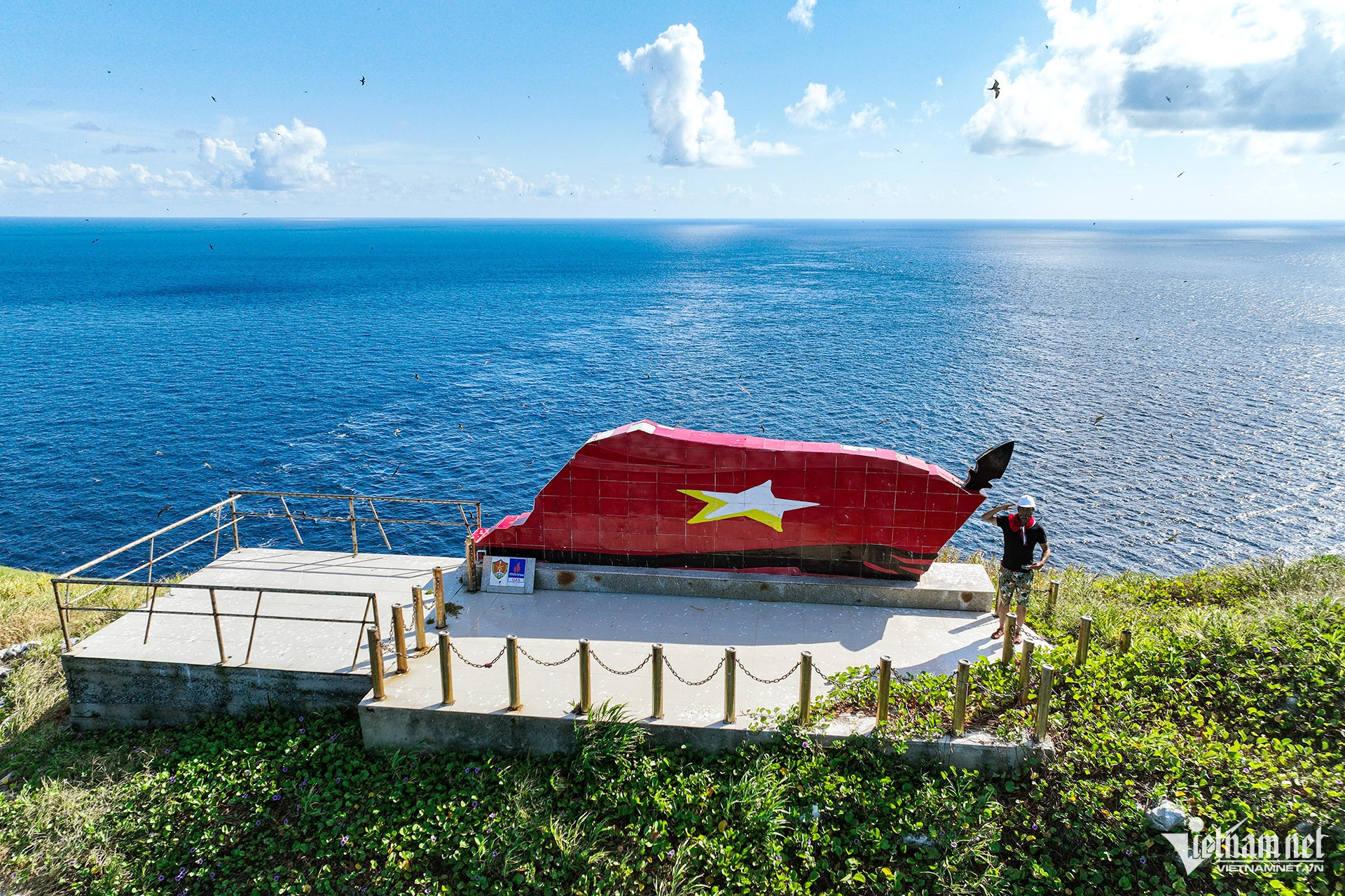
Located at the southeasternmost point of Vietnam’s baseline, the island acts as a territorial marker that helps affirm sovereignty over the vast southeastern sea zone - rich in marine resources and home to critical international shipping routes.
Hon Hai Island serves as a strategic base for Naval Region 4, the unit overseeing the Truong Sa (Spratly Islands) and the South Central Coast.
In the early 2000s, the Ministry of National Defense - specifically Naval Region 4 - surveyed the area and developed a plan to build a permanent pier on Hon Hai. Construction company Lung Lo was tasked with the challenging project.
With high waves and strong winds, and no flat land to gather materials, construction conditions were extreme. All materials - cement, steel, and stones - were shipped from the mainland and carried manually onto the island. During the construction of the pier, military engineers lived and worked directly on the island in harsh conditions.
Waves often reached 3–4 meters high. With no safe anchor point, naval personnel had to anchor offshore and use ropes to pull each bag of cement and steel bar to shore. During monsoon seasons, ships were swept away and materials - along with personnel - were dragged into the sea.
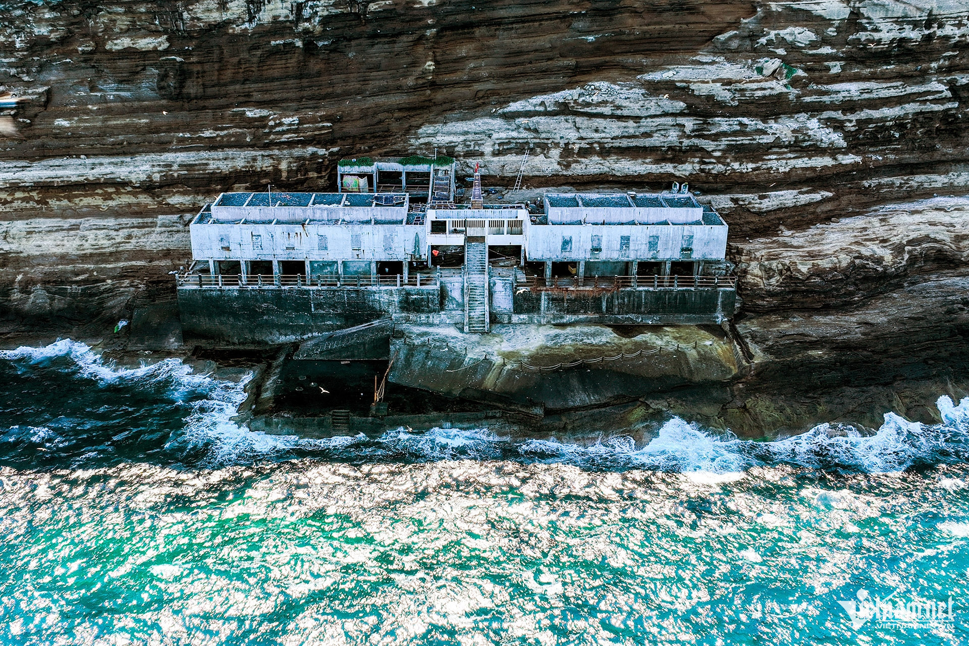
The Hon Hai pier, completed and put into use in 2005, features reinforced concrete construction about 30 to 40 meters long, extending westward - where waves are milder. The pier accommodates patrol boats and small transport vessels of the Navy and Fisheries Surveillance Force. These ships dock to deliver food, freshwater, fuel, rotate personnel, transport scientific equipment, and conduct rescue missions or maintain the lighthouse.
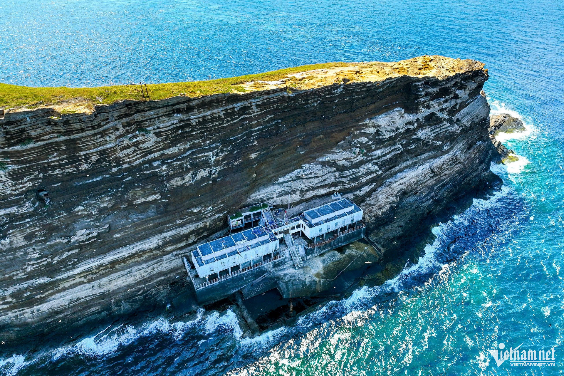
The pier also doubles as lodging and workspace for stationed personnel. It includes a tunnel system that runs beneath the jetty and leads straight to the island’s peak.
The tunnels were built by combat engineers to facilitate the transport of technical equipment and materials, and to provide shelter for technicians during storms or rough seas.
Quynh Anh – Roi