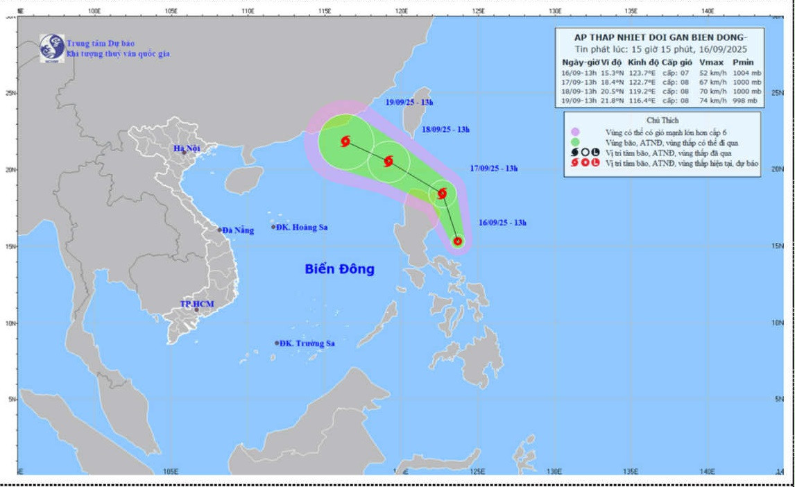
Forecast map showing the projected path and intensity of the tropical depression near the East Sea as of 3:15 p.m., September 16. Source: NCHMF
The National Center for Hydro-Meteorological Forecasting reported that at 1:00 p.m. on September 16, the center of the tropical depression was positioned at approximately 15.3°N latitude and 123.7°E longitude, over the waters east of Luzon. Maximum sustained winds near the center were between 39–61 km/h (level 6–7), with gusts reaching level 9.
The depression is forecast to move northwest at 15 km/h and has the potential to develop into a tropical storm. By the afternoon of September 17, the northeastern waters off Luzon could experience winds of level 8 with gusts up to level 10.
By 1:00 p.m. on September 18, the depression is expected to continue on a west-northwest course at a speed of 15–20 km/h and may enter the East Sea. The northeastern part of the northern East Sea is expected to experience level 8 winds with gusts reaching level 10. The disaster risk level has been rated at Level 3.
According to meteorologists, in the next 48 to 72 hours, the system will mainly move west-northwest at about 15 km/h, with little change in intensity.
Due to the tropical depression's influence, strong winds are expected in the northeastern waters of the northern East Sea. Wind speeds may reach level 6 with gusts at level 8, while areas near the storm center could experience winds of level 7–8 and gusts up to level 10. Wave heights may range from 2.5 to 4.5 meters, resulting in rough sea conditions. Vessels operating in these dangerous zones are at risk of thunderstorms, whirlwinds, strong winds, and large waves.
Minh Vy