Located about 120km from Ha Giang city center, the Chin Khoanh Slope (connecting the two communes of Sung La and Pho Cao) is part of the Bac Sum Slope, situated on National Highway 4C - the lifeline road of Ha Giang Province.
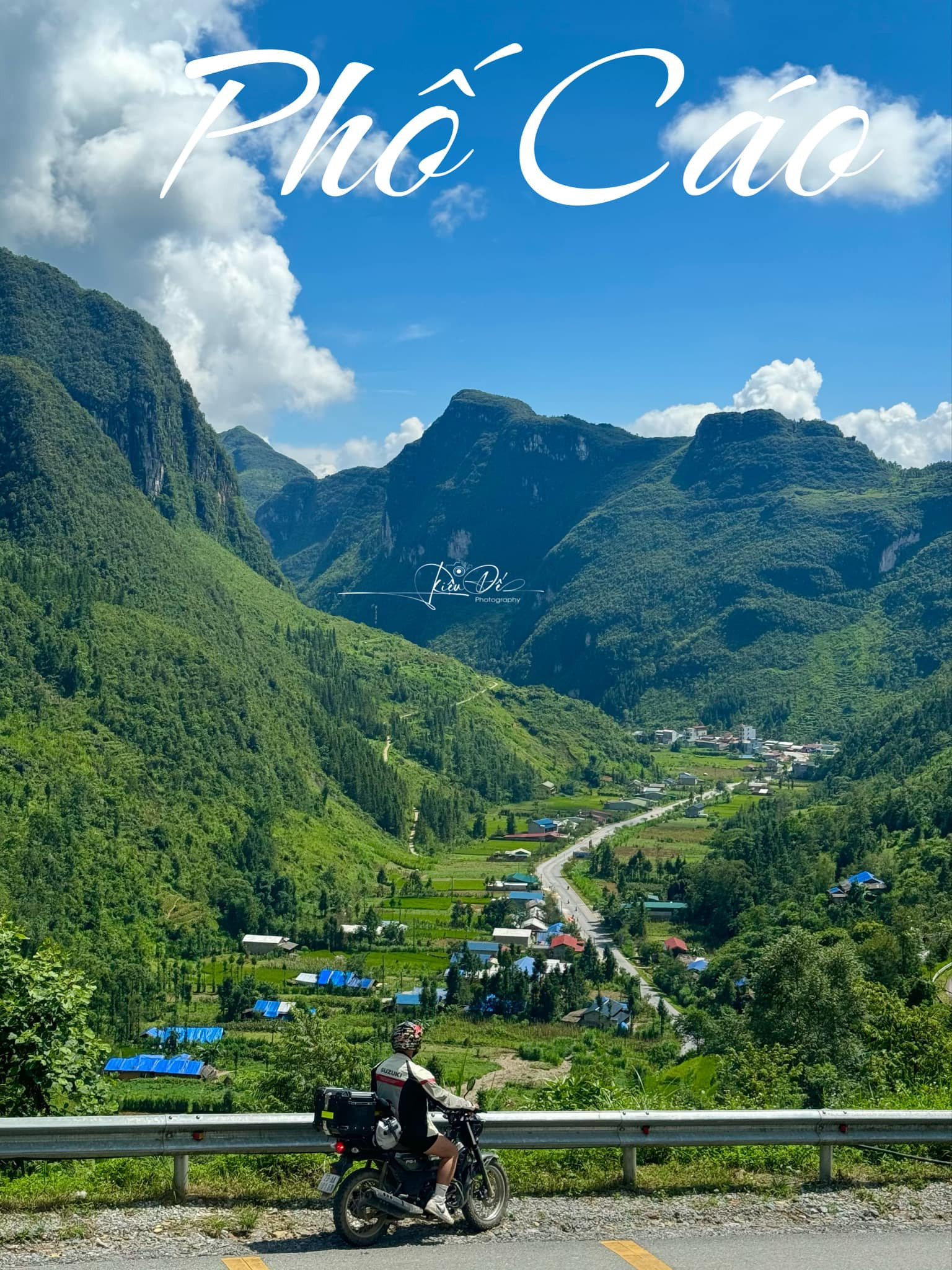
This slope is not only considered the gateway to the Dong Van Karst Plateau but has also become a popular spot where travelers stop for a quick photo, captivated by its scenic views.
Standing atop the slope, visitors can’t help but marvel at the lush, serene, and poetic green scenery, reminiscent of the landscapes of Switzerland often seen in movies.
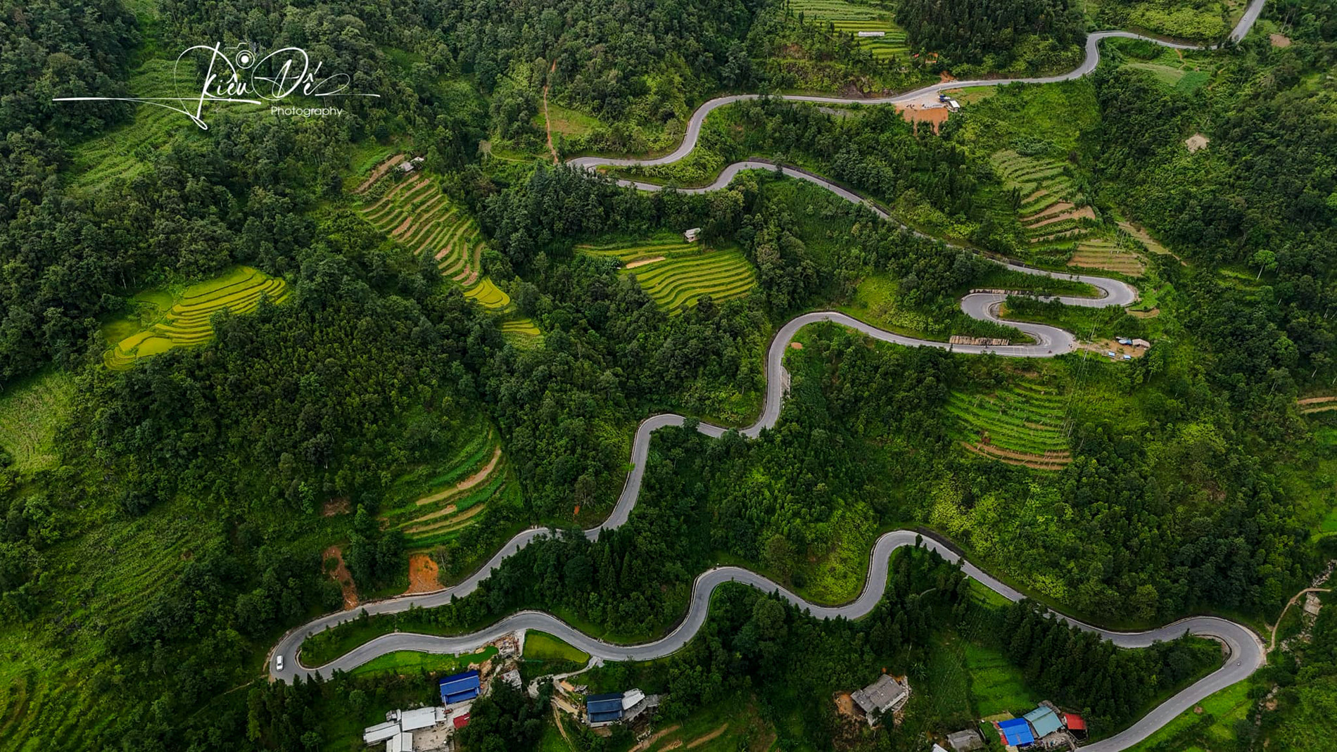
While the scenery along the way is impressive, travelers who have traversed the Chin Khoanh Slope describe it as a challenging route that tests even the most skilled drivers.
The slope clings to the mountainside, with multiple hairpin bends and U-turns that appear one after another. Locals often say that this is the place where “even horses hesitate, and humans feel the strain.”
Viet Anh, a traveler who has crossed Chin Khoanh several times, shared: “Going downhill is simple, but climbing up the slope is truly challenging. That’s why adventure seekers often joke that this is the ‘Tham Xe’ (test the vehicle) slope.”
“You not only need a motorcycle with a powerful engine but also steady hands to make it up this slope, or you might find yourself having to walk and push the bike or rely on others to help pull it up. Even experienced drivers approach this slope with caution.”
However, once travelers conquer this notorious slope, they will have the chance to explore various other attractions on the other side or visit and experience the culture and cuisine in Pho Cao and Sung La.
Hoang Van Huy, a tour guide specializing in Ha Giang - Cao Bang, noted that the ideal time to visit the Dong Van Karst Plateau and admire the beauty of Chin Khoanh Slope or the golden rice fields is from September to November.
Moreover, the area around Chin Khoanh is known for its fields of buckwheat flowers, so visitors traveling in the late months of the year will have plenty of opportunities to take stunning photos with this iconic flower.
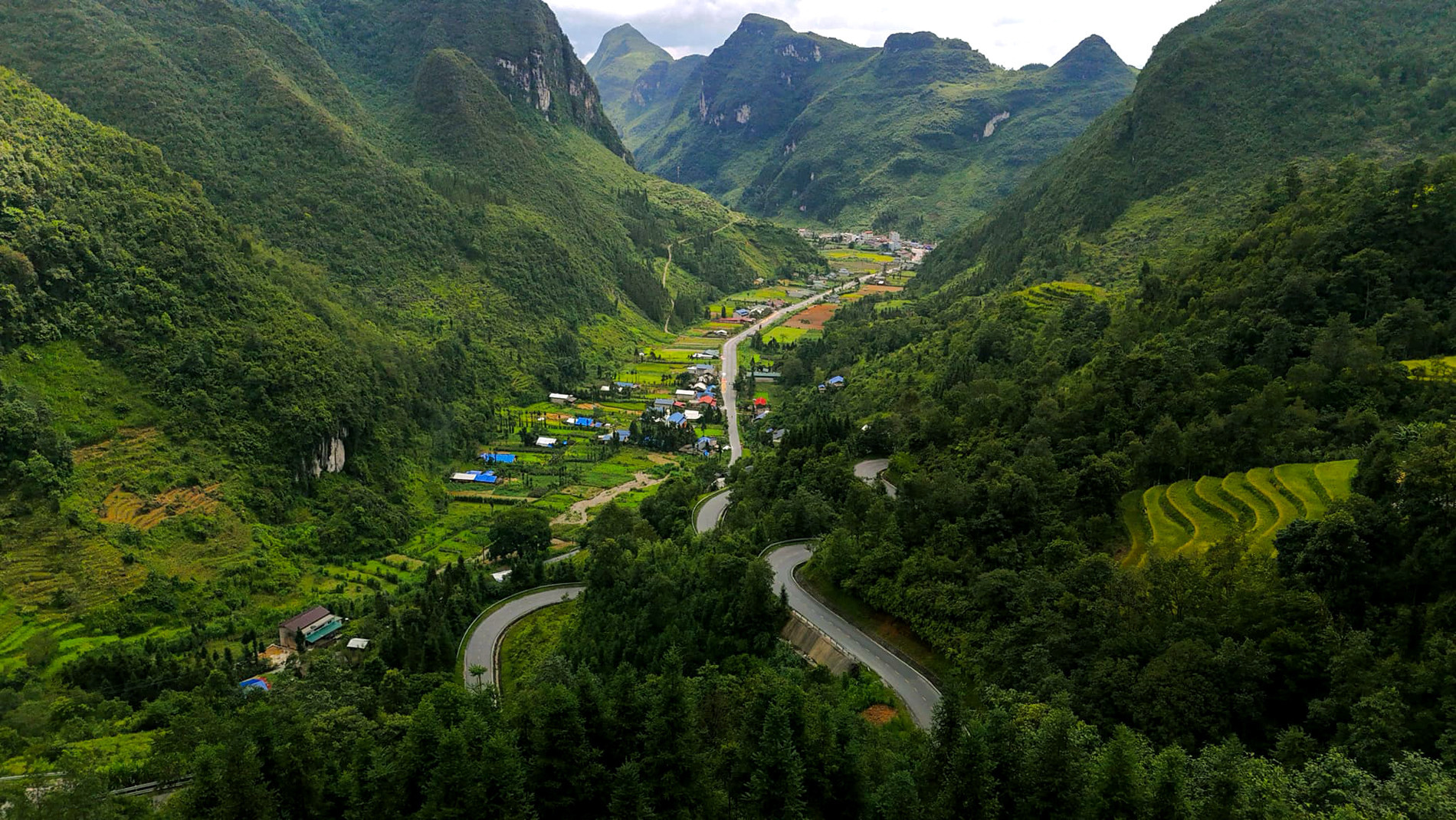
Photo credit: Hoang Dieu De
From Ha Giang city center, visitors take Nguyen Trai Road, then join National Highway 4C to reach Bac Sum Slope, which takes about three hours of travel. The slope sits at over 1,400 meters above sea level, and travelers will notice the cool, refreshing air as soon as they reach the beginning of the slope.
After passing Bac Sum Slope, visitors can head towards the Quan Ba Twin Mountains and continue through the Yen Minh pine forest before arriving at Chin Khoanh. These are all famous check-in spots that visitors can enjoy before reaching the “gateway to the Dong Van Karst Plateau.”
For a safe and enjoyable trip, travelers should check the weather forecast beforehand and avoid tackling the slope during the late afternoon, nighttime, or on days with rain, fog, or mist that can hinder visibility.
Additionally, ensure your vehicle is in good condition before starting, with a robust engine and a full tank. It’s wise to carry spare fuel and basic repair tools.
Thao Trinh