According to the National Center for Hydro-Meteorological Forecasting, as of the afternoon of May 6, a tropical depression in the Northwest Pacific had intensified into a storm, internationally named Hagupit. This is the fifth storm to form in the region during the 2026 typhoon season, following the super typhoon Sinlaku.
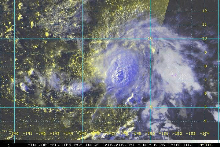
Observation data shows that at 1pm, the storm’s center was located at approximately 8.4 degrees North latitude and 147.3 degrees East longitude. Maximum sustained winds near the eye reached level 8, with gusts up to level 10. The system is currently nearly 2,000km east of the Philippines.
In the next 24 hours, Hagupit is expected to move mainly westward at a slow pace of 5-10km/h. It will then shift toward a west-northwest trajectory under the steering influence of the subtropical high-pressure ridge.
Meteorological experts note that the probability of Hagupit crossing the Philippines and entering the East Sea remains low, estimated at below 20%. The main reason lies in a strong subtropical high-pressure system at an altitude of around 5,000m over Vietnam’s East Sea. This system acts like a natural barrier, preventing the storm from advancing further westward.
In terms of intensity, Hagupit may reach a peak of level 10. However, it is likely to weaken into a tropical depression as it approaches waters east of the Philippines.
Although the likelihood of direct impact on land is low, the National Center for Hydro-Meteorological Forecasting cautions that projections from international models beyond the next two days remain scattered and lack strong consensus.
Authorities continue to closely monitor developments to provide timely updates as the situation evolves.
Bao Anh